Property Record
38019 47Th St E, Palmdale, CA 93552

Property Detail
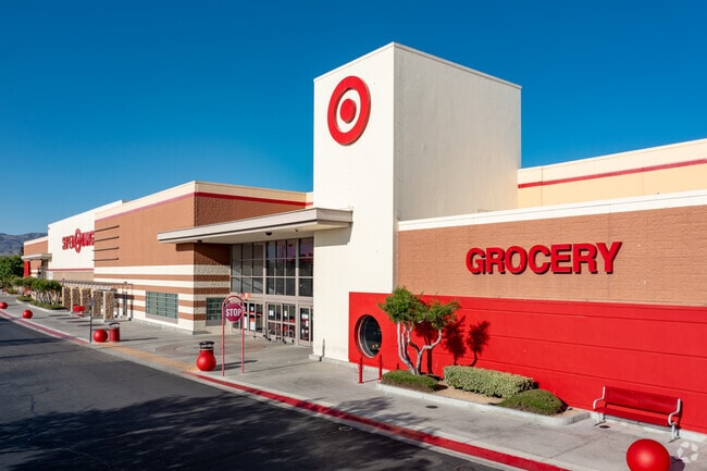
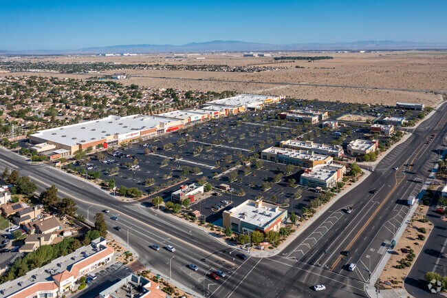
38019 47Th St E
3023-097-001
PM 364-22-30 LOT 1
Regionalshoppingcenterormallwithanchorstore
Los Angeles
PDC3*
California
C and X Area of minimal flood hazard, usually depicted on FIRMs as above the 500-year flood level.
1
2024
14.26 AC
2025
Antelope Valley
910721
Los Angeles
172,894 SF
Los Angeles-Long Beach-Glendale, CA
NEARBY LISTINGS FOR SALE OR LEASE
DEMOGRAPHICS near 38019 47Th St E
1 mile
3 mile
5 mile
2025 Total Population
18,291
87,916
126,216
2030 Population
18,277
86,914
125,707
Pop Growth 2025-2030
(0.08%)
(1.14%)
(0.40%)
Average Age
37
36
36
2025 Total Households
4,913
23,225
34,963
HH Growth 2025-2030
(0.14%)
(1.30%)
(0.40%)
Median Household Inc
$72,845
$80,089
$70,379
Avg Household Size
3.70
3.70
3.50
2025 Avg HH Vehicles
2.00
2.00
2.00
Median Home Value
$378,778
$416,891
$410,832
Median Year Built
1987
1988
1987
Nearby Places
Map Layers
Map Styles
 Street
 Aerial
Transit
 Traffic
 Biking
Places
Listings with unknown addresses are not visible on the map
- Restaurants
- Banks
- Shops
- Fitness
- Groceries
PUBLIC TRANSPORTATION
COMMUTER RAIL
Palmdale (Antelope Valley Line - Southern California Regional Rail Authority (Metrolink))
Drive
Walk
Distance
Palmdale (Antelope Valley Line - Southern California Regional Rail Authority (Metrolink))
9 min
5.3 mi
Vincent Grade/Acton (Antelope Valley Line - Southern California Regional Rail Authority (Metrolink))
Drive
Walk
Distance
Vincent Grade/Acton (Antelope Valley Line - Southern California Regional Rail Authority (Metrolink))
15 min
7.9 mi
AIRPORT
Bob Hope
Drive
Walk
Distance
Bob Hope
61 min
49.9 mi
Nearby Properties
Address
Land Use
TOTAL SIZE
Lot Size
Zoning
Address
Land Use
TOTAL SIZE
Lot Size
Zoning
167,366 SF
15.36 AC
PDC3
Address
Land Use
TOTAL SIZE
Lot Size
Zoning
221,536 SF
18.81 AC
PDR17000*
Address
Land Use
TOTAL SIZE
Lot Size
Zoning
101,172 SF
10.22 AC
PDR1*
Address
Land Use
TOTAL SIZE
Lot Size
Zoning
221,827 SF
14.90 AC
PDRPD10U-R
Address
Land Use
TOTAL SIZE
Lot Size
Zoning
157,021 SF
PDRN4
Address
Land Use
TOTAL SIZE
Lot Size
Zoning
209,328 SF
6.35 AC
PDC3-RPD15
Address
Land Use
TOTAL SIZE
Lot Size
Zoning
138,375 SF
7.83 AC
PDR17000*
Address
Land Use
TOTAL SIZE
Lot Size
Zoning
76,609 SF
3.61 AC
PDM2
Address
Land Use
TOTAL SIZE
Lot Size
Zoning
81,790 SF
5.70 AC
PDR1*
Address
Land Use
TOTAL SIZE
Lot Size
Zoning
78,176 SF
6.11 AC
PDR1*
Address
Land Use
TOTAL SIZE
Lot Size
Zoning
81,512 SF
4.25 AC
PDR1*
Address
Land Use
TOTAL SIZE
Lot Size
Zoning
67,560 SF
5.12 AC
PDR1*
Address
Land Use
TOTAL SIZE
Lot Size
Zoning
47,826 SF
5.92 AC
PDC3*
Address
Land Use
TOTAL SIZE
Lot Size
Zoning
106,048 SF
9.82 AC
PDR3*
Address
Land Use
TOTAL SIZE
Lot Size
Zoning
225,054 SF
PDC3
Address
Land Use
TOTAL SIZE
Lot Size
Zoning
111,132 SF
6.53 AC
PDR3DP-R3*
Address
Land Use
TOTAL SIZE
Lot Size
Zoning
53,896 SF
6.45 AC
PDC3
Address
Land Use
TOTAL SIZE
Lot Size
Zoning
38,493 SF
3.23 AC
PDR1*
Address
Land Use
TOTAL SIZE
Lot Size
Zoning
53,456 SF
8.69 AC
PDC3
Address
Land Use
TOTAL SIZE
Lot Size
Zoning
85,955 SF
4.30 AC
LCC3*
Address
Land Use
TOTAL SIZE
Lot Size
Zoning
56,256 SF
4.89 AC
LCR325U*
Address
Land Use
TOTAL SIZE
Lot Size
Zoning
19,654 SF
1.67 AC
PDR1*
Address
Land Use
TOTAL SIZE
Lot Size
Zoning
87,276 SF
7.57 AC
PDR3*
Address
Land Use
TOTAL SIZE
Lot Size
Zoning
19,564 SF
1.82 AC
PDR1*
Address
Land Use
TOTAL SIZE
Lot Size
Zoning
18,900 SF
3.71 AC
PDC3
Address
Land Use
TOTAL SIZE
Lot Size
Zoning
83,423 SF
5.17 AC
PDC5
Address
Land Use
TOTAL SIZE
Lot Size
Zoning
17,246 SF
1.83 AC
PDC1
Address
Land Use
TOTAL SIZE
Lot Size
Zoning
34,218 SF
2.10 AC
PDR1*
Address
Land Use
TOTAL SIZE
Lot Size
Zoning
50,143 SF
4.59 AC
LCA11*
The World's #1 Commercial Real Estate Marketplace
Connect with us
© 2026 CoStar Group
The information above has been obtained from sources believed reliable. While we do not doubt its accuracy we have not verified it and make no guarantee, warranty or representation about it. It is your responsibility to independently confirm its accuracy and completeness. Any projections, opinions, assumptions, or estimates used are for example only and do not represent the current or future performance of the property. The value of this transaction to you depends on tax and other factors which should be evaluated by your tax, financial, and legal advisors. You and your advisors should conduct a careful, independent investigation of the property to determine to your satisfaction the suitability of the property for your needs.