Property Record
3802 Ames Ave, Omaha, NE 68111
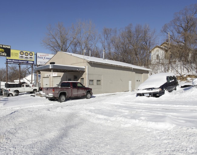

Property Detail
3802 Ames Ave
4752-0000-11
GLENWOOD HEIGHTS LOT 12 BLOCK 0 ALL LOTS 10-11 & 120 X 130
Autorepair
DOUGLAS
GC
Nebraska
B and X Area of moderate flood hazard, usually the area between the limits of the 100-year and 500-year floods.
12
2024
0.36 AC
2025
Northeast Omaha
005902
Omaha/Council Bluffs
3,120 SF
Omaha, NE-IA
NEARBY LISTINGS FOR SALE OR LEASE
DEMOGRAPHICS near 3802 Ames Ave
1 mile
3 mile
5 mile
2025 Total Population
16,014
118,885
241,805
2030 Population
16,534
122,933
249,227
Pop Growth 2025-2030
+ 3.25%
+ 3.40%
+ 3.07%
Average Age
35
36
37
2025 Total Households
5,717
46,277
98,611
HH Growth 2025-2030
+ 3.43%
+ 3.72%
+ 3.40%
Median Household Inc
$43,551
$53,299
$59,537
Avg Household Size
2.70
2.40
2.30
2025 Avg HH Vehicles
1.00
2.00
2.00
Median Home Value
$105,446
$170,183
$198,822
Median Year Built
1951
1955
1958
Nearby Places
Map Layers
Map Styles
 Street
 Aerial
Layers
 Traffic
 Biking
Places
Listings with unknown addresses are not visible on the map
- Restaurants
- Banks
- Shops
- Fitness
- Groceries
PUBLIC TRANSPORTATION
AIRPORT
Eppley Airfield
Drive
Walk
Distance
Eppley Airfield
13 min
5.7 mi
SALE & LEASE HISTORY
LISTING DATE
SALE/LEASE

Sep 24, 2016
For Sale
Nearby Properties
Address
Land Use
TOTAL SIZE
Lot Size
Zoning
Address
Land Use
TOTAL SIZE
Lot Size
Zoning
1,318,852 SF
8.77 AC
Address
Land Use
TOTAL SIZE
Lot Size
Zoning
370,431 SF
8.57 AC
Address
Land Use
TOTAL SIZE
Lot Size
Zoning
1,027,620 SF
4.33 AC
Address
Land Use
TOTAL SIZE
Lot Size
Zoning
189,720 SF
1.22 AC
CBD
Address
Land Use
TOTAL SIZE
Lot Size
Zoning
206,591 SF
0.60 AC
Address
Land Use
TOTAL SIZE
Lot Size
Zoning
140,130 SF
1.89 AC
Address
Land Use
TOTAL SIZE
Lot Size
Zoning
254,548 SF
1.67 AC
Address
Land Use
TOTAL SIZE
Lot Size
Zoning
200,501 SF
1.78 AC
DS
Address
Land Use
TOTAL SIZE
Lot Size
Zoning
39.68 AC
Address
Land Use
TOTAL SIZE
Lot Size
Zoning
266,775 SF
18.22 AC
CBD
Address
Land Use
TOTAL SIZE
Lot Size
Zoning
80,060 SF
Address
Land Use
TOTAL SIZE
Lot Size
Zoning
18.12 AC
Address
Land Use
TOTAL SIZE
Lot Size
Zoning
237,085 SF
4.26 AC
Address
Land Use
TOTAL SIZE
Lot Size
Zoning
540,097 SF
20.98 AC
GI
Address
Land Use
TOTAL SIZE
Lot Size
Zoning
179,012 SF
1.33 AC
Address
Land Use
TOTAL SIZE
Lot Size
Zoning
184,154 SF
9.93 AC
Address
Land Use
TOTAL SIZE
Lot Size
Zoning
135,617 SF
0.99 AC
Address
Land Use
TOTAL SIZE
Lot Size
Zoning
134,725 SF
0.68 AC
Address
Land Use
TOTAL SIZE
Lot Size
Zoning
69,043 SF
0.73 AC
Address
Land Use
TOTAL SIZE
Lot Size
Zoning
187,915 SF
1.19 AC
Address
Land Use
TOTAL SIZE
Lot Size
Zoning
159,534 SF
Address
Land Use
TOTAL SIZE
Lot Size
Zoning
172,424 SF
2.88 AC
R7
Address
Land Use
TOTAL SIZE
Lot Size
Zoning
94,352 SF
1.77 AC
CBD
Address
Land Use
TOTAL SIZE
Lot Size
Zoning
193,250 SF
0.69 AC
Address
Land Use
TOTAL SIZE
Lot Size
Zoning
64,764 SF
0.77 AC
Address
Land Use
TOTAL SIZE
Lot Size
Zoning
106,417 SF
1.95 AC
CBD
Address
Land Use
TOTAL SIZE
Lot Size
Zoning
69,787 SF
0.76 AC
Address
Land Use
TOTAL SIZE
Lot Size
Zoning
200,000 SF
11.49 AC
GI
The World's #1 Commercial Real Estate Marketplace
Connect with us
© 2026 CoStar Group
The information above has been obtained from sources believed reliable. While we do not doubt its accuracy we have not verified it and make no guarantee, warranty or representation about it. It is your responsibility to independently confirm its accuracy and completeness. Any projections, opinions, assumptions, or estimates used are for example only and do not represent the current or future performance of the property. The value of this transaction to you depends on tax and other factors which should be evaluated by your tax, financial, and legal advisors. You and your advisors should conduct a careful, independent investigation of the property to determine to your satisfaction the suitability of the property for your needs.