Property Record
3802 N Monroe St, Tallahassee, FL 32303

NEARBY LISTINGS FOR SALE OR LEASE
-
-
View all Tallahassee listings for sale on LoopNet.com
Property Detail
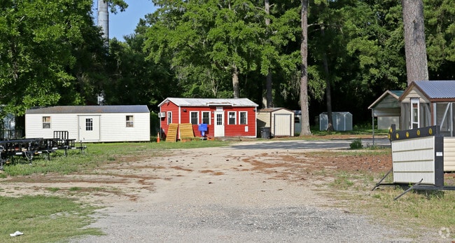
3802 N Monroe St
Tallahassee, FL
Plantation Of Fl Pecan Endowm Co 5Th Div
21-09-51-328-118.0
SECTION 9 T1N R1W PLANTATION OF THE FLORIDA PECAN ENDOWMENT COMPANY PB 1/4 PART OF LOT 720 LOT 1 LIMITED PARTITION OR 5628/2312 OR 5243/1081
Regionalshoppingcenterormallwithanchorstore
Leon
X
Florida
12073C0115F
720
2025
2.80 AC
2025
Northwest Leon County
002207
Tallahassee
19,999 SF
DEMOGRAPHICS near 3802 N Monroe St
1 Mile
3 Mile
5 Mile
2024 Total Population
5,043
46,550
114,576
2029 Population
5,316
49,267
119,798
Pop Growth 2024-2029
+ 5.41%
+ 5.84%
+ 4.56%
Average Age
38
35
34
2024 Total Households
2,101
19,752
49,093
HH Growth 2024-2029
+ 5.62%
+ 5.99%
+ 4.63%
Median Household Inc
$59,412
$53,517
$44,295
Avg Household Size
2.30
2.30
2.10
2024 Avg HH Vehicles
2.00
2.00
2.00
Median Home Value
$185,469
$186,547
$208,634
Median Year Built
1982
1986
1984
Nearby Places
Map Layers
Map Styles
 Street
 Aerial
- Restaurants
- Banks
- Shops
- Fitness
- Groceries
PUBLIC TRANSPORTATION
AIRPORT
Tallahassee International
DRIVE
WALK
Distance
Tallahassee International
18 min
8.5 mi
SALE & LEASE HISTORY
LISTING DATE
SALE/LEASE

Aug 16, 2023
For Sale
Nearby Properties
Address
Land Use
TOTAL SIZE
Lot Size
Zoning
Address
Land Use
TOTAL SIZE
Lot Size
Zoning
421,095 SF
28.06 AC
MR1
Address
Land Use
TOTAL SIZE
Lot Size
Zoning
883,293 SF
35.97 AC
R4
Address
Land Use
TOTAL SIZE
Lot Size
Zoning
1,241,812 SF
44.71 AC
MR1
Address
Land Use
TOTAL SIZE
Lot Size
Zoning
660,721 SF
30.95 AC
Address
Land Use
TOTAL SIZE
Lot Size
Zoning
901,437 SF
27.40 AC
Address
Land Use
TOTAL SIZE
Lot Size
Zoning
711,296 SF
17.86 AC
PUD
Address
Land Use
TOTAL SIZE
Lot Size
Zoning
127,486 SF
8.23 AC
M1
Address
Land Use
TOTAL SIZE
Lot Size
Zoning
236,679 SF
32.60 AC
MR1
Address
Land Use
TOTAL SIZE
Lot Size
Zoning
588,955 SF
36.20 AC
R3
Address
Land Use
TOTAL SIZE
Lot Size
Zoning
332,760 SF
14.68 AC
MR1
Address
Land Use
TOTAL SIZE
Lot Size
Zoning
123,020 SF
9.45 AC
M1
Address
Land Use
TOTAL SIZE
Lot Size
Zoning
240,852 SF
8.21 AC
MR1
Address
Land Use
TOTAL SIZE
Lot Size
Zoning
1,574,384 SF
63.42 AC
AC
Address
Land Use
TOTAL SIZE
Lot Size
Zoning
271,838 SF
6.31 AC
OR2
Address
Land Use
TOTAL SIZE
Lot Size
Zoning
347,286 SF
12.76 AC
MR1
Address
Land Use
TOTAL SIZE
Lot Size
Zoning
343,694 SF
11.76 AC
MR1
Address
Land Use
TOTAL SIZE
Lot Size
Zoning
233,372 SF
10.02 AC
LP
Address
Land Use
TOTAL SIZE
Lot Size
Zoning
98,912 SF
3.03 AC
OR2
Address
Land Use
TOTAL SIZE
Lot Size
Zoning
48,375 SF
5.61 AC
CP
Address
Land Use
TOTAL SIZE
Lot Size
Zoning
76,842 SF
16.42 AC
Address
Land Use
TOTAL SIZE
Lot Size
Zoning
374,982 SF
6.76 AC
M1
Address
Land Use
TOTAL SIZE
Lot Size
Zoning
154,499 SF
17.29 AC
PUD
Address
Land Use
TOTAL SIZE
Lot Size
Zoning
82,554 SF
3.65 AC
CP
Address
Land Use
TOTAL SIZE
Lot Size
Zoning
100,000 SF
20 AC
RP2
Address
Land Use
TOTAL SIZE
Lot Size
Zoning
272,330 SF
16.46 AC
R3
Address
Land Use
TOTAL SIZE
Lot Size
Zoning
105,608 SF
30 AC
RP
Address
Land Use
TOTAL SIZE
Lot Size
Zoning
24,864 SF
4.38 AC
PUD
Address
Land Use
TOTAL SIZE
Lot Size
Zoning
232,696 SF
10.76 AC
MR1
Address
Land Use
TOTAL SIZE
Lot Size
Zoning
102,584 SF
15.61 AC
PUD
Address
Land Use
TOTAL SIZE
Lot Size
Zoning
195,024 SF
4.90 AC
MR1
The World's #1 Commercial Real Estate Marketplace
Connect with us
© 2025 CoStar Group
The information above has been obtained from sources believed reliable. While we do not doubt its accuracy we have not verified it and make no guarantee, warranty or representation about it. It is your responsibility to independently confirm its accuracy and completeness. Any projections, opinions, assumptions, or estimates used are for example only and do not represent the current or future performance of the property. The value of this transaction to you depends on tax and other factors which should be evaluated by your tax, financial, and legal advisors. You and your advisors should conduct a careful, independent investigation of the property to determine to your satisfaction the suitability of the property for your needs.