Property Record
3804 40Th St, Seaview, WA 98644
NEARBY LISTINGS FOR SALE OR LEASE
Property Detail
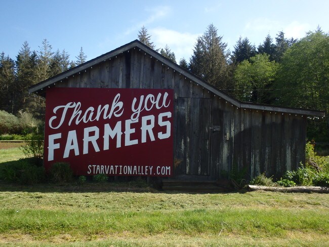
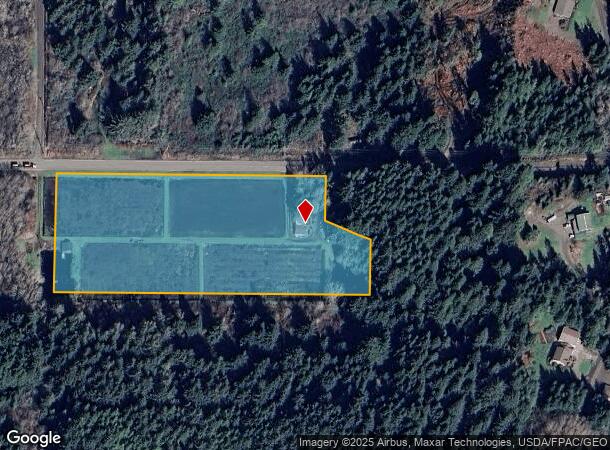
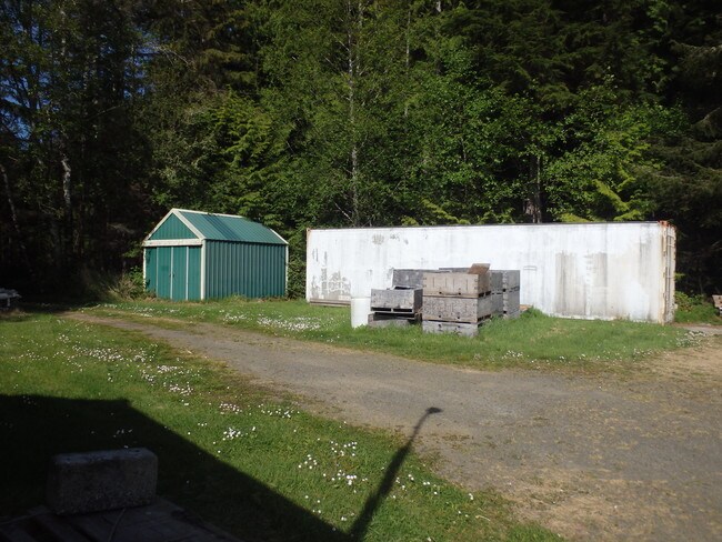
3804 40Th St
10112721025
Sagamore Cranberry
Agriculturalland
101127 025
X
Pacific
53049C0710D
Washington
2024
1,2
2025
6.49 AC
950501
Washington State Area
1,064 SF
Other Market Areas
DEMOGRAPHICS near 3804 40Th St
1 Mile
3 Mile
5 Mile
2024 Total Population
159
4,713
5,697
2029 Population
170
5,242
6,357
Pop Growth 2024-2029
+ 6.92%
+ 11.22%
+ 11.59%
Average Age
44
47
48
2024 Total Households
66
2,219
2,670
HH Growth 2024-2029
+ 6.06%
+ 10.82%
+ 11.20%
Median Household Inc
$105,769
$47,500
$48,507
Avg Household Size
2.30
2.10
2.10
2024 Avg HH Vehicles
3.00
2.00
2.00
Median Home Value
$425,000
$299,073
$297,695
Median Year Built
1974
1976
1977
Nearby Places
Map Layers
Map Styles
 Street
 Aerial
- Restaurants
- Banks
- Shops
- Fitness
- Groceries
SALE & LEASE HISTORY
LISTING DATE
SALE/LEASE

Jul 19, 2019
For Sale
Nearby Properties
Address
Land Use
TOTAL SIZE
Lot Size
Zoning
Address
Land Use
TOTAL SIZE
Lot Size
Zoning
35,664 SF
3.68 AC
UGA
Address
Land Use
TOTAL SIZE
Lot Size
Zoning
138.83 AC
FC
Address
Land Use
TOTAL SIZE
Lot Size
Zoning
100,971 SF
5.64 AC
AG
Address
Land Use
TOTAL SIZE
Lot Size
Zoning
26,000 SF
34.70 AC
MIX
Address
Land Use
TOTAL SIZE
Lot Size
Zoning
19,500 SF
0.31 AC
UGA
Address
Land Use
TOTAL SIZE
Lot Size
Zoning
19,520 SF
0.32 AC
UGA
Address
Land Use
TOTAL SIZE
Lot Size
Zoning
22,356 SF
0.62 AC
UGA
Address
Land Use
TOTAL SIZE
Lot Size
Zoning
6,900 SF
0.88 AC
UGA
Address
Land Use
TOTAL SIZE
Lot Size
Zoning
18,904 SF
0.31 AC
UGA
Address
Land Use
TOTAL SIZE
Lot Size
Zoning
1,200 SF
0.46 AC
CC
Address
Land Use
TOTAL SIZE
Lot Size
Zoning
10,255 SF
2.90 AC
UGA
Address
Land Use
TOTAL SIZE
Lot Size
Zoning
18,960 SF
1.06 AC
UGA
Address
Land Use
TOTAL SIZE
Lot Size
Zoning
17,664 SF
0.92 AC
CC
Address
Land Use
TOTAL SIZE
Lot Size
Zoning
3,096 SF
14.41 AC
R3
Address
Land Use
TOTAL SIZE
Lot Size
Zoning
2,880 SF
0.46 AC
CC
Address
Land Use
TOTAL SIZE
Lot Size
Zoning
5,159 SF
0.23 AC
CC
Address
Land Use
TOTAL SIZE
Lot Size
Zoning
12,672 SF
0.69 AC
UGA
Address
Land Use
TOTAL SIZE
Lot Size
Zoning
31,297 SF
1.14 AC
UGA
Address
Land Use
TOTAL SIZE
Lot Size
Zoning
24,710 SF
0.69 AC
UGA
Address
Land Use
TOTAL SIZE
Lot Size
Zoning
36,340 SF
4.37 AC
Address
Land Use
TOTAL SIZE
Lot Size
Zoning
13,137 SF
0.85 AC
UGA
Address
Land Use
TOTAL SIZE
Lot Size
Zoning
9,040 SF
10 AC
IND
Address
Land Use
TOTAL SIZE
Lot Size
Zoning
8,880 SF
0.40 AC
UGA
Address
Land Use
TOTAL SIZE
Lot Size
Zoning
7,800 SF
0.52 AC
Address
Land Use
TOTAL SIZE
Lot Size
Zoning
0.42 AC
UGA
Address
Land Use
TOTAL SIZE
Lot Size
Zoning
10,368 SF
0.35 AC
CC
Address
Land Use
TOTAL SIZE
Lot Size
Zoning
5,631 SF
0.45 AC
Address
Land Use
TOTAL SIZE
Lot Size
Zoning
7,010 SF
0.92 AC
UGA
Address
Land Use
TOTAL SIZE
Lot Size
Zoning
3,745 SF
0.86 AC
UGA
Address
Land Use
TOTAL SIZE
Lot Size
Zoning
11,376 SF
0.43 AC
UGA
The World's #1 Commercial Real Estate Marketplace
Connect with us
© 2025 CoStar Group
The information above has been obtained from sources believed reliable. While we do not doubt its accuracy we have not verified it and make no guarantee, warranty or representation about it. It is your responsibility to independently confirm its accuracy and completeness. Any projections, opinions, assumptions, or estimates used are for example only and do not represent the current or future performance of the property. The value of this transaction to you depends on tax and other factors which should be evaluated by your tax, financial, and legal advisors. You and your advisors should conduct a careful, independent investigation of the property to determine to your satisfaction the suitability of the property for your needs.