Property Record
381 Chestnut St, Union, NJ 07083
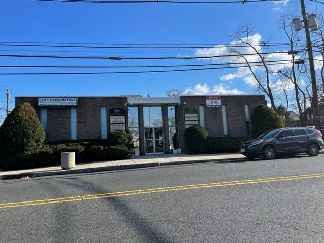

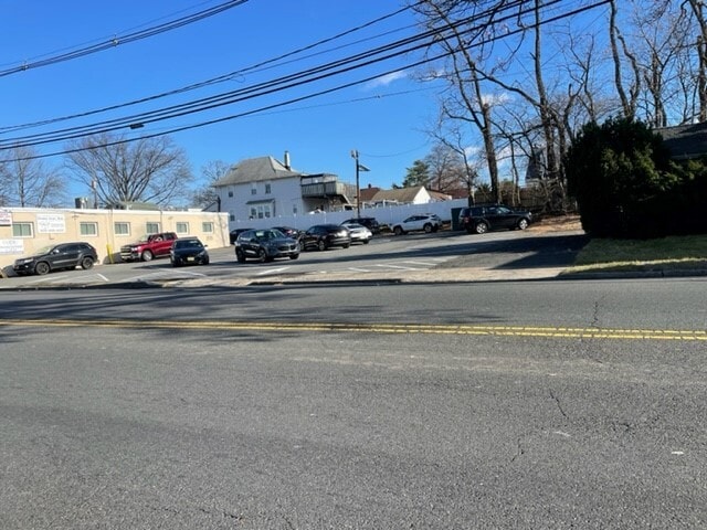
Property Detail
381 Chestnut St
19-01019-0000-00017
Union
Medicalbuilding
New Jersey
B and X Area of moderate flood hazard, usually the area between the limits of the 100-year and 500-year floods.
17
2024
0.32 AC
2025
Route 22 East
033400
Northern New Jersey
3,861 SF
Newark, NJ
NEARBY LISTINGS FOR SALE OR LEASE
DEMOGRAPHICS near 381 Chestnut St
1 mile
3 mile
5 mile
2025 Total Population
19,022
246,424
625,827
2030 Population
20,014
257,223
650,081
Pop Growth 2025-2030
+ 5.22%
+ 4.38%
+ 3.88%
Average Age
42
40
39
2025 Total Households
6,790
87,942
221,242
HH Growth 2025-2030
+ 5.39%
+ 4.55%
+ 4.05%
Median Household Inc
$124,590
$95,986
$88,480
Avg Household Size
2.70
2.70
2.70
2025 Avg HH Vehicles
2.00
2.00
2.00
Median Home Value
$457,136
$456,822
$483,630
Median Year Built
1952
1954
1955
Nearby Places
Map Layers
Map Styles
 Street
 Aerial
Transit
 Traffic
 Biking
Places
Listings with unknown addresses are not visible on the map
- Restaurants
- Banks
- Shops
- Fitness
- Groceries
PUBLIC TRANSPORTATION
COMMUTER RAIL
Roselle Park (Raritan Valley Line - NJ Transit Commuter Rail (NJ Transit))
Drive
Walk
Distance
Roselle Park (Raritan Valley Line - NJ Transit Commuter Rail (NJ Transit))
2 min
18 min
0.9 mi
Union (Raritan Valley Line - NJ Transit Commuter Rail (NJ Transit))
Drive
Walk
Distance
Union (Raritan Valley Line - NJ Transit Commuter Rail (NJ Transit))
5 min
2.1 mi
AIRPORT
Newark Liberty International
Drive
Walk
Distance
Newark Liberty International
13 min
9.1 mi
LaGuardia
Drive
Walk
Distance
LaGuardia
47 min
28.3 mi
John F Kennedy International
Drive
Walk
Distance
John F Kennedy International
55 min
35.0 mi
Freight Ports
New York Container Terminal
Drive
Walk
Distance
New York Container Terminal
16 min
7.6 mi
SALE & LEASE HISTORY
LISTING DATE
SALE/LEASE

Sep 24, 2016
For Lease
Nearby Properties
Address
Land Use
TOTAL SIZE
Lot Size
Zoning
Address
Land Use
TOTAL SIZE
Lot Size
Zoning
Address
Land Use
TOTAL SIZE
Lot Size
Zoning
Address
Land Use
TOTAL SIZE
Lot Size
Zoning
5.89 AC
Address
Land Use
TOTAL SIZE
Lot Size
Zoning
107.41 AC
Address
Land Use
TOTAL SIZE
Lot Size
Zoning
Address
Land Use
TOTAL SIZE
Lot Size
Zoning
0.83 AC
Address
Land Use
TOTAL SIZE
Lot Size
Zoning
1.01 AC
Address
Land Use
TOTAL SIZE
Lot Size
Zoning
1 SF
117.50 AC
Address
Land Use
TOTAL SIZE
Lot Size
Zoning
0.82 AC
Address
Land Use
TOTAL SIZE
Lot Size
Zoning
0.79 AC
Address
Land Use
TOTAL SIZE
Lot Size
Zoning
7.07 AC
Address
Land Use
TOTAL SIZE
Lot Size
Zoning
2.47 AC
Address
Land Use
TOTAL SIZE
Lot Size
Zoning
5.48 AC
Address
Land Use
TOTAL SIZE
Lot Size
Zoning
2.29 AC
Address
Land Use
TOTAL SIZE
Lot Size
Zoning
5.73 AC
Address
Land Use
TOTAL SIZE
Lot Size
Zoning
2.45 AC
Address
Land Use
TOTAL SIZE
Lot Size
Zoning
197 AC
RA
Address
Land Use
TOTAL SIZE
Lot Size
Zoning
1.62 AC
Address
Land Use
TOTAL SIZE
Lot Size
Zoning
1.59 AC
Address
Land Use
TOTAL SIZE
Lot Size
Zoning
17,416 SF
19.42 AC
Address
Land Use
TOTAL SIZE
Lot Size
Zoning
253,287 SF
6.03 AC
Address
Land Use
TOTAL SIZE
Lot Size
Zoning
4,700,000 SF
5.53 AC
Address
Land Use
TOTAL SIZE
Lot Size
Zoning
238,948 SF
1.89 AC
Address
Land Use
TOTAL SIZE
Lot Size
Zoning
12.20 AC
Address
Land Use
TOTAL SIZE
Lot Size
Zoning
3.23 AC
Address
Land Use
TOTAL SIZE
Lot Size
Zoning
4.82 AC
Address
Land Use
TOTAL SIZE
Lot Size
Zoning
1.45 AC
Address
Land Use
TOTAL SIZE
Lot Size
Zoning
2.73 AC
Address
Land Use
TOTAL SIZE
Lot Size
Zoning
100,660 SF
1.61 AC
Address
Land Use
TOTAL SIZE
Lot Size
Zoning
2.71 AC
RD-2
The World's #1 Commercial Real Estate Marketplace
Connect with us
© 2026 CoStar Group
The information above has been obtained from sources believed reliable. While we do not doubt its accuracy we have not verified it and make no guarantee, warranty or representation about it. It is your responsibility to independently confirm its accuracy and completeness. Any projections, opinions, assumptions, or estimates used are for example only and do not represent the current or future performance of the property. The value of this transaction to you depends on tax and other factors which should be evaluated by your tax, financial, and legal advisors. You and your advisors should conduct a careful, independent investigation of the property to determine to your satisfaction the suitability of the property for your needs.