Property Record
381 Stacy Rd, Fairview, TX 75069


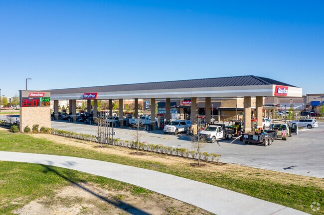
Property Detail
381 Stacy Rd
Dallas-Fort Worth-Arlington, TX
ABS A0909 JOHN A TAYLOR SURVEY, TRACT 64, .057 ACRES
R-6909-000-0640-1
COLLIN
Municipalproperty
Texas
B and X Area of moderate flood hazard, usually the area between the limits of the 100-year and 500-year floods.
64
0
0.06 AC
2025
Allen
031412
Dallas/Ft Worth
NEARBY LISTINGS FOR SALE OR LEASE
DEMOGRAPHICS near 381 Stacy Rd
1 mile
3 mile
5 mile
2024 Total Population
12,171
95,862
245,171
2029 Population
14,916
117,245
299,543
Pop Growth 2024-2029
+ 22.55%
+ 22.31%
+ 22.18%
Average Age
38
38
38
2024 Total Households
4,497
34,683
88,536
HH Growth 2024-2029
+ 23.04%
+ 22.67%
+ 22.57%
Median Household Inc
$98,570
$99,315
$102,439
Avg Household Size
2.70
2.70
2.70
2024 Avg HH Vehicles
2.00
2.00
2.00
Median Home Value
$365,992
$387,019
$406,786
Median Year Built
2007
2005
2004
Nearby Places
Map Layers
Map Styles
 Street
 Aerial
Transit
 Traffic
 Biking
Places
Listings with unknown addresses are not visible on the map
- Restaurants
- Banks
- Shops
- Fitness
- Groceries
PUBLIC TRANSPORTATION
AIRPORT
Dallas Love Field
Drive
Walk
Distance
Dallas Love Field
38 min
29.1 mi
Dallas-Fort Worth International
Drive
Walk
Distance
Dallas-Fort Worth International
40 min
32.9 mi
Nearby Properties
Address
Land Use
TOTAL SIZE
Lot Size
Zoning
Address
Land Use
TOTAL SIZE
Lot Size
Zoning
1,089,284 SF
90.69 AC
Address
Land Use
TOTAL SIZE
Lot Size
Zoning
638,539 SF
42.76 AC
Address
Land Use
TOTAL SIZE
Lot Size
Zoning
472,185 SF
63.51 AC
AO
Address
Land Use
TOTAL SIZE
Lot Size
Zoning
611,780 SF
59.06 AC
L1
Address
Land Use
TOTAL SIZE
Lot Size
Zoning
720,571 SF
68.28 AC
Address
Land Use
TOTAL SIZE
Lot Size
Zoning
709,804 SF
32.68 AC
Address
Land Use
TOTAL SIZE
Lot Size
Zoning
162,000 SF
34 AC
L1
Address
Land Use
TOTAL SIZE
Lot Size
Zoning
495,048 SF
7.37 AC
Address
Land Use
TOTAL SIZE
Lot Size
Zoning
479,620 SF
14.02 AC
Address
Land Use
TOTAL SIZE
Lot Size
Zoning
288,826 SF
18.71 AC
CC
Address
Land Use
TOTAL SIZE
Lot Size
Zoning
586,110 SF
10.50 AC
LI
Address
Land Use
TOTAL SIZE
Lot Size
Zoning
511,383 SF
10.89 AC
PD-OC
Address
Land Use
TOTAL SIZE
Lot Size
Zoning
509,085 SF
11.63 AC
PD-OC
Address
Land Use
TOTAL SIZE
Lot Size
Zoning
442,695 SF
24.65 AC
MF-M
Address
Land Use
TOTAL SIZE
Lot Size
Zoning
414,198 SF
72.67 AC
Address
Land Use
TOTAL SIZE
Lot Size
Zoning
350,018 SF
7.02 AC
MF-E
Address
Land Use
TOTAL SIZE
Lot Size
Zoning
370,860 SF
25.48 AC
Address
Land Use
TOTAL SIZE
Lot Size
Zoning
260,340 SF
18.64 AC
RG-18
Address
Land Use
TOTAL SIZE
Lot Size
Zoning
379,701 SF
17.58 AC
MULTI-FAMI
Address
Land Use
TOTAL SIZE
Lot Size
Zoning
334,313 SF
13.61 AC
MF
Address
Land Use
TOTAL SIZE
Lot Size
Zoning
344,076 SF
15.49 AC
MULTI-FAMI
Address
Land Use
TOTAL SIZE
Lot Size
Zoning
382,360 SF
68.99 AC
Address
Land Use
TOTAL SIZE
Lot Size
Zoning
439,754 SF
13.09 AC
SF
Address
Land Use
TOTAL SIZE
Lot Size
Zoning
349,991 SF
13.53 AC
MF-M
Address
Land Use
TOTAL SIZE
Lot Size
Zoning
325,956 SF
17.33 AC
A-0
Address
Land Use
TOTAL SIZE
Lot Size
Zoning
356,096 SF
19.50 AC
MF-M
Address
Land Use
TOTAL SIZE
Lot Size
Zoning
337,121 SF
9.39 AC
Address
Land Use
TOTAL SIZE
Lot Size
Zoning
321,982 SF
22.83 AC
SFR
Address
Land Use
TOTAL SIZE
Lot Size
Zoning
272,853 SF
17.32 AC
PD/ML
Address
Land Use
TOTAL SIZE
Lot Size
Zoning
283,286 SF
18.58 AC
COMM
The World's #1 Commercial Real Estate Marketplace
Connect with us
© 2026 CoStar Group
The information above has been obtained from sources believed reliable. While we do not doubt its accuracy we have not verified it and make no guarantee, warranty or representation about it. It is your responsibility to independently confirm its accuracy and completeness. Any projections, opinions, assumptions, or estimates used are for example only and do not represent the current or future performance of the property. The value of this transaction to you depends on tax and other factors which should be evaluated by your tax, financial, and legal advisors. You and your advisors should conduct a careful, independent investigation of the property to determine to your satisfaction the suitability of the property for your needs.