Property Record
3810 Governors Dr Nw, Huntsville, AL 35805

NEARBY LISTINGS FOR SALE OR LEASE
Property Detail
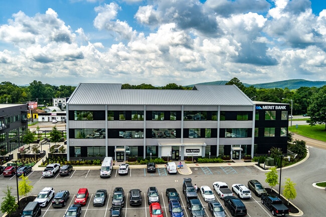
3810 Governors Dr Nw
Huntsville, AL
West Hville Add
17-02-03-2-003-012.000
LOT 2 THE FOUNDRY PH 2 PB# 2023-348
Officebuilding
Madison
X
Alabama
01089C0326E
2
2025
2.17 AC
2025
South Huntsville
002100
Huntsville
17,082 SF
DEMOGRAPHICS near 3810 Governors Dr Nw
1 Mile
3 Mile
5 Mile
2024 Total Population
11,041
65,124
129,478
2029 Population
12,227
72,359
143,698
Pop Growth 2024-2029
+ 10.74%
+ 11.11%
+ 10.98%
Average Age
35
37
39
2024 Total Households
4,449
28,504
56,685
HH Growth 2024-2029
+ 11.64%
+ 11.65%
+ 11.73%
Median Household Inc
$38,043
$39,960
$50,892
Avg Household Size
2.10
2.00
2.10
2024 Avg HH Vehicles
2.00
2.00
2.00
Median Home Value
$98,447
$146,669
$181,244
Median Year Built
1969
1970
1973
Nearby Places
- Restaurants
- Banks
- Shops
- Fitness
- Groceries
PUBLIC TRANSPORTATION
AIRPORT
Huntsville International-Carl T Jones Field
DRIVE
WALK
Distance
Huntsville International-Carl T Jones Field
17 min
12.1 mi
Freight Ports
Port of Mobile
DRIVE
WALK
Distance
Port of Mobile
385 min
353.3 mi
Nearby Properties
Address
Land Use
TOTAL SIZE
Lot Size
Zoning
Address
Land Use
TOTAL SIZE
Lot Size
Zoning
91,060 SF
8.37 AC
Address
Land Use
TOTAL SIZE
Lot Size
Zoning
208,719 SF
26.55 AC
Address
Land Use
TOTAL SIZE
Lot Size
Zoning
67,440 SF
10.04 AC
Address
Land Use
TOTAL SIZE
Lot Size
Zoning
92,055 SF
4.83 AC
Address
Land Use
TOTAL SIZE
Lot Size
Zoning
5,577 SF
12.72 AC
Address
Land Use
TOTAL SIZE
Lot Size
Zoning
76,442 SF
Address
Land Use
TOTAL SIZE
Lot Size
Zoning
79,332 SF
4.03 AC
Address
Land Use
TOTAL SIZE
Lot Size
Zoning
56,426 SF
13.78 AC
Address
Land Use
TOTAL SIZE
Lot Size
Zoning
0.77 AC
Address
Land Use
TOTAL SIZE
Lot Size
Zoning
60,647 SF
4.90 AC
Address
Land Use
TOTAL SIZE
Lot Size
Zoning
18,182 SF
Address
Land Use
TOTAL SIZE
Lot Size
Zoning
61,559 SF
5.15 AC
Address
Land Use
TOTAL SIZE
Lot Size
Zoning
47,696 SF
1.63 AC
Address
Land Use
TOTAL SIZE
Lot Size
Zoning
76,079 SF
12.71 AC
Address
Land Use
TOTAL SIZE
Lot Size
Zoning
61,712 SF
0.01 AC
Address
Land Use
TOTAL SIZE
Lot Size
Zoning
41,624 SF
3.80 AC
Address
Land Use
TOTAL SIZE
Lot Size
Zoning
9,940 SF
4.59 AC
Address
Land Use
TOTAL SIZE
Lot Size
Zoning
14,630 SF
13.44 AC
Address
Land Use
TOTAL SIZE
Lot Size
Zoning
57,286 SF
7.30 AC
Address
Land Use
TOTAL SIZE
Lot Size
Zoning
64,650 SF
2 AC
Address
Land Use
TOTAL SIZE
Lot Size
Zoning
56,100 SF
63.13 AC
Address
Land Use
TOTAL SIZE
Lot Size
Zoning
15,121 SF
1.73 AC
Address
Land Use
TOTAL SIZE
Lot Size
Zoning
Address
Land Use
TOTAL SIZE
Lot Size
Zoning
42,231 SF
6.69 AC
Address
Land Use
TOTAL SIZE
Lot Size
Zoning
17,333 SF
1.65 AC
Address
Land Use
TOTAL SIZE
Lot Size
Zoning
31,946 SF
16.67 AC
Address
Land Use
TOTAL SIZE
Lot Size
Zoning
21,068 SF
1.39 AC
Address
Land Use
TOTAL SIZE
Lot Size
Zoning
17,985 SF
0.74 AC
Address
Land Use
TOTAL SIZE
Lot Size
Zoning
16,379 SF
0.86 AC
Address
Land Use
TOTAL SIZE
Lot Size
Zoning
33,558 SF
4.30 AC
The World's #1 Commercial Real Estate Marketplace
Connect with us
© 2025 CoStar Group
The information above has been obtained from sources believed reliable. While we do not doubt its accuracy we have not verified it and make no guarantee, warranty or representation about it. It is your responsibility to independently confirm its accuracy and completeness. Any projections, opinions, assumptions, or estimates used are for example only and do not represent the current or future performance of the property. The value of this transaction to you depends on tax and other factors which should be evaluated by your tax, financial, and legal advisors. You and your advisors should conduct a careful, independent investigation of the property to determine to your satisfaction the suitability of the property for your needs.