Property Record
3810 Laborde Pl, Bakersfield, CA 93308


Property Detail
3810 Laborde Pl
Bakersfield-Delano, CA
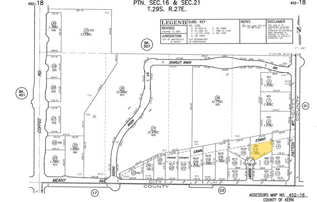
PARCEL MAP 10854 , LOT 9
452-180-14-00-9
Kern
Lightindustrial
California
B and X Area of moderate flood hazard, usually the area between the limits of the 100-year and 500-year floods.
9
2024
1.14 AC
2025
Northwest Bakersfield
000506
Bakersfield
3,600 SF
NEARBY LISTINGS FOR SALE OR LEASE
DEMOGRAPHICS near 3810 Laborde Pl
1 mile
3 mile
5 mile
2025 Total Population
9,168
78,492
237,687
2030 Population
9,240
80,181
241,068
Pop Growth 2025-2030
+ 0.79%
+ 2.15%
+ 1.42%
Average Age
38
38
37
2025 Total Households
3,430
27,388
84,072
HH Growth 2025-2030
+ 0.85%
+ 2.06%
+ 1.40%
Median Household Inc
$88,096
$97,304
$77,313
Avg Household Size
2.60
2.80
2.80
2025 Avg HH Vehicles
2.00
2.00
2.00
Median Home Value
$389,698
$410,412
$399,073
Median Year Built
1995
1993
1984
Nearby Places
Map Layers
Map Styles
 Street
 Aerial
Transit
 Traffic
 Biking
Places
Listings with unknown addresses are not visible on the map
- Restaurants
- Banks
- Shops
- Fitness
- Groceries
PUBLIC TRANSPORTATION
COMMUTER RAIL
Drive
Walk
Distance
12 min
5.9 mi
AIRPORT
Meadows Field
Drive
Walk
Distance
Meadows Field
15 min
5.5 mi
Nearby Properties
Address
Land Use
TOTAL SIZE
Lot Size
Zoning
Address
Land Use
TOTAL SIZE
Lot Size
Zoning
60.03 AC
M-3
Address
Land Use
TOTAL SIZE
Lot Size
Zoning
3,788 SF
54.09 AC
M3
Address
Land Use
TOTAL SIZE
Lot Size
Zoning
1,200 SF
5.89 AC
M-1
Address
Land Use
TOTAL SIZE
Lot Size
Zoning
85,971 SF
5.31 AC
C-2
Address
Land Use
TOTAL SIZE
Lot Size
Zoning
112,849 SF
5.31 AC
C-2
Address
Land Use
TOTAL SIZE
Lot Size
Zoning
30,326 SF
19 AC
M3
Address
Land Use
TOTAL SIZE
Lot Size
Zoning
2,032 SF
11.08 AC
M3
Address
Land Use
TOTAL SIZE
Lot Size
Zoning
1 SF
14.26 AC
R-2 PUD
Address
Land Use
TOTAL SIZE
Lot Size
Zoning
386,282 SF
14.05 AC
Address
Land Use
TOTAL SIZE
Lot Size
Zoning
10,064 SF
13.44 AC
R3
Address
Land Use
TOTAL SIZE
Lot Size
Zoning
155,550 SF
18.51 AC
M2
Address
Land Use
TOTAL SIZE
Lot Size
Zoning
63,428 SF
5.18 AC
C-2
Address
Land Use
TOTAL SIZE
Lot Size
Zoning
41,394 SF
14.74 AC
Address
Land Use
TOTAL SIZE
Lot Size
Zoning
134,728 SF
7.56 AC
R3
Address
Land Use
TOTAL SIZE
Lot Size
Zoning
149,197 SF
8.21 AC
PUD
Address
Land Use
TOTAL SIZE
Lot Size
Zoning
15,027 SF
17.72 AC
C-2
Address
Land Use
TOTAL SIZE
Lot Size
Zoning
161,539 SF
4 AC
CO
Address
Land Use
TOTAL SIZE
Lot Size
Zoning
2,129 SF
11.42 AC
M-2
Address
Land Use
TOTAL SIZE
Lot Size
Zoning
71,000 SF
5.89 AC
C-2
Address
Land Use
TOTAL SIZE
Lot Size
Zoning
193,524 SF
2.34 AC
C-O
Address
Land Use
TOTAL SIZE
Lot Size
Zoning
1,949 SF
6.43 AC
R-2
Address
Land Use
TOTAL SIZE
Lot Size
Zoning
51,666 SF
6.08 AC
C2
Address
Land Use
TOTAL SIZE
Lot Size
Zoning
3,383 SF
19.40 AC
M-2
Address
Land Use
TOTAL SIZE
Lot Size
Zoning
140,210 SF
1.74 AC
C-2
Address
Land Use
TOTAL SIZE
Lot Size
Zoning
72,726 SF
13.15 AC
M2
Address
Land Use
TOTAL SIZE
Lot Size
Zoning
92,953 SF
13.59 AC
C2
Address
Land Use
TOTAL SIZE
Lot Size
Zoning
200,503 SF
5.85 AC
C-2-D
Address
Land Use
TOTAL SIZE
Lot Size
Zoning
144,414 SF
11.90 AC
PCD
Address
Land Use
TOTAL SIZE
Lot Size
Zoning
115,267 SF
9.14 AC
C-2
The World's #1 Commercial Real Estate Marketplace
Connect with us
© 2026 CoStar Group
The information above has been obtained from sources believed reliable. While we do not doubt its accuracy we have not verified it and make no guarantee, warranty or representation about it. It is your responsibility to independently confirm its accuracy and completeness. Any projections, opinions, assumptions, or estimates used are for example only and do not represent the current or future performance of the property. The value of this transaction to you depends on tax and other factors which should be evaluated by your tax, financial, and legal advisors. You and your advisors should conduct a careful, independent investigation of the property to determine to your satisfaction the suitability of the property for your needs.