Property Record
3811 E Kiest Blvd, Dallas, TX 75203


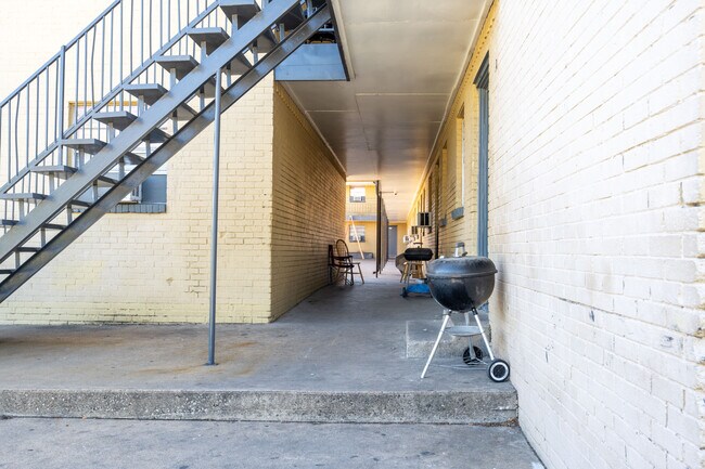

Property Detail
3811 E Kiest Blvd
00000456253000000
S E GREEN BLK 2/5888-1/2 LTS 10-15 ACS 0.99 INT201500104593 DD04242015 C-DC 58882002 01100 2DA58882002
Apartment
DALLAS
Z202
Texas
B and X Area of moderate flood hazard, usually the area between the limits of the 100-year and 500-year floods.
10-15
2024
0.99 AC
2025
Cedar Crest
005500
Dallas/Ft Worth
23,220 SF
Dallas-Fort Worth-Arlington, TX
NEARBY LISTINGS FOR SALE OR LEASE
DEMOGRAPHICS near 3811 E Kiest Blvd
1 mile
3 mile
5 mile
2025 Total Population
7,257
113,790
348,980
2030 Population
7,595
119,236
364,251
Pop Growth 2025-2030
+ 4.66%
+ 4.79%
+ 4.38%
Average Age
37
37
37
2025 Total Households
2,529
41,858
142,528
HH Growth 2025-2030
+ 4.67%
+ 5.25%
+ 4.78%
Median Household Inc
$38,855
$55,282
$66,727
Avg Household Size
2.70
2.60
2.30
2025 Avg HH Vehicles
2.00
2.00
2.00
Median Home Value
$193,971
$219,538
$266,651
Median Year Built
1958
1966
1980
Nearby Places
Map Layers
Map Styles
 Street
 Aerial
Layers
 Traffic
 Biking
Places
Listings with unknown addresses are not visible on the map
- Restaurants
- Banks
- Shops
- Fitness
- Groceries
PUBLIC TRANSPORTATION
TRANSIT/SUBWAY
Morrell Station (DART LIGHT RAIL - BLUE LINE - Dallas Area Rapid Transit (DART))
Drive
Walk
Distance
Morrell Station (DART LIGHT RAIL - BLUE LINE - Dallas Area Rapid Transit (DART))
3 min
20 min
1.1 mi
8Th And Corinth (Blue Line - Dallas Area Rapid Transit (DART), Red Line - Dallas Area Rapid Transit (DART))
Drive
Walk
Distance
8Th And Corinth (Blue Line - Dallas Area Rapid Transit (DART), Red Line - Dallas Area Rapid Transit (DART))
4 min
20 min
1.1 mi
COMMUTER RAIL
Victory Station (DART LIGHT RAIL - GREEN LINE - Dallas Area Rapid Transit (DART), DART LIGHT RAIL - ORANGE LINE - Dallas Area Rapid Transit (DART), TRINITY RAILWAY - Dallas Area Rapid Transit (DART))
Drive
Walk
Distance
Victory Station (DART LIGHT RAIL - GREEN LINE - Dallas Area Rapid Transit (DART), DART LIGHT RAIL - ORANGE LINE - Dallas Area Rapid Transit (DART), TRINITY RAILWAY - Dallas Area Rapid Transit (DART))
9 min
4.9 mi
Medical/Market Ctr Station (TRINITY RAILWAY - Dallas Area Rapid Transit (DART))
Drive
Walk
Distance
Medical/Market Ctr Station (TRINITY RAILWAY - Dallas Area Rapid Transit (DART))
13 min
7.5 mi
AIRPORT
Dallas Love Field
Drive
Walk
Distance
Dallas Love Field
19 min
9.9 mi
Dallas-Fort Worth International
Drive
Walk
Distance
Dallas-Fort Worth International
32 min
24.1 mi
Freight Ports
Port of Shreveport
Drive
Walk
Distance
Port of Shreveport
215 min
198.2 mi
SALE & LEASE HISTORY
LISTING DATE
SALE/LEASE

Mar 23, 2023
For Sale
Nearby Properties
Address
Land Use
TOTAL SIZE
Lot Size
Zoning
Address
Land Use
TOTAL SIZE
Lot Size
Zoning
1,298,826 SF
33.16 AC
Z163
Address
Land Use
TOTAL SIZE
Lot Size
Zoning
1,308,710 SF
8.42 AC
Z21
Address
Land Use
TOTAL SIZE
Lot Size
Zoning
432,919 SF
0.69 AC
Z21
Address
Land Use
TOTAL SIZE
Lot Size
Zoning
741,673 SF
1.30 AC
Z21
Address
Land Use
TOTAL SIZE
Lot Size
Zoning
26,896 SF
3.56 AC
Z239
Address
Land Use
TOTAL SIZE
Lot Size
Zoning
698.53 AC
Z46
Address
Land Use
TOTAL SIZE
Lot Size
Zoning
608,242 SF
1.29 AC
Z239
Address
Land Use
TOTAL SIZE
Lot Size
Zoning
1,083,196 SF
6.13 AC
Z21
Address
Land Use
TOTAL SIZE
Lot Size
Zoning
179,370 SF
13.18 AC
Z248
Address
Land Use
TOTAL SIZE
Lot Size
Zoning
419,729 SF
3.62 AC
Z115
Address
Land Use
TOTAL SIZE
Lot Size
Zoning
452,834 SF
2.76 AC
Z21
Address
Land Use
TOTAL SIZE
Lot Size
Zoning
1,137,345 SF
0.83 AC
Z21
Address
Land Use
TOTAL SIZE
Lot Size
Zoning
381,448 SF
19.99 AC
Z151
Address
Land Use
TOTAL SIZE
Lot Size
Zoning
458,874 SF
4.71 AC
Z239
Address
Land Use
TOTAL SIZE
Lot Size
Zoning
512,824 SF
0.47 AC
Z21
Address
Land Use
TOTAL SIZE
Lot Size
Zoning
521,757 SF
3.85 AC
Z239
Address
Land Use
TOTAL SIZE
Lot Size
Zoning
513,833 SF
0.17 AC
Z59
Address
Land Use
TOTAL SIZE
Lot Size
Zoning
339,086 SF
4.35 AC
Z163
Address
Land Use
TOTAL SIZE
Lot Size
Zoning
512,628 SF
2.72 AC
Z239
Address
Land Use
TOTAL SIZE
Lot Size
Zoning
539,635 SF
0.80 AC
Address
Land Use
TOTAL SIZE
Lot Size
Zoning
213,616 SF
16.31 AC
Z239
Address
Land Use
TOTAL SIZE
Lot Size
Zoning
356,540 SF
2.89 AC
Z21
Address
Land Use
TOTAL SIZE
Lot Size
Zoning
290,902 SF
13.90 AC
Z151
Address
Land Use
TOTAL SIZE
Lot Size
Zoning
859,038 SF
0.92 AC
Z21
Address
Land Use
TOTAL SIZE
Lot Size
Zoning
380,000 SF
6.52 AC
Z21
Address
Land Use
TOTAL SIZE
Lot Size
Zoning
404,722 SF
3.72 AC
Z239
Address
Land Use
TOTAL SIZE
Lot Size
Zoning
428,759 SF
16.39 AC
Z239
Address
Land Use
TOTAL SIZE
Lot Size
Zoning
563,339 SF
7.10 AC
Z21
Address
Land Use
TOTAL SIZE
Lot Size
Zoning
859,038 SF
1.29 AC
Z21
Address
Land Use
TOTAL SIZE
Lot Size
Zoning
505,910 SF
6.30 AC
Z21
The World's #1 Commercial Real Estate Marketplace
Connect with us
© 2026 CoStar Group
The information above has been obtained from sources believed reliable. While we do not doubt its accuracy we have not verified it and make no guarantee, warranty or representation about it. It is your responsibility to independently confirm its accuracy and completeness. Any projections, opinions, assumptions, or estimates used are for example only and do not represent the current or future performance of the property. The value of this transaction to you depends on tax and other factors which should be evaluated by your tax, financial, and legal advisors. You and your advisors should conduct a careful, independent investigation of the property to determine to your satisfaction the suitability of the property for your needs.