Property Record
3811 Mount Vernon Ave, Bakersfield, CA 93306


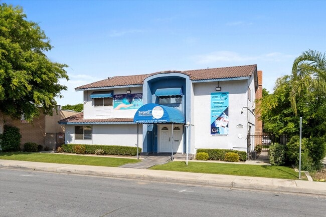

Property Detail
3811 Mount Vernon Ave
382-360-10-00-9
SECTION 15 , TOWNSHIP 29 , RANGE 28 , QUARTER
Officebuilding
Kern
C-O
California
B and X Area of moderate flood hazard, usually the area between the limits of the 100-year and 500-year floods.
0.18 AC
2024
Northeast Bakersfield
2025
Bakersfield
000902
Bakersfield-Delano, CA
3,811 SF
NEARBY LISTINGS FOR SALE OR LEASE
DEMOGRAPHICS near 3811 Mount Vernon Ave
1 mile
3 mile
5 mile
2025 Total Population
13,259
96,531
214,741
2030 Population
13,354
97,498
217,629
Pop Growth 2025-2030
+ 0.72%
+ 1.00%
+ 1.34%
Average Age
36
34
34
2025 Total Households
4,274
30,150
67,789
HH Growth 2025-2030
+ 0.70%
+ 1.10%
+ 1.38%
Median Household Inc
$69,043
$51,409
$52,465
Avg Household Size
3.00
3.10
3.10
2025 Avg HH Vehicles
2.00
2.00
2.00
Median Home Value
$303,059
$292,132
$285,938
Median Year Built
1963
1969
1970
Nearby Places
Map Layers
Map Styles
 Street
 Aerial
Layers
 Traffic
 Biking
Places
Listings with unknown addresses are not visible on the map
- Restaurants
- Banks
- Shops
- Fitness
- Groceries
PUBLIC TRANSPORTATION
COMMUTER RAIL
Drive
Walk
Distance
10 min
4.7 mi
AIRPORT
Meadows Field
Drive
Walk
Distance
Meadows Field
20 min
9.8 mi
SALE & LEASE HISTORY
LISTING DATE
SALE/LEASE

May 22, 2024
For Sale
Nearby Properties
Address
Land Use
TOTAL SIZE
Lot Size
Zoning
Address
Land Use
TOTAL SIZE
Lot Size
Zoning
402,037 SF
17.72 AC
R1
Address
Land Use
TOTAL SIZE
Lot Size
Zoning
1.38 AC
C-2
Address
Land Use
TOTAL SIZE
Lot Size
Zoning
87,389 SF
1.76 AC
M1
Address
Land Use
TOTAL SIZE
Lot Size
Zoning
Address
Land Use
TOTAL SIZE
Lot Size
Zoning
112,052 SF
3.14 AC
R3
Address
Land Use
TOTAL SIZE
Lot Size
Zoning
161,946 SF
17.84 AC
C2 PD
Address
Land Use
TOTAL SIZE
Lot Size
Zoning
8 AC
M-3
Address
Land Use
TOTAL SIZE
Lot Size
Zoning
103,536 SF
6.31 AC
R-3
Address
Land Use
TOTAL SIZE
Lot Size
Zoning
102,262 SF
3.93 AC
Address
Land Use
TOTAL SIZE
Lot Size
Zoning
141,662 SF
9.39 AC
R-2
Address
Land Use
TOTAL SIZE
Lot Size
Zoning
2.14 AC
C2
Address
Land Use
TOTAL SIZE
Lot Size
Zoning
127,224 SF
7 AC
R-2/PUD
Address
Land Use
TOTAL SIZE
Lot Size
Zoning
137,900 SF
15.69 AC
C2
Address
Land Use
TOTAL SIZE
Lot Size
Zoning
19,350 SF
2.05 AC
Address
Land Use
TOTAL SIZE
Lot Size
Zoning
115,058 SF
13.02 AC
C2
Address
Land Use
TOTAL SIZE
Lot Size
Zoning
1.50 AC
Address
Land Use
TOTAL SIZE
Lot Size
Zoning
1.06 AC
R-1
Address
Land Use
TOTAL SIZE
Lot Size
Zoning
0.41 AC
R1
Address
Land Use
TOTAL SIZE
Lot Size
Zoning
8.58 AC
M-3
Address
Land Use
TOTAL SIZE
Lot Size
Zoning
39,024 SF
2.35 AC
C-O-D
Address
Land Use
TOTAL SIZE
Lot Size
Zoning
3,239 SF
32 AC
R1
Address
Land Use
TOTAL SIZE
Lot Size
Zoning
66,582 SF
3.36 AC
R-2
Address
Land Use
TOTAL SIZE
Lot Size
Zoning
179,460 SF
10.20 AC
R3
Address
Land Use
TOTAL SIZE
Lot Size
Zoning
3,934 SF
8.58 AC
M-3
Address
Land Use
TOTAL SIZE
Lot Size
Zoning
68,264 SF
6.56 AC
C2
Address
Land Use
TOTAL SIZE
Lot Size
Zoning
4.94 AC
R-3
Address
Land Use
TOTAL SIZE
Lot Size
Zoning
74,038 SF
6.64 AC
C2
Address
Land Use
TOTAL SIZE
Lot Size
Zoning
34,733 SF
7.25 AC
C2
Address
Land Use
TOTAL SIZE
Lot Size
Zoning
29,440 SF
2.83 AC
C-2
Address
Land Use
TOTAL SIZE
Lot Size
Zoning
101,437 SF
9.05 AC
PCD
The World's #1 Commercial Real Estate Marketplace
Connect with us
© 2026 CoStar Group
The information above has been obtained from sources believed reliable. While we do not doubt its accuracy we have not verified it and make no guarantee, warranty or representation about it. It is your responsibility to independently confirm its accuracy and completeness. Any projections, opinions, assumptions, or estimates used are for example only and do not represent the current or future performance of the property. The value of this transaction to you depends on tax and other factors which should be evaluated by your tax, financial, and legal advisors. You and your advisors should conduct a careful, independent investigation of the property to determine to your satisfaction the suitability of the property for your needs.