Property Record
3811 Shipping Ave, Miami, FL 33146


Save to a Folder
{{folder.Name}}
{{folder.ListingIds.length}} Properties
{{folder.ListingIds.length}} Property
Create a New Folder
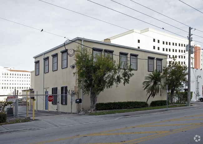
Property Detail
3811 Shipping Ave
01-4117-003-2090
RLTY SEC CORP OF COCO GR PB 2-85 LOTS 37 TO 48 INC BLK 11 LESS W10FT E10FT & S10FT & LESS EXT AREA OF CURVE IN SE & SW COR FOR R/W LOT SIZE 38467 SQ FT M/L
Apartmenthouse5plusunits
Miami-Dade
6110
Florida
B and X Area of moderate flood hazard, usually the area between the limits of the 100-year and 500-year floods.
37-48
2025
0.88 AC
2025
South Dixie Hwy
007007
South Florida
408,292 SF
Miami-Miami Beach-Kendall, FL
NEARBY LISTINGS FOR SALE OR LEASE
DEMOGRAPHICS near 3811 Shipping Ave
1 mile
3 mile
5 mile
2025 Total Population
28,877
180,591
473,612
2030 Population
31,419
193,376
508,352
Pop Growth 2025-2030
+ 8.80%
+ 7.08%
+ 7.34%
Average Age
41
43
42
2025 Total Households
12,386
72,174
194,380
HH Growth 2025-2030
+ 9.25%
+ 7.31%
+ 7.54%
Median Household Inc
$93,186
$89,815
$73,793
Avg Household Size
2.20
2.40
2.30
2025 Avg HH Vehicles
1.00
2.00
1.00
Median Home Value
$880,869
$801,517
$695,323
Median Year Built
1975
1965
1974
Nearby Places
Map Layers
Map Styles
 Street
 Aerial
Layers
 Traffic
 Biking
Places
Listings with unknown addresses are not visible on the map
- Restaurants
- Banks
- Shops
- Fitness
- Groceries
PUBLIC TRANSPORTATION
COMMUTER RAIL
Douglas Road (Metrorail Green Line - Miami-Dade Transit (Metrorail/Metromover))
Drive
Walk
Distance
Douglas Road (Metrorail Green Line - Miami-Dade Transit (Metrorail/Metromover))
0 min
3 min
0.2 mi
Coconut Grove (Metrorail Green Line - Miami-Dade Transit (Metrorail/Metromover))
Drive
Walk
Distance
Coconut Grove (Metrorail Green Line - Miami-Dade Transit (Metrorail/Metromover))
3 min
1.5 mi
AIRPORT
Miami International
Drive
Walk
Distance
Miami International
22 min
10.7 mi
Fort Lauderdale/Hollywood International
Drive
Walk
Distance
Fort Lauderdale/Hollywood International
41 min
28.2 mi
Freight Ports
Port of Miami
Drive
Walk
Distance
Port of Miami
16 min
7.9 mi
Nearby Properties
Address
Land Use
TOTAL SIZE
Lot Size
Zoning
Address
Land Use
TOTAL SIZE
Lot Size
Zoning
870,720 SF
1.90 AC
4800
Address
Land Use
TOTAL SIZE
Lot Size
Zoning
883,561 SF
5.63 AC
8200
Address
Land Use
TOTAL SIZE
Lot Size
Zoning
1,101,032 SF
5.18 AC
8000
Address
Land Use
TOTAL SIZE
Lot Size
Zoning
1,647,481 SF
23.04 AC
5000
Address
Land Use
TOTAL SIZE
Lot Size
Zoning
715,755 SF
2.66 AC
5005
Address
Land Use
TOTAL SIZE
Lot Size
Zoning
1,428,214 SF
31.07 AC
8000
Address
Land Use
TOTAL SIZE
Lot Size
Zoning
973,728 SF
76.18 AC
8200
Address
Land Use
TOTAL SIZE
Lot Size
Zoning
91,119 SF
50.72 AC
8000
Address
Land Use
TOTAL SIZE
Lot Size
Zoning
759,863 SF
7.02 AC
6506
Address
Land Use
TOTAL SIZE
Lot Size
Zoning
345,178 SF
6.73 AC
5005
Address
Land Use
TOTAL SIZE
Lot Size
Zoning
1,168,390 SF
0.04 AC
7100
Address
Land Use
TOTAL SIZE
Lot Size
Zoning
482,246 SF
0.83 AC
5005
Address
Land Use
TOTAL SIZE
Lot Size
Zoning
525,786 SF
2.64 AC
6100
Address
Land Use
TOTAL SIZE
Lot Size
Zoning
275,755 SF
6.73 AC
5005
Address
Land Use
TOTAL SIZE
Lot Size
Zoning
247,488 SF
4.25 AC
5005
Address
Land Use
TOTAL SIZE
Lot Size
Zoning
688,104 SF
3.16 AC
6101
Address
Land Use
TOTAL SIZE
Lot Size
Zoning
365,003 SF
15.05 AC
8200
Address
Land Use
TOTAL SIZE
Lot Size
Zoning
299,785 SF
0.55 AC
6110
Address
Land Use
TOTAL SIZE
Lot Size
Zoning
431,941 SF
2.06 AC
6110
Address
Land Use
TOTAL SIZE
Lot Size
Zoning
407,265 SF
1.59 AC
6100
Address
Land Use
TOTAL SIZE
Lot Size
Zoning
518,244 SF
1.06 AC
5005
Address
Land Use
TOTAL SIZE
Lot Size
Zoning
668,569 SF
2.33 AC
5004
Address
Land Use
TOTAL SIZE
Lot Size
Zoning
948,568 SF
6.20 AC
5005
Address
Land Use
TOTAL SIZE
Lot Size
Zoning
449,572 SF
1.74 AC
6110
Address
Land Use
TOTAL SIZE
Lot Size
Zoning
473,214 SF
2.51 AC
5005
Address
Land Use
TOTAL SIZE
Lot Size
Zoning
540,267 SF
1.74 AC
5005
Address
Land Use
TOTAL SIZE
Lot Size
Zoning
14.30 AC
0700
Address
Land Use
TOTAL SIZE
Lot Size
Zoning
516,656 SF
9.65 AC
6300
Address
Land Use
TOTAL SIZE
Lot Size
Zoning
173,357 SF
30.51 AC
8000
The World's #1 Commercial Real Estate Marketplace
Connect with us
© 2026 CoStar Group
The information above has been obtained from sources believed reliable. While we do not doubt its accuracy we have not verified it and make no guarantee, warranty or representation about it. It is your responsibility to independently confirm its accuracy and completeness. Any projections, opinions, assumptions, or estimates used are for example only and do not represent the current or future performance of the property. The value of this transaction to you depends on tax and other factors which should be evaluated by your tax, financial, and legal advisors. You and your advisors should conduct a careful, independent investigation of the property to determine to your satisfaction the suitability of the property for your needs.