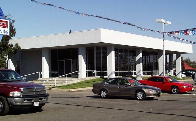
Property Record
3815 Florin Rd, Sacramento, CA 95823


NEARBY LISTINGS FOR SALE OR LEASE
Property Detail
3815 Florin Rd
Sacramento--Roseville--Arden-Arcade, CA
Parcel Map
041-0120-022
PARCEL MAP, LOT B
Commercialacreage
Sacramento
X
California
06067C0302H
b
2024
14.21 AC
2025
South Sacramento
004502
Sacramento
98,393 SF
DEMOGRAPHICS near 3815 Florin Rd
1 Mile
3 Mile
5 Mile
2024 Total Population
23,234
190,016
387,584
2029 Population
23,433
191,179
390,013
Pop Growth 2024-2029
+ 0.86%
+ 0.61%
+ 0.63%
Average Age
35
37
38
2024 Total Households
6,849
58,454
133,862
HH Growth 2024-2029
+ 0.88%
+ 0.57%
+ 0.65%
Median Household Inc
$47,730
$57,623
$70,925
Avg Household Size
3.20
3.10
2.70
2024 Avg HH Vehicles
2.00
2.00
2.00
Median Home Value
$305,619
$343,037
$435,171
Median Year Built
1973
1970
1973
Nearby Places
Map Layers
Map Styles
 Street
 Aerial
- Restaurants
- Banks
- Shops
- Fitness
- Groceries
PUBLIC TRANSPORTATION
TRANSIT/SUBWAY
Florin (Blue Line - Sacramento Regional Transit District Light Rail (The RT))
DRIVE
WALK
Distance
Florin (Blue Line - Sacramento Regional Transit District Light Rail (The RT))
3 min
15 min
0.8 mi
COMMUTER RAIL
Sacramento (Capitol Corridor - Capitol Corridor Joint Powers Authority)
DRIVE
WALK
Distance
Sacramento (Capitol Corridor - Capitol Corridor Joint Powers Authority)
14 min
9.9 mi
AIRPORT
Sacramento International
DRIVE
WALK
Distance
Sacramento International
28 min
20.2 mi
Freight Ports
Port of Stockton
DRIVE
WALK
Distance
Port of Stockton
51 min
42.8 mi
Nearby Properties
Address
Land Use
TOTAL SIZE
Lot Size
Zoning
Address
Land Use
TOTAL SIZE
Lot Size
Zoning
728,235 SF
29.15 AC
H-R
Address
Land Use
TOTAL SIZE
Lot Size
Zoning
12.70 AC
SC-PUD
Address
Land Use
TOTAL SIZE
Lot Size
Zoning
7.55 AC
SPA
Address
Land Use
TOTAL SIZE
Lot Size
Zoning
53,386 SF
7.75 AC
C-2-SPD
Address
Land Use
TOTAL SIZE
Lot Size
Zoning
173,323 SF
10.39 AC
C-2-PUD
Address
Land Use
TOTAL SIZE
Lot Size
Zoning
13.87 AC
C-2-PUD
Address
Land Use
TOTAL SIZE
Lot Size
Zoning
249,868 SF
15.23 AC
R-2B-R
Address
Land Use
TOTAL SIZE
Lot Size
Zoning
64,082 SF
2.38 AC
R-1
Address
Land Use
TOTAL SIZE
Lot Size
Zoning
213,445 SF
18.25 AC
SC
Address
Land Use
TOTAL SIZE
Lot Size
Zoning
186.36 AC
R-1-PUD R-
Address
Land Use
TOTAL SIZE
Lot Size
Zoning
156,873 SF
14.98 AC
C-2-PUD
Address
Land Use
TOTAL SIZE
Lot Size
Zoning
58.59 AC
R-1
Address
Land Use
TOTAL SIZE
Lot Size
Zoning
144,849 SF
5.72 AC
R-3
Address
Land Use
TOTAL SIZE
Lot Size
Zoning
109,532 SF
5.03 AC
R-3
Address
Land Use
TOTAL SIZE
Lot Size
Zoning
50,729 SF
12.30 AC
H-R
Address
Land Use
TOTAL SIZE
Lot Size
Zoning
95,548 SF
24.25 AC
R-1
Address
Land Use
TOTAL SIZE
Lot Size
Zoning
91,586 SF
6.03 AC
R-3-R
Address
Land Use
TOTAL SIZE
Lot Size
Zoning
95,427 SF
7.07 AC
LC
Address
Land Use
TOTAL SIZE
Lot Size
Zoning
100,704 SF
5.63 AC
RD-20
Address
Land Use
TOTAL SIZE
Lot Size
Zoning
162,259 SF
12.73 AC
R-3
Address
Land Use
TOTAL SIZE
Lot Size
Zoning
165,523 SF
15.76 AC
A-PUD OB-P
Address
Land Use
TOTAL SIZE
Lot Size
Zoning
100,787 SF
8.78 AC
SPA
Address
Land Use
TOTAL SIZE
Lot Size
Zoning
6.90 AC
RD-20
Address
Land Use
TOTAL SIZE
Lot Size
Zoning
129,305 SF
9.37 AC
C-2-SPD
Address
Land Use
TOTAL SIZE
Lot Size
Zoning
90,716 SF
7.52 AC
C-2-R
Address
Land Use
TOTAL SIZE
Lot Size
Zoning
29.28 AC
C-2-PUD
Address
Land Use
TOTAL SIZE
Lot Size
Zoning
111,196 SF
5.40 AC
C-2-R
Address
Land Use
TOTAL SIZE
Lot Size
Zoning
126,358 SF
7.30 AC
RD-20
Address
Land Use
TOTAL SIZE
Lot Size
Zoning
105,700 SF
12.41 AC
C-2-R
Address
Land Use
TOTAL SIZE
Lot Size
Zoning
82,404 SF
4.38 AC
RD-30 (NPA
The World's #1 Commercial Real Estate Marketplace
Connect with us
© 2026 CoStar Group
The information above has been obtained from sources believed reliable. While we do not doubt its accuracy we have not verified it and make no guarantee, warranty or representation about it. It is your responsibility to independently confirm its accuracy and completeness. Any projections, opinions, assumptions, or estimates used are for example only and do not represent the current or future performance of the property. The value of this transaction to you depends on tax and other factors which should be evaluated by your tax, financial, and legal advisors. You and your advisors should conduct a careful, independent investigation of the property to determine to your satisfaction the suitability of the property for your needs.