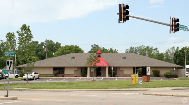
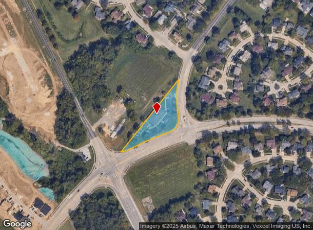
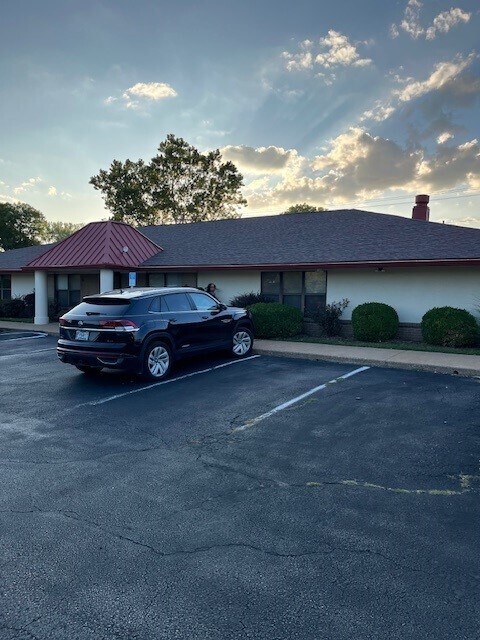
Property Record
3815 Shackelford Rd, Florissant, MO 63034
NEARBY LISTINGS FOR SALE OR LEASE
Property Detail
3815 Shackelford Rd
St. Louis, MO-IL
Villages At Barrington Downs Church &
04J-22-1169
VILLAGES AT BARRINGTON DOWNS CHURCH & DAY CARE SITE (THE) DAY CARE SITE 9 28 89
Daycare
St. Louis
X
Missouri
29183C0325G
1
2024
1.36 AC
2025
North County
210927
St. Louis
6,155 SF
DEMOGRAPHICS near 3815 Shackelford Rd
1 Mile
3 Mile
5 Mile
2024 Total Population
6,721
45,039
103,242
2029 Population
6,534
43,956
100,957
Pop Growth 2024-2029
(2.78%)
(2.40%)
(2.21%)
Average Age
42
40
40
2024 Total Households
2,414
17,152
40,799
HH Growth 2024-2029
(2.86%)
(2.43%)
(2.25%)
Median Household Inc
$99,285
$73,239
$66,640
Avg Household Size
2.70
2.60
2.40
2024 Avg HH Vehicles
2.00
2.00
2.00
Median Home Value
$220,661
$163,468
$154,167
Median Year Built
1983
1971
1967
Nearby Places
Map Layers
Map Styles
 Street
 Aerial
- Restaurants
- Banks
- Shops
- Fitness
- Groceries
PUBLIC TRANSPORTATION
AIRPORT
St Louis Lambert International
DRIVE
WALK
Distance
St Louis Lambert International
17 min
9.7 mi
Freight Ports
Port Milwaukee
DRIVE
WALK
Distance
Port Milwaukee
428 min
375.7 mi
SALE & LEASE HISTORY
LISTING DATE
SALE/LEASE

Jan 24, 2024
For Sale
Nearby Properties
Address
Land Use
TOTAL SIZE
Lot Size
Zoning
Address
Land Use
TOTAL SIZE
Lot Size
Zoning
47,184 SF
71.66 AC
R4
Address
Land Use
TOTAL SIZE
Lot Size
Zoning
296,795 SF
286.21 AC
C-8
Address
Land Use
TOTAL SIZE
Lot Size
Zoning
15.37 AC
R
Address
Land Use
TOTAL SIZE
Lot Size
Zoning
271,184 SF
13.67 AC
B3
Address
Land Use
TOTAL SIZE
Lot Size
Zoning
354,790 SF
22.46 AC
B6
Address
Land Use
TOTAL SIZE
Lot Size
Zoning
21.29 AC
24R4
Address
Land Use
TOTAL SIZE
Lot Size
Zoning
2,429 SF
79.10 AC
NU
Address
Land Use
TOTAL SIZE
Lot Size
Zoning
320,176 SF
9.83 AC
24MFD
Address
Land Use
TOTAL SIZE
Lot Size
Zoning
169,426 SF
26.38 AC
R1
Address
Land Use
TOTAL SIZE
Lot Size
Zoning
1,560 SF
12.84 AC
R4
Address
Land Use
TOTAL SIZE
Lot Size
Zoning
999 SF
21.20 AC
R
Address
Land Use
TOTAL SIZE
Lot Size
Zoning
17.26 AC
24R4
Address
Land Use
TOTAL SIZE
Lot Size
Zoning
193,344 SF
14.37 AC
24MFD
Address
Land Use
TOTAL SIZE
Lot Size
Zoning
146,186 SF
8.24 AC
R4
Address
Land Use
TOTAL SIZE
Lot Size
Zoning
1,797 SF
23.66 AC
NU
Address
Land Use
TOTAL SIZE
Lot Size
Zoning
106,935 SF
8.25 AC
24B5
Address
Land Use
TOTAL SIZE
Lot Size
Zoning
16.58 AC
24R4
Address
Land Use
TOTAL SIZE
Lot Size
Zoning
136,874 SF
13.18 AC
R1
Address
Land Use
TOTAL SIZE
Lot Size
Zoning
9.20 AC
R-4
Address
Land Use
TOTAL SIZE
Lot Size
Zoning
121,945 SF
10.10 AC
24B5
Address
Land Use
TOTAL SIZE
Lot Size
Zoning
14.23 AC
24R4
Address
Land Use
TOTAL SIZE
Lot Size
Zoning
6.58 AC
24R4
Address
Land Use
TOTAL SIZE
Lot Size
Zoning
7.19 AC
NU
Address
Land Use
TOTAL SIZE
Lot Size
Zoning
149,105 SF
9.71 AC
R4
Address
Land Use
TOTAL SIZE
Lot Size
Zoning
58,353 SF
5.55 AC
24B3
Address
Land Use
TOTAL SIZE
Lot Size
Zoning
Address
Land Use
TOTAL SIZE
Lot Size
Zoning
2,344 SF
5.03 AC
24R4
Address
Land Use
TOTAL SIZE
Lot Size
Zoning
63,078 SF
1.60 AC
24B3
Address
Land Use
TOTAL SIZE
Lot Size
Zoning
220 SF
5.20 AC
NU
Address
Land Use
TOTAL SIZE
Lot Size
Zoning
10 AC
24R4
The World's #1 Commercial Real Estate Marketplace
Connect with us
© 2025 CoStar Group
The information above has been obtained from sources believed reliable. While we do not doubt its accuracy we have not verified it and make no guarantee, warranty or representation about it. It is your responsibility to independently confirm its accuracy and completeness. Any projections, opinions, assumptions, or estimates used are for example only and do not represent the current or future performance of the property. The value of this transaction to you depends on tax and other factors which should be evaluated by your tax, financial, and legal advisors. You and your advisors should conduct a careful, independent investigation of the property to determine to your satisfaction the suitability of the property for your needs.