Property Record
3815 Wilkens Ave, Baltimore, MD 21229


Property Detail
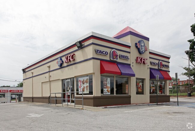
3815 Wilkens Ave
7653C-014
140X210
Medicalbuilding
Baltimore City
C-2
Maryland
B and X Area of moderate flood hazard, usually the area between the limits of the 100-year and 500-year floods.
14
2024
0.68 AC
2025
Baltimore Southwest
250103
Baltimore
3,560 SF
Baltimore-Columbia-Towson, MD
NEARBY LISTINGS FOR SALE OR LEASE
DEMOGRAPHICS near 3815 Wilkens Ave
1 mile
3 mile
5 mile
2025 Total Population
14,544
156,330
390,446
2030 Population
14,115
156,875
390,544
Pop Growth 2025-2030
(2.95%)
+ 0.35%
+ 0.03%
Average Age
39
39
39
2025 Total Households
5,824
60,385
164,268
HH Growth 2025-2030
(3.23%)
+ 0.19%
(0.17%)
Median Household Inc
$55,545
$58,133
$63,494
Avg Household Size
2.40
2.40
2.30
2025 Avg HH Vehicles
1.00
1.00
1.00
Median Home Value
$205,333
$232,544
$273,489
Median Year Built
1953
1952
1953
Nearby Places
Map Layers
Map Styles
 Street
 Aerial
Layers
 Traffic
 Biking
Places
Listings with unknown addresses are not visible on the map
- Restaurants
- Banks
- Shops
- Fitness
- Groceries
PUBLIC TRANSPORTATION
COMMUTER RAIL
Drive
Walk
Distance
6 min
2.5 mi
Drive
Walk
Distance
6 min
2.5 mi
AIRPORT
Baltimore/Washington International Thurgood Marshall
Drive
Walk
Distance
Baltimore/Washington International Thurgood Marshall
14 min
7.7 mi
Ronald Reagan Washington Ntl
Drive
Walk
Distance
Ronald Reagan Washington Ntl
62 min
39.8 mi
Freight Ports
Port of Baltimore
Drive
Walk
Distance
Port of Baltimore
12 min
4.3 mi
Nearby Properties
Address
Land Use
TOTAL SIZE
Lot Size
Zoning
Address
Land Use
TOTAL SIZE
Lot Size
Zoning
1,396,807 SF
32.73 AC
R-6
Address
Land Use
TOTAL SIZE
Lot Size
Zoning
2,182,087 SF
95.52 AC
DR5.5
Address
Land Use
TOTAL SIZE
Lot Size
Zoning
98,318 SF
175.16 AC
OT
Address
Land Use
TOTAL SIZE
Lot Size
Zoning
523,800 SF
28.02 AC
I-1
Address
Land Use
TOTAL SIZE
Lot Size
Zoning
315,055 SF
9.60 AC
ML
Address
Land Use
TOTAL SIZE
Lot Size
Zoning
1,308,804 SF
16.24 AC
I-MU
Address
Land Use
TOTAL SIZE
Lot Size
Zoning
88,254 SF
105.20 AC
DR2
Address
Land Use
TOTAL SIZE
Lot Size
Zoning
207,168 SF
63.84 AC
DR3.5
Address
Land Use
TOTAL SIZE
Lot Size
Zoning
312,231 SF
11.23 AC
R-5
Address
Land Use
TOTAL SIZE
Lot Size
Zoning
40.17 AC
DR16
Address
Land Use
TOTAL SIZE
Lot Size
Zoning
300,513 SF
32.53 AC
I-1
Address
Land Use
TOTAL SIZE
Lot Size
Zoning
48,300 SF
30.96 AC
ML
Address
Land Use
TOTAL SIZE
Lot Size
Zoning
156,834 SF
10.26 AC
DR5.5
Address
Land Use
TOTAL SIZE
Lot Size
Zoning
197,754 SF
12.63 AC
DR5.5
Address
Land Use
TOTAL SIZE
Lot Size
Zoning
101,220 SF
17.51 AC
DR5.5
Address
Land Use
TOTAL SIZE
Lot Size
Zoning
330,025 SF
13.16 AC
R-3
Address
Land Use
TOTAL SIZE
Lot Size
Zoning
15.29 AC
BLCCL
Address
Land Use
TOTAL SIZE
Lot Size
Zoning
19.86 AC
DR16
Address
Land Use
TOTAL SIZE
Lot Size
Zoning
148,500 SF
5.10 AC
Address
Land Use
TOTAL SIZE
Lot Size
Zoning
21.46 AC
ML
Address
Land Use
TOTAL SIZE
Lot Size
Zoning
15.08 AC
DR105
Address
Land Use
TOTAL SIZE
Lot Size
Zoning
820,980 SF
14.68 AC
R-8
Address
Land Use
TOTAL SIZE
Lot Size
Zoning
132,000 SF
29.26 AC
ML
Address
Land Use
TOTAL SIZE
Lot Size
Zoning
590,745 SF
52.60 AC
OS
Address
Land Use
TOTAL SIZE
Lot Size
Zoning
14.91 AC
DR16
Address
Land Use
TOTAL SIZE
Lot Size
Zoning
210,000 SF
11.11 AC
MH
Address
Land Use
TOTAL SIZE
Lot Size
Zoning
656,963 SF
30.41 AC
ML
Address
Land Use
TOTAL SIZE
Lot Size
Zoning
214,265 SF
21.03 AC
BLAS
Address
Land Use
TOTAL SIZE
Lot Size
Zoning
400,495 SF
28 AC
MH
Address
Land Use
TOTAL SIZE
Lot Size
Zoning
283,178 SF
15.84 AC
MH-IM
The World's #1 Commercial Real Estate Marketplace
Connect with us
© 2026 CoStar Group
The information above has been obtained from sources believed reliable. While we do not doubt its accuracy we have not verified it and make no guarantee, warranty or representation about it. It is your responsibility to independently confirm its accuracy and completeness. Any projections, opinions, assumptions, or estimates used are for example only and do not represent the current or future performance of the property. The value of this transaction to you depends on tax and other factors which should be evaluated by your tax, financial, and legal advisors. You and your advisors should conduct a careful, independent investigation of the property to determine to your satisfaction the suitability of the property for your needs.