Property Record
3817 Dearborn Dr, Durham, NC 27704
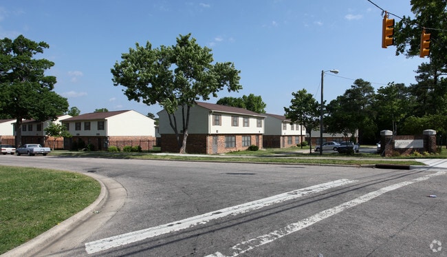
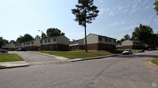
Property Detail
3817 Dearborn Dr
171834
INDEPENDENCE SQUARE/BLK:B LT#03 PL:000064-000001
Welfaresocialservicelowincomehousingexempt
DURHAM
RS-M
North Carolina
B and X Area of moderate flood hazard, usually the area between the limits of the 100-year and 500-year floods.
3
0
4.03 AC
2025
Weaver
001801
Raleigh/Durham
58,106 SF
Durham-Chapel Hill, NC
NEARBY LISTINGS FOR SALE OR LEASE
DEMOGRAPHICS near 3817 Dearborn Dr
1 mile
3 mile
5 mile
2025 Total Population
8,892
65,795
160,079
2030 Population
9,374
69,630
169,764
Pop Growth 2025-2030
+ 5.42%
+ 5.83%
+ 6.05%
Average Age
38
38
38
2025 Total Households
3,288
26,873
64,029
HH Growth 2025-2030
+ 5.57%
+ 6.11%
+ 6.49%
Median Household Inc
$64,133
$69,493
$68,270
Avg Household Size
2.50
2.30
2.30
2025 Avg HH Vehicles
2.00
2.00
2.00
Median Home Value
$315,521
$373,592
$377,074
Median Year Built
1988
1981
1984
Nearby Places
Map Layers
Map Styles
 Street
 Aerial
Transit
 Traffic
 Biking
Places
Listings with unknown addresses are not visible on the map
- Restaurants
- Banks
- Shops
- Fitness
- Groceries
PUBLIC TRANSPORTATION
COMMUTER RAIL
Durham Amtrak Station (Carolinian - Amtrak, Piedmont - Amtrak)
Drive
Walk
Distance
Durham Amtrak Station (Carolinian - Amtrak, Piedmont - Amtrak)
10 min
3.8 mi
AIRPORT
Raleigh-Durham International
Drive
Walk
Distance
Raleigh-Durham International
27 min
15.7 mi
Freight Ports
Virginia Port Authority - Richmond
Drive
Walk
Distance
Virginia Port Authority - Richmond
167 min
144.7 mi
Nearby Properties
Address
Land Use
TOTAL SIZE
Lot Size
Zoning
Address
Land Use
TOTAL SIZE
Lot Size
Zoning
749,544 SF
100.49 AC
OI,RS-8
Address
Land Use
TOTAL SIZE
Lot Size
Zoning
26,512 SF
6.40 AC
CD-C
Address
Land Use
TOTAL SIZE
Lot Size
Zoning
294,862 SF
2.37 AC
DD-C
Address
Land Use
TOTAL SIZE
Lot Size
Zoning
69,430 SF
2.61 AC
DD-C
Address
Land Use
TOTAL SIZE
Lot Size
Zoning
218,946 SF
1.91 AC
DD-S1
Address
Land Use
TOTAL SIZE
Lot Size
Zoning
368,569 SF
2.77 AC
Address
Land Use
TOTAL SIZE
Lot Size
Zoning
250,392 SF
16.67 AC
DD-S2
Address
Land Use
TOTAL SIZE
Lot Size
Zoning
485,295 SF
27.35 AC
RS-8
Address
Land Use
TOTAL SIZE
Lot Size
Zoning
69.37 AC
IL
Address
Land Use
TOTAL SIZE
Lot Size
Zoning
137,472 SF
1.04 AC
DD-C
Address
Land Use
TOTAL SIZE
Lot Size
Zoning
167,530 SF
1.46 AC
DD-S1
Address
Land Use
TOTAL SIZE
Lot Size
Zoning
6,753 SF
22.99 AC
OI(D)
Address
Land Use
TOTAL SIZE
Lot Size
Zoning
69,247 SF
3.09 AC
DD-C
Address
Land Use
TOTAL SIZE
Lot Size
Zoning
3.61 AC
DD-S1
Address
Land Use
TOTAL SIZE
Lot Size
Zoning
11,520 SF
1.18 AC
DD-S1
Address
Land Use
TOTAL SIZE
Lot Size
Zoning
124,420 SF
1.72 AC
DD-C
Address
Land Use
TOTAL SIZE
Lot Size
Zoning
114,840 SF
1.03 AC
DD-S1
Address
Land Use
TOTAL SIZE
Lot Size
Zoning
166,866 SF
76.52 AC
RS-10
Address
Land Use
TOTAL SIZE
Lot Size
Zoning
114,060 SF
2.28 AC
DD-C
Address
Land Use
TOTAL SIZE
Lot Size
Zoning
12,468 SF
13.33 AC
RU-M(D)
Address
Land Use
TOTAL SIZE
Lot Size
Zoning
81,930 SF
2.47 AC
DD-S1
Address
Land Use
TOTAL SIZE
Lot Size
Zoning
97.24 AC
UC(D)
Address
Land Use
TOTAL SIZE
Lot Size
Zoning
354,480 SF
34.53 AC
IL
Address
Land Use
TOTAL SIZE
Lot Size
Zoning
395,280 SF
1.27 AC
DD-C
Address
Land Use
TOTAL SIZE
Lot Size
Zoning
2,104 SF
0.49 AC
DD-S1
Address
Land Use
TOTAL SIZE
Lot Size
Zoning
156,975 SF
0.75 AC
DD-C
Address
Land Use
TOTAL SIZE
Lot Size
Zoning
119,322 SF
1.62 AC
DD-S2
Address
Land Use
TOTAL SIZE
Lot Size
Zoning
8.12 AC
RS-M
Address
Land Use
TOTAL SIZE
Lot Size
Zoning
4,644 SF
19.04 AC
RU-M
Address
Land Use
TOTAL SIZE
Lot Size
Zoning
156,909 SF
0.76 AC
DD-C
The World's #1 Commercial Real Estate Marketplace
Connect with us
© 2026 CoStar Group
The information above has been obtained from sources believed reliable. While we do not doubt its accuracy we have not verified it and make no guarantee, warranty or representation about it. It is your responsibility to independently confirm its accuracy and completeness. Any projections, opinions, assumptions, or estimates used are for example only and do not represent the current or future performance of the property. The value of this transaction to you depends on tax and other factors which should be evaluated by your tax, financial, and legal advisors. You and your advisors should conduct a careful, independent investigation of the property to determine to your satisfaction the suitability of the property for your needs.