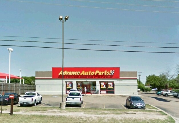
Property Record
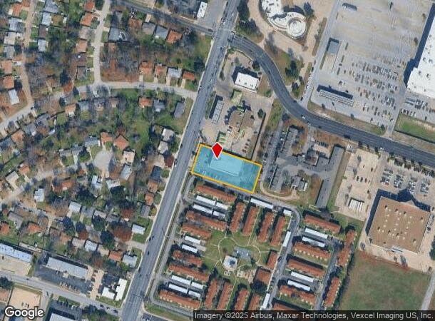
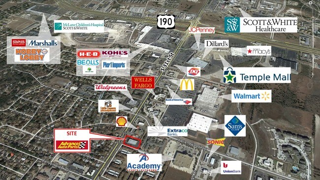
3817 S 31St St, Temple, TX 76502
NEARBY LISTINGS FOR SALE OR LEASE
Property Detail
3817 S 31St St
Killeen-Temple, TX
Hilltop Estates Addition Viii
133596
HILLTOP ESTATES ADDITION VIII, BLOCK 004, LOT 0002
Commercialnec
Bell
X
Texas
48027C0355E
2
2024
0.93 AC
2025
Temple
021304
Killeen/Temple/Fort Hood
11,340 SF
DEMOGRAPHICS near 3817 S 31St St
1 Mile
3 Mile
5 Mile
2024 Total Population
12,427
50,382
81,815
2029 Population
14,005
56,873
92,229
Pop Growth 2024-2029
+ 12.70%
+ 12.88%
+ 12.73%
Average Age
39
39
39
2024 Total Households
5,281
21,114
33,324
HH Growth 2024-2029
+ 13.16%
+ 13.15%
+ 13.01%
Median Household Inc
$55,333
$51,716
$53,384
Avg Household Size
2.20
2.30
2.40
2024 Avg HH Vehicles
2.00
2.00
2.00
Median Home Value
$179,256
$181,249
$182,151
Median Year Built
1991
1986
1986
Nearby Places
Map Layers
Map Styles
 Street
 Aerial
- Restaurants
- Banks
- Shops
- Fitness
- Groceries
PUBLIC TRANSPORTATION
COMMUTER RAIL
Temple (Texas Eagle - Amtrak)
DRIVE
WALK
Distance
Temple (Texas Eagle - Amtrak)
7 min
3.7 mi
AIRPORT
Killeen Municipal
DRIVE
WALK
Distance
Killeen Municipal
30 min
22.9 mi
Robert Gray AAF
DRIVE
WALK
Distance
Robert Gray AAF
50 min
36.8 mi
Freight Ports
Port of Houston
DRIVE
WALK
Distance
Port of Houston
229 min
180.3 mi
SALE & LEASE HISTORY
LISTING DATE
SALE/LEASE

Jun 27, 2019
For Sale
Nearby Properties
Address
Land Use
TOTAL SIZE
Lot Size
Zoning
Address
Land Use
TOTAL SIZE
Lot Size
Zoning
1,656,661 SF
194.39 AC
Address
Land Use
TOTAL SIZE
Lot Size
Zoning
1,546,481 SF
111.97 AC
MF2
Address
Land Use
TOTAL SIZE
Lot Size
Zoning
1 SF
23.50 AC
Address
Land Use
TOTAL SIZE
Lot Size
Zoning
208,941 SF
9.23 AC
Address
Land Use
TOTAL SIZE
Lot Size
Zoning
1 SF
30.52 AC
Address
Land Use
TOTAL SIZE
Lot Size
Zoning
250,571 SF
12 AC
Address
Land Use
TOTAL SIZE
Lot Size
Zoning
200,642 SF
9.01 AC
Address
Land Use
TOTAL SIZE
Lot Size
Zoning
202,292 SF
10.17 AC
Address
Land Use
TOTAL SIZE
Lot Size
Zoning
86,326 SF
8.70 AC
MF1
Address
Land Use
TOTAL SIZE
Lot Size
Zoning
77,450 SF
16.51 AC
Address
Land Use
TOTAL SIZE
Lot Size
Zoning
216,109 SF
8.16 AC
Address
Land Use
TOTAL SIZE
Lot Size
Zoning
198,957 SF
15.18 AC
Address
Land Use
TOTAL SIZE
Lot Size
Zoning
180,360 SF
9.66 AC
Address
Land Use
TOTAL SIZE
Lot Size
Zoning
1 SF
15 AC
SCHL
Address
Land Use
TOTAL SIZE
Lot Size
Zoning
167,344 SF
11.29 AC
Address
Land Use
TOTAL SIZE
Lot Size
Zoning
Address
Land Use
TOTAL SIZE
Lot Size
Zoning
287,006 SF
22.67 AC
Address
Land Use
TOTAL SIZE
Lot Size
Zoning
228,154 SF
17.95 AC
Address
Land Use
TOTAL SIZE
Lot Size
Zoning
168,754 SF
10.36 AC
LI
Address
Land Use
TOTAL SIZE
Lot Size
Zoning
Address
Land Use
TOTAL SIZE
Lot Size
Zoning
175,904 SF
20.33 AC
C
Address
Land Use
TOTAL SIZE
Lot Size
Zoning
45,641 SF
3.94 AC
O
Address
Land Use
TOTAL SIZE
Lot Size
Zoning
170,234 SF
8.97 AC
C
Address
Land Use
TOTAL SIZE
Lot Size
Zoning
153,043 SF
12.61 AC
Address
Land Use
TOTAL SIZE
Lot Size
Zoning
161,036 SF
52.18 AC
PD
Address
Land Use
TOTAL SIZE
Lot Size
Zoning
85,860 SF
4.26 AC
Address
Land Use
TOTAL SIZE
Lot Size
Zoning
277,885 SF
31.07 AC
Address
Land Use
TOTAL SIZE
Lot Size
Zoning
71,931 SF
8.64 AC
Address
Land Use
TOTAL SIZE
Lot Size
Zoning
48,463 SF
5.18 AC
Address
Land Use
TOTAL SIZE
Lot Size
Zoning
60,584 SF
2.14 AC
The World's #1 Commercial Real Estate Marketplace
Connect with us
© 2026 CoStar Group
The information above has been obtained from sources believed reliable. While we do not doubt its accuracy we have not verified it and make no guarantee, warranty or representation about it. It is your responsibility to independently confirm its accuracy and completeness. Any projections, opinions, assumptions, or estimates used are for example only and do not represent the current or future performance of the property. The value of this transaction to you depends on tax and other factors which should be evaluated by your tax, financial, and legal advisors. You and your advisors should conduct a careful, independent investigation of the property to determine to your satisfaction the suitability of the property for your needs.