Property Record
3817 S Lapeer Rd, Metamora, MI 48455
NEARBY LISTINGS FOR SALE OR LEASE
Property Detail
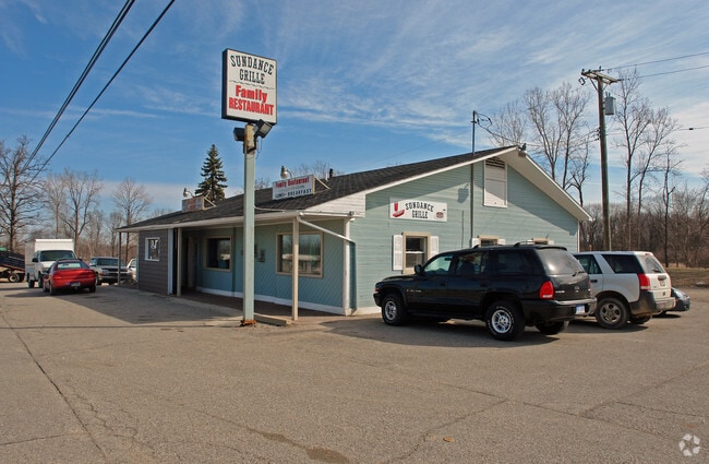
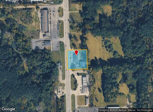
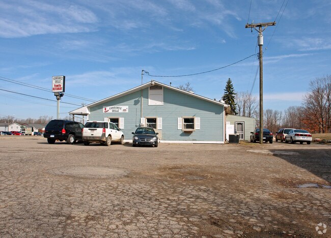
3817 S Lapeer Rd
015-008-059-10
PARCEL B - PART OF THE SE 1/4 OF SEC 8, T6N-R10E, METAMORA TWP, LAPEER CO, MICH DESCR AS BEG S03DEG40'30W 524FT ALONG THE
Restaurantbuilding
Lapeer
X
Michigan
26087C0400E
1.15 AC
2024
St Clair & Lapeer Counties
2025
Detroit
341500
Detroit-Warren-Dearborn, MI
6,140 SF
DEMOGRAPHICS near 3817 S Lapeer Rd
1 Mile
3 Mile
5 Mile
2024 Total Population
916
4,651
10,267
2029 Population
932
4,705
10,324
Pop Growth 2024-2029
+ 1.75%
+ 1.16%
+ 0.56%
Average Age
46
45
45
2024 Total Households
378
1,815
3,897
HH Growth 2024-2029
+ 1.85%
+ 1.16%
+ 0.56%
Median Household Inc
$72,817
$84,606
$95,847
Avg Household Size
2.40
2.50
2.60
2024 Avg HH Vehicles
2.00
2.00
2.00
Median Home Value
$256,976
$283,903
$313,053
Median Year Built
1979
1980
1980
Nearby Places
Map Layers
Map Styles
 Street
 Aerial
- Restaurants
- Banks
- Shops
- Fitness
- Groceries
PUBLIC TRANSPORTATION
COMMUTER RAIL
Lapeer Amtrak Station (Blue Water - Amtrak)
DRIVE
WALK
Distance
Lapeer Amtrak Station (Blue Water - Amtrak)
12 min
8.0 mi
AIRPORT
Bishop International
DRIVE
WALK
Distance
Bishop International
46 min
32.9 mi
Freight Ports
Port of Toledo
DRIVE
WALK
Distance
Port of Toledo
138 min
109.9 mi
Nearby Properties
Address
Land Use
TOTAL SIZE
Lot Size
Zoning
Address
Land Use
TOTAL SIZE
Lot Size
Zoning
240 AC
RC
Address
Land Use
TOTAL SIZE
Lot Size
Zoning
147,978 SF
6.87 AC
INDUSTRIAL
Address
Land Use
TOTAL SIZE
Lot Size
Zoning
71.96 AC
REC
Address
Land Use
TOTAL SIZE
Lot Size
Zoning
8,577 SF
154.36 AC
AR
Address
Land Use
TOTAL SIZE
Lot Size
Zoning
5.24 AC
REC
Address
Land Use
TOTAL SIZE
Lot Size
Zoning
208.46 AC
A-2
Address
Land Use
TOTAL SIZE
Lot Size
Zoning
576 SF
24.63 AC
MH
Address
Land Use
TOTAL SIZE
Lot Size
Zoning
220.81 AC
A-2
Address
Land Use
TOTAL SIZE
Lot Size
Zoning
80,800 SF
5.32 AC
M-1
Address
Land Use
TOTAL SIZE
Lot Size
Zoning
16,680 SF
10.95 AC
B-2
Address
Land Use
TOTAL SIZE
Lot Size
Zoning
121.60 AC
A-2
Address
Land Use
TOTAL SIZE
Lot Size
Zoning
71.64 AC
A-2
Address
Land Use
TOTAL SIZE
Lot Size
Zoning
6,782 SF
31.97 AC
A-2
Address
Land Use
TOTAL SIZE
Lot Size
Zoning
208 AC
R-1
Address
Land Use
TOTAL SIZE
Lot Size
Zoning
228.30 AC
R-1
Address
Land Use
TOTAL SIZE
Lot Size
Zoning
4,659 SF
34.44 AC
RA
Address
Land Use
TOTAL SIZE
Lot Size
Zoning
11,180 SF
2.05 AC
B-2
Address
Land Use
TOTAL SIZE
Lot Size
Zoning
5,305 SF
2.27 AC
B-2
Address
Land Use
TOTAL SIZE
Lot Size
Zoning
183.40 AC
A-2
Address
Land Use
TOTAL SIZE
Lot Size
Zoning
3,794 SF
76.05 AC
AR
Address
Land Use
TOTAL SIZE
Lot Size
Zoning
45.96 AC
R-1
Address
Land Use
TOTAL SIZE
Lot Size
Zoning
2,331 SF
65.73 AC
AR
Address
Land Use
TOTAL SIZE
Lot Size
Zoning
102.31 AC
A-2
Address
Land Use
TOTAL SIZE
Lot Size
Zoning
177.92 AC
R-1
Address
Land Use
TOTAL SIZE
Lot Size
Zoning
995 SF
156.21 AC
A-1
Address
Land Use
TOTAL SIZE
Lot Size
Zoning
19,740 SF
3.01 AC
B-2
Address
Land Use
TOTAL SIZE
Lot Size
Zoning
10,558 SF
7.48 AC
B-2
Address
Land Use
TOTAL SIZE
Lot Size
Zoning
2,281 SF
28 AC
AR
Address
Land Use
TOTAL SIZE
Lot Size
Zoning
4,000 SF
71.96 AC
AR
Address
Land Use
TOTAL SIZE
Lot Size
Zoning
3,168 SF
1.43 AC
B-2
The World's #1 Commercial Real Estate Marketplace
Connect with us
© 2025 CoStar Group
The information above has been obtained from sources believed reliable. While we do not doubt its accuracy we have not verified it and make no guarantee, warranty or representation about it. It is your responsibility to independently confirm its accuracy and completeness. Any projections, opinions, assumptions, or estimates used are for example only and do not represent the current or future performance of the property. The value of this transaction to you depends on tax and other factors which should be evaluated by your tax, financial, and legal advisors. You and your advisors should conduct a careful, independent investigation of the property to determine to your satisfaction the suitability of the property for your needs.