Property Record
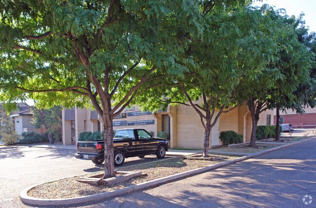
3819 22Nd Pl, Lubbock, TX 79410


Property Detail
3819 22Nd Pl
Lubbock, TX
Hord Buchanan
R115746
HORD BUCHANAN BLK 1 L 7 & 8
Commercialnec
Lubbock
AE
Texas
48303C0285E
7
2024
0.43 AC
2025
Southwest Inner Loop
001602
Lubbock
3,533 SF
NEARBY LISTINGS FOR SALE OR LEASE
DEMOGRAPHICS near 3819 22Nd Pl
1 mile
3 mile
5 mile
2024 Total Population
9,432
110,906
205,677
2029 Population
10,032
117,110
218,111
Pop Growth 2024-2029
+ 6.36%
+ 5.59%
+ 6.05%
Average Age
37
35
36
2024 Total Households
3,854
45,675
84,408
HH Growth 2024-2029
+ 7.16%
+ 5.94%
+ 6.36%
Median Household Inc
$44,173
$43,673
$51,323
Avg Household Size
2.10
2.30
2.30
2024 Avg HH Vehicles
2.00
2.00
2.00
Median Home Value
$181,050
$153,914
$167,557
Median Year Built
1964
1972
1979
Nearby Places
Map Layers
Map Styles
 Street
 Aerial
Transit
 Traffic
 Biking
Places
Listings with unknown addresses are not visible on the map
- Restaurants
- Banks
- Shops
- Fitness
- Groceries
PUBLIC TRANSPORTATION
AIRPORT
Lubbock Preston Smith International
Drive
Walk
Distance
Lubbock Preston Smith International
26 min
13.6 mi
Freight Ports
Tulsa Port Of Catoosa
Drive
Walk
Distance
Tulsa Port Of Catoosa
508 min
471.0 mi
SALE & LEASE HISTORY
LISTING DATE
SALE/LEASE

Oct 31, 2016
For Lease
Mar 04, 2019
For Sale
Mar 04, 2019
For Lease
Aug 02, 2017
For Sale
Nearby Properties
Address
Land Use
TOTAL SIZE
Lot Size
Zoning
Address
Land Use
TOTAL SIZE
Lot Size
Zoning
791,096 SF
63.76 AC
Address
Land Use
TOTAL SIZE
Lot Size
Zoning
79,376 SF
11.25 AC
Address
Land Use
TOTAL SIZE
Lot Size
Zoning
15,506 SF
18.67 AC
Address
Land Use
TOTAL SIZE
Lot Size
Zoning
103,717 SF
25.26 AC
Address
Land Use
TOTAL SIZE
Lot Size
Zoning
380,785 SF
36.72 AC
Address
Land Use
TOTAL SIZE
Lot Size
Zoning
353,616 SF
5.24 AC
Address
Land Use
TOTAL SIZE
Lot Size
Zoning
379,029 SF
29.43 AC
Address
Land Use
TOTAL SIZE
Lot Size
Zoning
351,150 SF
3.65 AC
Address
Land Use
TOTAL SIZE
Lot Size
Zoning
21,110 SF
13.02 AC
Address
Land Use
TOTAL SIZE
Lot Size
Zoning
342,611 SF
12.21 AC
Address
Land Use
TOTAL SIZE
Lot Size
Zoning
409,380 SF
30.13 AC
Address
Land Use
TOTAL SIZE
Lot Size
Zoning
321,540 SF
10.87 AC
Address
Land Use
TOTAL SIZE
Lot Size
Zoning
425,975 SF
45.17 AC
Address
Land Use
TOTAL SIZE
Lot Size
Zoning
286,541 SF
4.25 AC
Address
Land Use
TOTAL SIZE
Lot Size
Zoning
360,108 SF
18.63 AC
Address
Land Use
TOTAL SIZE
Lot Size
Zoning
304,276 SF
22.69 AC
Address
Land Use
TOTAL SIZE
Lot Size
Zoning
179,627 SF
2.66 AC
Address
Land Use
TOTAL SIZE
Lot Size
Zoning
274,547 SF
18.92 AC
Address
Land Use
TOTAL SIZE
Lot Size
Zoning
473,857 SF
17.64 AC
Address
Land Use
TOTAL SIZE
Lot Size
Zoning
444,507 SF
5.89 AC
Address
Land Use
TOTAL SIZE
Lot Size
Zoning
355,384 SF
19.63 AC
Address
Land Use
TOTAL SIZE
Lot Size
Zoning
120,867 SF
3.41 AC
Address
Land Use
TOTAL SIZE
Lot Size
Zoning
244,834 SF
14.54 AC
Address
Land Use
TOTAL SIZE
Lot Size
Zoning
665,100 SF
5.20 AC
Address
Land Use
TOTAL SIZE
Lot Size
Zoning
230,286 SF
8.01 AC
Address
Land Use
TOTAL SIZE
Lot Size
Zoning
122,016 SF
1.13 AC
Address
Land Use
TOTAL SIZE
Lot Size
Zoning
122,976 SF
14.50 AC
Address
Land Use
TOTAL SIZE
Lot Size
Zoning
396,570 SF
2.56 AC
Address
Land Use
TOTAL SIZE
Lot Size
Zoning
88,803 SF
7.23 AC
Address
Land Use
TOTAL SIZE
Lot Size
Zoning
106,894 SF
5.83 AC
The World's #1 Commercial Real Estate Marketplace
Connect with us
© 2026 CoStar Group
The information above has been obtained from sources believed reliable. While we do not doubt its accuracy we have not verified it and make no guarantee, warranty or representation about it. It is your responsibility to independently confirm its accuracy and completeness. Any projections, opinions, assumptions, or estimates used are for example only and do not represent the current or future performance of the property. The value of this transaction to you depends on tax and other factors which should be evaluated by your tax, financial, and legal advisors. You and your advisors should conduct a careful, independent investigation of the property to determine to your satisfaction the suitability of the property for your needs.