Property Record
3819 Route 1, Princeton, NJ 08540


NEARBY LISTINGS FOR SALE OR LEASE
-
-
View all Princeton listings for sale on LoopNet.com
Property Detail
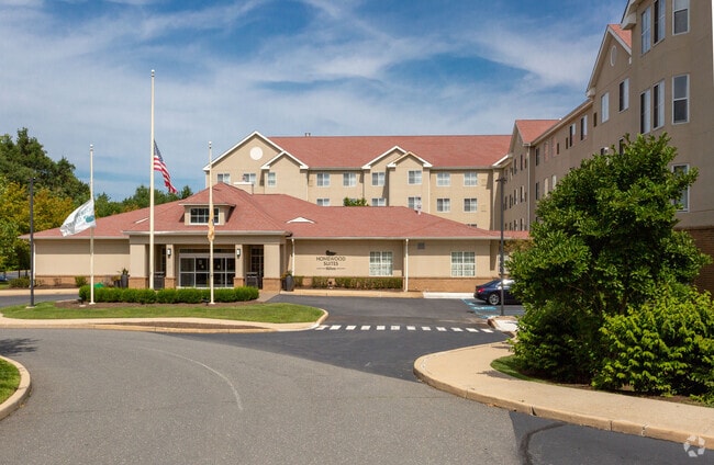
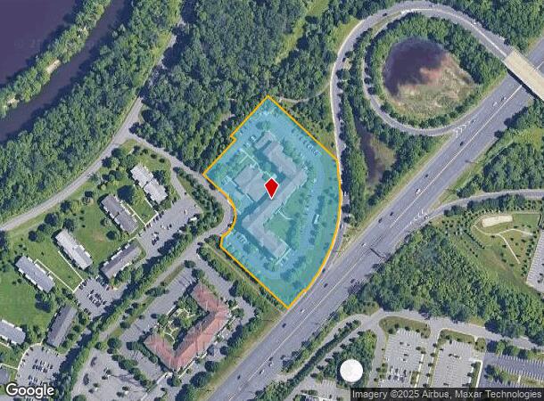
3819 Route 1
New York-Jersey City-White Plains, NY-NJ
4.50 AC
18-00302-0000-00005-02
Middlesex
Vacantlandnec
New Jersey
X
5.2
34021C0134F
4.50 AC
2024
Princeton/Central
2025
Northern New Jersey
008605
DEMOGRAPHICS near 3819 Route 1
1 Mile
3 Mile
5 Mile
2024 Total Population
3,332
47,738
103,090
2029 Population
3,315
47,684
102,560
Pop Growth 2024-2029
(0.51%)
(0.11%)
(0.51%)
Average Age
44
40
40
2024 Total Households
1,324
17,747
38,135
HH Growth 2024-2029
(0.53%)
+ 0.04%
(0.47%)
Median Household Inc
$139,705
$138,035
$145,598
Avg Household Size
2.40
2.50
2.60
2024 Avg HH Vehicles
2.00
2.00
2.00
Median Home Value
$762,959
$748,576
$698,929
Median Year Built
1981
1982
1985
Nearby Places
Map Layers
Map Styles
 Street
 Aerial
- Restaurants
- Banks
- Shops
- Fitness
- Groceries
PUBLIC TRANSPORTATION
COMMUTER RAIL
Princeton Junction (Northeast Corridor Line - NJ Transit Commuter Rail (NJ Transit), Princeton Branch - NJ Transit Commuter Rail (NJ Transit))
DRIVE
WALK
Distance
Princeton Junction (Northeast Corridor Line - NJ Transit Commuter Rail (NJ Transit), Princeton Branch - NJ Transit Commuter Rail (NJ Transit))
5 min
2.5 mi
Princeton (Princeton Branch - NJ Transit Commuter Rail (NJ Transit))
DRIVE
WALK
Distance
Princeton (Princeton Branch - NJ Transit Commuter Rail (NJ Transit))
6 min
2.9 mi
AIRPORT
Trenton Mercer
DRIVE
WALK
Distance
Trenton Mercer
21 min
14.4 mi
Freight Ports
New York Container Terminal
DRIVE
WALK
Distance
New York Container Terminal
50 min
35.2 mi
Nearby Properties
Address
Land Use
TOTAL SIZE
Lot Size
Zoning
Address
Land Use
TOTAL SIZE
Lot Size
Zoning
636,000 SF
60.76 AC
PHCR
Address
Land Use
TOTAL SIZE
Lot Size
Zoning
58.63 AC
PMUD
Address
Land Use
TOTAL SIZE
Lot Size
Zoning
492,110 SF
58.48 AC
I100
Address
Land Use
TOTAL SIZE
Lot Size
Zoning
Address
Land Use
TOTAL SIZE
Lot Size
Zoning
Address
Land Use
TOTAL SIZE
Lot Size
Zoning
46.23 AC
PCD
Address
Land Use
TOTAL SIZE
Lot Size
Zoning
30.62 AC
E
Address
Land Use
TOTAL SIZE
Lot Size
Zoning
24.85 AC
E
Address
Land Use
TOTAL SIZE
Lot Size
Zoning
62.22 AC
PRN1
Address
Land Use
TOTAL SIZE
Lot Size
Zoning
50.08 AC
PMUD
Address
Land Use
TOTAL SIZE
Lot Size
Zoning
265,000 SF
4.84 AC
Address
Land Use
TOTAL SIZE
Lot Size
Zoning
34.97 AC
PMUD
Address
Land Use
TOTAL SIZE
Lot Size
Zoning
23.64 AC
PMUD
Address
Land Use
TOTAL SIZE
Lot Size
Zoning
24.38 AC
ROM2
Address
Land Use
TOTAL SIZE
Lot Size
Zoning
8.97 AC
HMC
Address
Land Use
TOTAL SIZE
Lot Size
Zoning
25.66 AC
PHCR
Address
Land Use
TOTAL SIZE
Lot Size
Zoning
44.62 AC
R5A
Address
Land Use
TOTAL SIZE
Lot Size
Zoning
115,000 SF
7.98 AC
OR2
Address
Land Use
TOTAL SIZE
Lot Size
Zoning
405,811 SF
4.14 AC
Address
Land Use
TOTAL SIZE
Lot Size
Zoning
17.17 AC
PMN
Address
Land Use
TOTAL SIZE
Lot Size
Zoning
89.76 AC
R100
Address
Land Use
TOTAL SIZE
Lot Size
Zoning
18.52 AC
ROM2
Address
Land Use
TOTAL SIZE
Lot Size
Zoning
216,000 SF
22.79 AC
SC
Address
Land Use
TOTAL SIZE
Lot Size
Zoning
27.69 AC
B-2
Address
Land Use
TOTAL SIZE
Lot Size
Zoning
66.62 AC
PMUD
Address
Land Use
TOTAL SIZE
Lot Size
Zoning
258,277 SF
5.96 AC
Address
Land Use
TOTAL SIZE
Lot Size
Zoning
225,407 SF
22 AC
PMUD
Address
Land Use
TOTAL SIZE
Lot Size
Zoning
2.49 AC
E3
Address
Land Use
TOTAL SIZE
Lot Size
Zoning
0.78 AC
PHCR
Address
Land Use
TOTAL SIZE
Lot Size
Zoning
11.75 AC
PMUD
The World's #1 Commercial Real Estate Marketplace
Connect with us
© 2025 CoStar Group
The information above has been obtained from sources believed reliable. While we do not doubt its accuracy we have not verified it and make no guarantee, warranty or representation about it. It is your responsibility to independently confirm its accuracy and completeness. Any projections, opinions, assumptions, or estimates used are for example only and do not represent the current or future performance of the property. The value of this transaction to you depends on tax and other factors which should be evaluated by your tax, financial, and legal advisors. You and your advisors should conduct a careful, independent investigation of the property to determine to your satisfaction the suitability of the property for your needs.