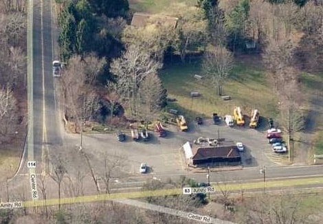
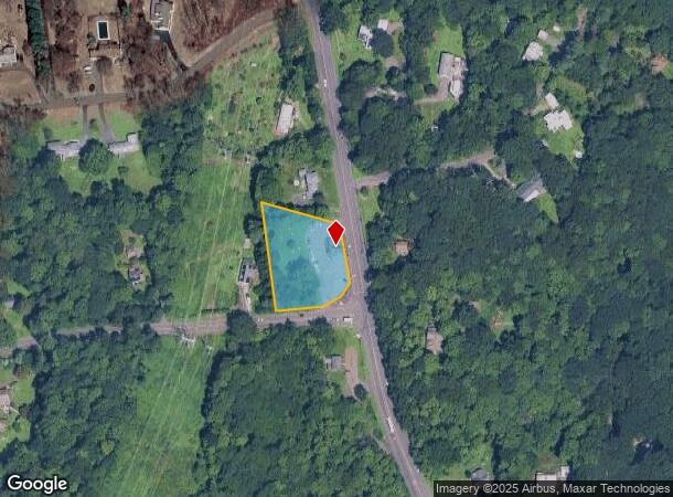
Property Record
382 Amity Rd, Woodbridge, CT 06525
NEARBY LISTINGS FOR SALE OR LEASE
Property Detail
382 Amity Rd
WOOD-001804-000030-000382
New Haven
Storebuilding
Connecticut
X
382
09009C0426H
1.17 AC
2025
Woodbridge
2025
Westchester/So Connecticut
160200
New Haven, CT
1,271 SF
DEMOGRAPHICS near 382 Amity Rd
1 mile
3 mile
5 mile
2024 Total Population
1,632
39,931
182,155
2029 Population
1,637
39,608
181,510
Pop Growth 2024-2029
+ 0.31%
(0.81%)
(0.35%)
Average Age
46
39
38
2024 Total Households
638
14,583
70,827
HH Growth 2024-2029
+ 0.31%
(1.00%)
(0.35%)
Median Household Inc
$106,640
$90,425
$68,908
Avg Household Size
2.40
2.50
2.30
2024 Avg HH Vehicles
2.00
2.00
1.00
Median Home Value
$435,200
$284,115
$273,841
Median Year Built
1964
1956
1957
Nearby Places
Map Layers
Map Styles
 Street
 Aerial
Transit
 Traffic
 Biking
Places
Listings with unknown addresses are not visible on the map
- Restaurants
- Banks
- Shops
- Fitness
- Groceries
PUBLIC TRANSPORTATION
COMMUTER RAIL
New Haven-State Street Station (New Haven Line - Metro-North Commuter Railroad Company (Metro-North))
Drive
Walk
Distance
New Haven-State Street Station (New Haven Line - Metro-North Commuter Railroad Company (Metro-North))
10 min
5.3 mi
Drive
Walk
Distance
10 min
6.0 mi
AIRPORT
Tweed/New Haven
Drive
Walk
Distance
Tweed/New Haven
20 min
9.6 mi
Freight Ports
Port of New Haven
Drive
Walk
Distance
Port of New Haven
14 min
7.4 mi
Nearby Properties
Address
Land Use
TOTAL SIZE
Lot Size
Zoning
Address
Land Use
TOTAL SIZE
Lot Size
Zoning
111,274 SF
22.62 AC
CEM
Address
Land Use
TOTAL SIZE
Lot Size
Zoning
9,767 SF
33.63 AC
RM1
Address
Land Use
TOTAL SIZE
Lot Size
Zoning
57,339 SF
3.46 AC
RM2
Address
Land Use
TOTAL SIZE
Lot Size
Zoning
75,139 SF
3.54 AC
RM1
Address
Land Use
TOTAL SIZE
Lot Size
Zoning
6,784 SF
17.53 AC
RM1
Address
Land Use
TOTAL SIZE
Lot Size
Zoning
73,504 SF
7.97 AC
PDD 10
Address
Land Use
TOTAL SIZE
Lot Size
Zoning
25 AC
A
Address
Land Use
TOTAL SIZE
Lot Size
Zoning
576 SF
RS2
Address
Land Use
TOTAL SIZE
Lot Size
Zoning
46,962 SF
1.48 AC
RM1/RS
Address
Land Use
TOTAL SIZE
Lot Size
Zoning
86,644 SF
14 AC
PARK
Address
Land Use
TOTAL SIZE
Lot Size
Zoning
59,950 SF
3.29 AC
R4
Address
Land Use
TOTAL SIZE
Lot Size
Zoning
90,740 SF
1.97 AC
BA/RM1
Address
Land Use
TOTAL SIZE
Lot Size
Zoning
10.43 AC
M
Address
Land Use
TOTAL SIZE
Lot Size
Zoning
89,436 SF
14.41 AC
R2
Address
Land Use
TOTAL SIZE
Lot Size
Zoning
146,678 SF
43.44 AC
A
Address
Land Use
TOTAL SIZE
Lot Size
Zoning
2,180 SF
20.50 AC
PARK
Address
Land Use
TOTAL SIZE
Lot Size
Zoning
53.48 AC
A
Address
Land Use
TOTAL SIZE
Lot Size
Zoning
104,815 SF
14.50 AC
BA/RS2
Address
Land Use
TOTAL SIZE
Lot Size
Zoning
9,498 SF
8.85 AC
RS2
Address
Land Use
TOTAL SIZE
Lot Size
Zoning
56,573 SF
10.70 AC
RM1
Address
Land Use
TOTAL SIZE
Lot Size
Zoning
18,073 SF
2.81 AC
RM2
Address
Land Use
TOTAL SIZE
Lot Size
Zoning
203.57 AC
PARK
Address
Land Use
TOTAL SIZE
Lot Size
Zoning
203.58 AC
RS2
Address
Land Use
TOTAL SIZE
Lot Size
Zoning
192,769 SF
18.84 AC
R4
Address
Land Use
TOTAL SIZE
Lot Size
Zoning
7,551 SF
287.59 AC
RS2
Address
Land Use
TOTAL SIZE
Lot Size
Zoning
14,582 SF
1.94 AC
RM1
Address
Land Use
TOTAL SIZE
Lot Size
Zoning
19 AC
B&I
Address
Land Use
TOTAL SIZE
Lot Size
Zoning
47,423 SF
2.14 AC
R4
Address
Land Use
TOTAL SIZE
Lot Size
Zoning
3,264 SF
PDD 11
Address
Land Use
TOTAL SIZE
Lot Size
Zoning
51,368 SF
13 AC
R4
The World's #1 Commercial Real Estate Marketplace
Connect with us
© 2026 CoStar Group
The information above has been obtained from sources believed reliable. While we do not doubt its accuracy we have not verified it and make no guarantee, warranty or representation about it. It is your responsibility to independently confirm its accuracy and completeness. Any projections, opinions, assumptions, or estimates used are for example only and do not represent the current or future performance of the property. The value of this transaction to you depends on tax and other factors which should be evaluated by your tax, financial, and legal advisors. You and your advisors should conduct a careful, independent investigation of the property to determine to your satisfaction the suitability of the property for your needs.