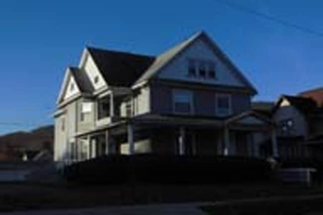
Property Record
382 E 2Nd St, Corning, NY 14830

Property Detail
382 E 2Nd St
Corning, NY
MAP 5 BLOCK 3 LOT 6 63X165
460300-318-055-0001-051-000
Steuben
Commercialofficeresidentialmixeduse
New York
R2
51.000
2025
0.24 AC
2025
Ithaca/Elmira
962700
Other Market Areas
2,685 SF
NEARBY LISTINGS FOR SALE OR LEASE
DEMOGRAPHICS near 382 E 2Nd St
1 mile
3 mile
5 mile
2025 Total Population
4,768
14,647
23,601
2030 Population
4,633
14,196
22,962
Pop Growth 2025-2030
(2.83%)
(3.08%)
(2.71%)
Average Age
41
41
42
2025 Total Households
2,170
6,624
10,358
HH Growth 2025-2030
(3.13%)
(3.19%)
(2.81%)
Median Household Inc
$65,012
$68,916
$76,547
Avg Household Size
2.10
2.10
2.20
2025 Avg HH Vehicles
2.00
2.00
2.00
Median Home Value
$197,643
$176,239
$187,594
Median Year Built
1948
1949
1958
Nearby Places
Map Layers
Map Styles
 Street
 Aerial
Layers
 Traffic
 Biking
Places
Listings with unknown addresses are not visible on the map
- Restaurants
- Banks
- Shops
- Fitness
- Groceries
PUBLIC TRANSPORTATION
AIRPORT
Elmira/Corning Regional
Drive
Walk
Distance
Elmira/Corning Regional
15 min
9.8 mi
Freight Ports
Albany, NY Port
Drive
Walk
Distance
Albany, NY Port
252 min
211.5 mi
SALE & LEASE HISTORY
LISTING DATE
SALE/LEASE

Sep 24, 2016
For Sale
Sep 11, 2017
For Sale
Oct 11, 2017
For Sale
Apr 13, 2017
For Sale
Nearby Properties
Address
Land Use
TOTAL SIZE
Lot Size
Zoning
Address
Land Use
TOTAL SIZE
Lot Size
Zoning
52,288 SF
9.50 AC
BD
Address
Land Use
TOTAL SIZE
Lot Size
Zoning
302,250 SF
19.74 AC
BD
Address
Land Use
TOTAL SIZE
Lot Size
Zoning
Address
Land Use
TOTAL SIZE
Lot Size
Zoning
Address
Land Use
TOTAL SIZE
Lot Size
Zoning
27,603 SF
90.91 AC
CONF
Address
Land Use
TOTAL SIZE
Lot Size
Zoning
17,717 SF
205.78 AC
CONF
Address
Land Use
TOTAL SIZE
Lot Size
Zoning
279,299 SF
6.72 AC
PC
Address
Land Use
TOTAL SIZE
Lot Size
Zoning
78,653 SF
4.06 AC
BD
Address
Land Use
TOTAL SIZE
Lot Size
Zoning
3.32 AC
C
Address
Land Use
TOTAL SIZE
Lot Size
Zoning
81,728 SF
4.03 AC
BD
Address
Land Use
TOTAL SIZE
Lot Size
Zoning
97,110 SF
13.31 AC
C
Address
Land Use
TOTAL SIZE
Lot Size
Zoning
82,123 SF
1.35 AC
C
Address
Land Use
TOTAL SIZE
Lot Size
Zoning
90,947 SF
2.49 AC
C
Address
Land Use
TOTAL SIZE
Lot Size
Zoning
43,869 SF
5.02 AC
BD
Address
Land Use
TOTAL SIZE
Lot Size
Zoning
Address
Land Use
TOTAL SIZE
Lot Size
Zoning
48,040 SF
12.11 AC
BD
Address
Land Use
TOTAL SIZE
Lot Size
Zoning
Address
Land Use
TOTAL SIZE
Lot Size
Zoning
20.37 AC
07 - MIXED
Address
Land Use
TOTAL SIZE
Lot Size
Zoning
82,146 SF
2.60 AC
R2
Address
Land Use
TOTAL SIZE
Lot Size
Zoning
18,524 SF
2.86 AC
C
Address
Land Use
TOTAL SIZE
Lot Size
Zoning
242,379 SF
4.30 AC
BD
Address
Land Use
TOTAL SIZE
Lot Size
Zoning
49,384 SF
1.19 AC
C
Address
Land Use
TOTAL SIZE
Lot Size
Zoning
29,752 SF
0.33 AC
C
Address
Land Use
TOTAL SIZE
Lot Size
Zoning
84,356 SF
2.46 AC
MR
Address
Land Use
TOTAL SIZE
Lot Size
Zoning
40,000 SF
1.84 AC
CONF
Address
Land Use
TOTAL SIZE
Lot Size
Zoning
22.80 AC
05 - COMME
Address
Land Use
TOTAL SIZE
Lot Size
Zoning
1.09 AC
CONF
Address
Land Use
TOTAL SIZE
Lot Size
Zoning
18,760 SF
0.01 AC
BD
Address
Land Use
TOTAL SIZE
Lot Size
Zoning
28 AC
CL
Address
Land Use
TOTAL SIZE
Lot Size
Zoning
96,080 SF
1.96 AC
MR
The World's #1 Commercial Real Estate Marketplace
Connect with us
© 2026 CoStar Group
The information above has been obtained from sources believed reliable. While we do not doubt its accuracy we have not verified it and make no guarantee, warranty or representation about it. It is your responsibility to independently confirm its accuracy and completeness. Any projections, opinions, assumptions, or estimates used are for example only and do not represent the current or future performance of the property. The value of this transaction to you depends on tax and other factors which should be evaluated by your tax, financial, and legal advisors. You and your advisors should conduct a careful, independent investigation of the property to determine to your satisfaction the suitability of the property for your needs.