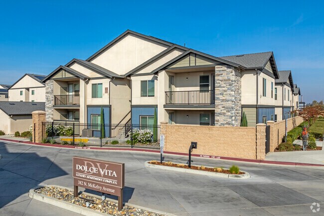
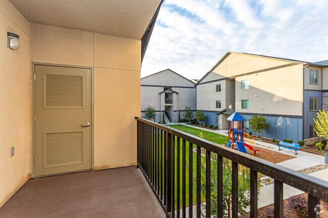
Property Record
382 N Mckelvy Ave, Clovis, CA 93611

Property Detail
382 N Mckelvy Ave
550-020-70
6.51 AC IN E1/2 OF LOT 16 MCKELVY TRACT
Apartment
Fresno
RA
California
B and X Area of moderate flood hazard, usually the area between the limits of the 100-year and 500-year floods.
6.51 AC
2025
East Fresno
2025
Fresno
005702
Fresno, CA
182,606 SF
NEARBY LISTINGS FOR SALE OR LEASE
-
-
View all Clovis listings for sale on LoopNet.com
DEMOGRAPHICS near 382 N Mckelvy Ave
1 mile
3 mile
5 mile
2025 Total Population
10,350
92,737
201,561
2030 Population
10,540
94,160
205,206
Pop Growth 2025-2030
+ 1.84%
+ 1.53%
+ 1.81%
Average Age
39
39
38
2025 Total Households
3,669
32,169
69,691
HH Growth 2025-2030
+ 1.94%
+ 1.54%
+ 1.78%
Median Household Inc
$109,680
$107,117
$96,976
Avg Household Size
2.80
2.80
2.80
2025 Avg HH Vehicles
2.00
2.00
2.00
Median Home Value
$454,462
$505,409
$480,172
Median Year Built
1995
1996
1993
Nearby Places
Map Layers
Map Styles
 Street
 Aerial
Layers
 Traffic
 Biking
Places
Listings with unknown addresses are not visible on the map
- Restaurants
- Banks
- Shops
- Fitness
- Groceries
PUBLIC TRANSPORTATION
AIRPORT
Fresno Yosemite International
Drive
Walk
Distance
Fresno Yosemite International
15 min
9.3 mi
Nearby Properties
Address
Land Use
TOTAL SIZE
Lot Size
Zoning
Address
Land Use
TOTAL SIZE
Lot Size
Zoning
397,556 SF
20.45 AC
CP
Address
Land Use
TOTAL SIZE
Lot Size
Zoning
110,872 SF
2.62 AC
CP
Address
Land Use
TOTAL SIZE
Lot Size
Zoning
165,476 SF
13.90 AC
CP
Address
Land Use
TOTAL SIZE
Lot Size
Zoning
268,956 SF
13.25 AC
R3
Address
Land Use
TOTAL SIZE
Lot Size
Zoning
249,818 SF
12.24 AC
PCC
Address
Land Use
TOTAL SIZE
Lot Size
Zoning
96,386 SF
8.47 AC
RT
Address
Land Use
TOTAL SIZE
Lot Size
Zoning
102,688 SF
10.59 AC
CP
Address
Land Use
TOTAL SIZE
Lot Size
Zoning
191,177 SF
19.19 AC
C2
Address
Land Use
TOTAL SIZE
Lot Size
Zoning
91,715 SF
4.50 AC
R3
Address
Land Use
TOTAL SIZE
Lot Size
Zoning
152,918 SF
15.85 AC
C2
Address
Land Use
TOTAL SIZE
Lot Size
Zoning
86,678 SF
4.16 AC
CP
Address
Land Use
TOTAL SIZE
Lot Size
Zoning
32,151 SF
14.84 AC
Address
Land Use
TOTAL SIZE
Lot Size
Zoning
67,465 SF
12.60 AC
C
Address
Land Use
TOTAL SIZE
Lot Size
Zoning
8.11 AC
Address
Land Use
TOTAL SIZE
Lot Size
Zoning
156,738 SF
12.05 AC
R3A
Address
Land Use
TOTAL SIZE
Lot Size
Zoning
86,136 SF
5.50 AC
M2
Address
Land Use
TOTAL SIZE
Lot Size
Zoning
83,458 SF
2.66 AC
PCC
Address
Land Use
TOTAL SIZE
Lot Size
Zoning
124,728 SF
10.96 AC
R2
Address
Land Use
TOTAL SIZE
Lot Size
Zoning
30,149 SF
16.79 AC
CP
Address
Land Use
TOTAL SIZE
Lot Size
Zoning
114,460 SF
7.79 AC
R2
Address
Land Use
TOTAL SIZE
Lot Size
Zoning
57,695 SF
4.99 AC
R2A
Address
Land Use
TOTAL SIZE
Lot Size
Zoning
401,192 SF
0.01 AC
PCC
Address
Land Use
TOTAL SIZE
Lot Size
Zoning
123,120 SF
8.82 AC
RA
Address
Land Use
TOTAL SIZE
Lot Size
Zoning
110,784 SF
6.63 AC
Address
Land Use
TOTAL SIZE
Lot Size
Zoning
109,347 SF
9.12 AC
R3
Address
Land Use
TOTAL SIZE
Lot Size
Zoning
83,543 SF
6.79 AC
C2
Address
Land Use
TOTAL SIZE
Lot Size
Zoning
32,230 SF
7.76 AC
R2
The World's #1 Commercial Real Estate Marketplace
Connect with us
© 2026 CoStar Group
The information above has been obtained from sources believed reliable. While we do not doubt its accuracy we have not verified it and make no guarantee, warranty or representation about it. It is your responsibility to independently confirm its accuracy and completeness. Any projections, opinions, assumptions, or estimates used are for example only and do not represent the current or future performance of the property. The value of this transaction to you depends on tax and other factors which should be evaluated by your tax, financial, and legal advisors. You and your advisors should conduct a careful, independent investigation of the property to determine to your satisfaction the suitability of the property for your needs.