Property Record
382 Steels Bridge Rd, Canton, GA 30114
NEARBY LISTINGS FOR SALE OR LEASE
Property Detail
382 Steels Bridge Rd
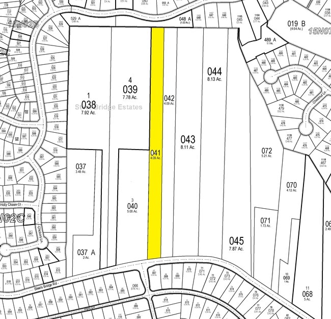
015N02-00000-044-000-0000
LL 290 15TH D
Agriculturalland
Cherokee
X
Georgia
13057C0240E
290
2025
28.40 AC
2025
Cherokee County
090706
Atlanta
1,755 SF
Atlanta-Sandy Springs-Roswell, GA
DEMOGRAPHICS near 382 Steels Bridge Rd
1 Mile
3 Mile
5 Mile
2024 Total Population
5,103
33,031
87,158
2029 Population
5,830
37,597
99,651
Pop Growth 2024-2029
+ 14.25%
+ 13.82%
+ 14.33%
Average Age
41
40
40
2024 Total Households
1,759
11,451
31,139
HH Growth 2024-2029
+ 14.44%
+ 13.95%
+ 14.51%
Median Household Inc
$147,043
$130,495
$105,656
Avg Household Size
2.90
2.80
2.70
2024 Avg HH Vehicles
2.00
2.00
2.00
Median Home Value
$434,068
$380,097
$348,604
Median Year Built
2003
2000
1999
Nearby Places
- Restaurants
- Banks
- Shops
- Fitness
- Groceries
SALE & LEASE HISTORY
LISTING DATE
SALE/LEASE

Sep 13, 2019
For Sale
Nearby Properties
Address
Land Use
TOTAL SIZE
Lot Size
Zoning
Address
Land Use
TOTAL SIZE
Lot Size
Zoning
79,162 SF
8.54 AC
RM16
Address
Land Use
TOTAL SIZE
Lot Size
Zoning
302,757 SF
62.80 AC
PUD
Address
Land Use
TOTAL SIZE
Lot Size
Zoning
177,744 SF
23.73 AC
PUD
Address
Land Use
TOTAL SIZE
Lot Size
Zoning
299,408 SF
15 AC
TND
Address
Land Use
TOTAL SIZE
Lot Size
Zoning
94,150 SF
24.74 AC
AG
Address
Land Use
TOTAL SIZE
Lot Size
Zoning
70,397 SF
13.24 AC
R-20
Address
Land Use
TOTAL SIZE
Lot Size
Zoning
33,071 SF
1.70 AC
TND
Address
Land Use
TOTAL SIZE
Lot Size
Zoning
24,984 SF
2.16 AC
GC
Address
Land Use
TOTAL SIZE
Lot Size
Zoning
57,363 SF
19.68 AC
PUD
Address
Land Use
TOTAL SIZE
Lot Size
Zoning
67,422 SF
8.14 AC
PUD
Address
Land Use
TOTAL SIZE
Lot Size
Zoning
56,991 SF
5.82 AC
NC
Address
Land Use
TOTAL SIZE
Lot Size
Zoning
41,010 SF
22.25 AC
PUD
Address
Land Use
TOTAL SIZE
Lot Size
Zoning
57,616 SF
14.29 AC
LI
Address
Land Use
TOTAL SIZE
Lot Size
Zoning
15,014 SF
210.76 AC
PUD
Address
Land Use
TOTAL SIZE
Lot Size
Zoning
14,505 SF
2.58 AC
TND
Address
Land Use
TOTAL SIZE
Lot Size
Zoning
40 AC
PUD
Address
Land Use
TOTAL SIZE
Lot Size
Zoning
10,286 SF
174.50 AC
PUD
Address
Land Use
TOTAL SIZE
Lot Size
Zoning
23,182 SF
2.43 AC
PUD
Address
Land Use
TOTAL SIZE
Lot Size
Zoning
20,822 SF
27.59 AC
PUD
Address
Land Use
TOTAL SIZE
Lot Size
Zoning
616 SF
25 AC
PUD
Address
Land Use
TOTAL SIZE
Lot Size
Zoning
23,420 SF
8.24 AC
GC
Address
Land Use
TOTAL SIZE
Lot Size
Zoning
35,517 SF
2.19 AC
GC
Address
Land Use
TOTAL SIZE
Lot Size
Zoning
14,550 SF
1.70 AC
PUD
Address
Land Use
TOTAL SIZE
Lot Size
Zoning
11,290 SF
1.58 AC
TND
Address
Land Use
TOTAL SIZE
Lot Size
Zoning
12,765 SF
3.92 AC
GC
Address
Land Use
TOTAL SIZE
Lot Size
Zoning
18,742 SF
1.93 AC
PUD
Address
Land Use
TOTAL SIZE
Lot Size
Zoning
7,886 SF
2 AC
PUD
Address
Land Use
TOTAL SIZE
Lot Size
Zoning
4,848 SF
1.43 AC
PUD
Address
Land Use
TOTAL SIZE
Lot Size
Zoning
4,109 SF
1.38 AC
GC
Address
Land Use
TOTAL SIZE
Lot Size
Zoning
20,249 SF
7.86 AC
AG
The World's #1 Commercial Real Estate Marketplace
Connect with us
© 2025 CoStar Group
The information above has been obtained from sources believed reliable. While we do not doubt its accuracy we have not verified it and make no guarantee, warranty or representation about it. It is your responsibility to independently confirm its accuracy and completeness. Any projections, opinions, assumptions, or estimates used are for example only and do not represent the current or future performance of the property. The value of this transaction to you depends on tax and other factors which should be evaluated by your tax, financial, and legal advisors. You and your advisors should conduct a careful, independent investigation of the property to determine to your satisfaction the suitability of the property for your needs.