Property Record
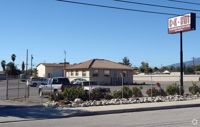
3820 Cajon Blvd, San Bernardino, CA 92407


NEARBY LISTINGS FOR SALE OR LEASE
Property Detail
3820 Cajon Blvd
Riverside-San Bernardino-Ontario, CA
LOTS 22, 23 AND 24 OF TRACT NO. 2946 AND EX RD
0267-081-32
San Bernardino
Slaughterhousestockyard
California
2024
22,23
2025
2.36 AC
004101
San Bernardino
960 SF
Inland Empire (California)
DEMOGRAPHICS near 3820 Cajon Blvd
1 Mile
3 Mile
5 Mile
2024 Total Population
12,205
90,006
266,501
2029 Population
12,323
91,226
270,166
Pop Growth 2024-2029
+ 0.97%
+ 1.36%
+ 1.38%
Average Age
33
34
34
2024 Total Households
3,198
24,783
73,161
HH Growth 2024-2029
+ 1.03%
+ 1.37%
+ 1.41%
Median Household Inc
$68,672
$74,393
$66,759
Avg Household Size
3.70
3.50
3.50
2024 Avg HH Vehicles
2.00
2.00
2.00
Median Home Value
$338,826
$376,928
$370,635
Median Year Built
1981
1978
1971
Nearby Places
Map Layers
Map Styles
 Street
 Aerial
- Restaurants
- Banks
- Shops
- Fitness
- Groceries
PUBLIC TRANSPORTATION
COMMUTER RAIL
San Bernardino (Inland Empire-Orange County Line - Southern California Regional Rail Authority (Metrolink), San Bernardino Line - Southern California Regional Rail Authority (Metrolink))
DRIVE
WALK
Distance
San Bernardino (Inland Empire-Orange County Line - Southern California Regional Rail Authority (Metrolink), San Bernardino Line - Southern California Regional Rail Authority (Metrolink))
10 min
6.0 mi
DRIVE
WALK
Distance
12 min
6.4 mi
AIRPORT
Ontario International
DRIVE
WALK
Distance
Ontario International
31 min
21.1 mi
Freight Ports
Port of Long Beach
DRIVE
WALK
Distance
Port of Long Beach
90 min
73.2 mi
Nearby Properties
Address
Land Use
TOTAL SIZE
Lot Size
Zoning
Address
Land Use
TOTAL SIZE
Lot Size
Zoning
335,460 SF
16.45 AC
Address
Land Use
TOTAL SIZE
Lot Size
Zoning
379,299 SF
19.97 AC
Address
Land Use
TOTAL SIZE
Lot Size
Zoning
340,057 SF
14.43 AC
Address
Land Use
TOTAL SIZE
Lot Size
Zoning
250,111 SF
12.04 AC
Address
Land Use
TOTAL SIZE
Lot Size
Zoning
843,440 SF
35.85 AC
Address
Land Use
TOTAL SIZE
Lot Size
Zoning
624,376 SF
37.65 AC
Address
Land Use
TOTAL SIZE
Lot Size
Zoning
801,377 SF
20.81 AC
Address
Land Use
TOTAL SIZE
Lot Size
Zoning
214,534 SF
17.98 AC
Address
Land Use
TOTAL SIZE
Lot Size
Zoning
127,176 SF
18.55 AC
Address
Land Use
TOTAL SIZE
Lot Size
Zoning
277,822 SF
13.65 AC
Address
Land Use
TOTAL SIZE
Lot Size
Zoning
52,258 SF
8.90 AC
Address
Land Use
TOTAL SIZE
Lot Size
Zoning
76,234 SF
24.42 AC
Address
Land Use
TOTAL SIZE
Lot Size
Zoning
392,650 SF
20.14 AC
Address
Land Use
TOTAL SIZE
Lot Size
Zoning
226,072 SF
20.42 AC
Address
Land Use
TOTAL SIZE
Lot Size
Zoning
354,108 SF
16.93 AC
Address
Land Use
TOTAL SIZE
Lot Size
Zoning
24.24 AC
Address
Land Use
TOTAL SIZE
Lot Size
Zoning
248,368 SF
19.34 AC
Address
Land Use
TOTAL SIZE
Lot Size
Zoning
326,094 SF
18.08 AC
Address
Land Use
TOTAL SIZE
Lot Size
Zoning
158,804 SF
5.63 AC
Address
Land Use
TOTAL SIZE
Lot Size
Zoning
272,408 SF
18.41 AC
Address
Land Use
TOTAL SIZE
Lot Size
Zoning
152,714 SF
9.99 AC
Address
Land Use
TOTAL SIZE
Lot Size
Zoning
254,500 SF
11.58 AC
Address
Land Use
TOTAL SIZE
Lot Size
Zoning
150,200 SF
10.08 AC
Address
Land Use
TOTAL SIZE
Lot Size
Zoning
448,460 SF
24.10 AC
Address
Land Use
TOTAL SIZE
Lot Size
Zoning
55,432 SF
5.31 AC
Address
Land Use
TOTAL SIZE
Lot Size
Zoning
191,216 SF
10.28 AC
Address
Land Use
TOTAL SIZE
Lot Size
Zoning
103,370 SF
5.07 AC
GHSP
Address
Land Use
TOTAL SIZE
Lot Size
Zoning
137,200 SF
10.07 AC
Address
Land Use
TOTAL SIZE
Lot Size
Zoning
135,000 SF
8.62 AC
Address
Land Use
TOTAL SIZE
Lot Size
Zoning
173,958 SF
4.88 AC
The World's #1 Commercial Real Estate Marketplace
Connect with us
© 2025 CoStar Group
The information above has been obtained from sources believed reliable. While we do not doubt its accuracy we have not verified it and make no guarantee, warranty or representation about it. It is your responsibility to independently confirm its accuracy and completeness. Any projections, opinions, assumptions, or estimates used are for example only and do not represent the current or future performance of the property. The value of this transaction to you depends on tax and other factors which should be evaluated by your tax, financial, and legal advisors. You and your advisors should conduct a careful, independent investigation of the property to determine to your satisfaction the suitability of the property for your needs.