Property Record
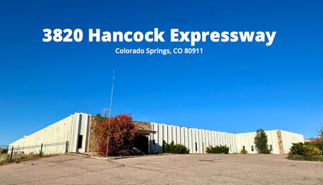
3820 Hancock Expy, Colorado Springs, CO 80911


Current Lease Availabilities
NEARBY LISTINGS FOR SALE OR LEASE
Property Detail
3820 Hancock Expy
65020-00-136
Monument Add
Industrialgeneral
TRACT IN NE4 SEC 2-15-66 AS FOLS, COM AT E4 COR OF SEC, RUN NLY ALG E SEC LN 525.00 FT, WLY PARA TO N SEC LN 50.00 FT TO WLY R/W LN OF HANCOCK XWY FOR POB, TH WLY 871.00 FT, N 500.00 FT, E 871.00 FT TO AFSD WLY R/W LN, TH SLY ALG SD R/W LN 500.00 FT
X
El Paso
08041C0763G
Colorado
2024
13.31 AC
2025
Southeast
004502
Colorado Springs
48,438 SF
Colorado Springs, CO
DEMOGRAPHICS near 3820 Hancock Expy
1 Mile
3 Mile
5 Mile
2024 Total Population
12,899
66,581
179,529
2029 Population
13,362
69,360
187,860
Pop Growth 2024-2029
+ 3.59%
+ 4.17%
+ 4.64%
Average Age
36
35
34
2024 Total Households
4,452
23,077
64,174
HH Growth 2024-2029
+ 3.80%
+ 4.48%
+ 5.03%
Median Household Inc
$74,432
$63,858
$60,878
Avg Household Size
2.80
2.70
2.60
2024 Avg HH Vehicles
2.00
2.00
2.00
Median Home Value
$304,923
$278,352
$305,950
Median Year Built
1990
1985
1984
Nearby Places
Map Layers
Map Styles
 Street
 Aerial
- Restaurants
- Banks
- Shops
- Fitness
- Groceries
PUBLIC TRANSPORTATION
AIRPORT
City of Colorado Springs Municipal
DRIVE
WALK
Distance
City of Colorado Springs Municipal
16 min
7.5 mi
Freight Ports
Tulsa Port Of Catoosa
DRIVE
WALK
Distance
Tulsa Port Of Catoosa
742 min
693.9 mi
Nearby Properties
Address
Land Use
TOTAL SIZE
Lot Size
Zoning
Address
Land Use
TOTAL SIZE
Lot Size
Zoning
241,806 SF
937.06 AC
A-5 CAD-O
Address
Land Use
TOTAL SIZE
Lot Size
Zoning
309,046 SF
28.95 AC
PF SS
Address
Land Use
TOTAL SIZE
Lot Size
Zoning
3,486,127 SF
69.25 AC
APD APZ1 A
Address
Land Use
TOTAL SIZE
Lot Size
Zoning
339,516 SF
1,090.76 AC
APD RPZ AP
Address
Land Use
TOTAL SIZE
Lot Size
Zoning
200,642 SF
6.65 AC
MX-M HR AO
Address
Land Use
TOTAL SIZE
Lot Size
Zoning
233,194 SF
30 AC
R-1 6 AO S
Address
Land Use
TOTAL SIZE
Lot Size
Zoning
162,945 SF
20.05 AC
BP/CR CU A
Address
Land Use
TOTAL SIZE
Lot Size
Zoning
117,648 SF
3,971.89 AC
APD
Address
Land Use
TOTAL SIZE
Lot Size
Zoning
89,487 SF
Address
Land Use
TOTAL SIZE
Lot Size
Zoning
704,240 SF
41.99 AC
BP/CR UV A
Address
Land Use
TOTAL SIZE
Lot Size
Zoning
78,815 SF
Address
Land Use
TOTAL SIZE
Lot Size
Zoning
98,638 SF
7.22 AC
MX-M AO
Address
Land Use
TOTAL SIZE
Lot Size
Zoning
23,535 SF
15.91 AC
BP/CR AO
Address
Land Use
TOTAL SIZE
Lot Size
Zoning
48,255 SF
17.35 AC
A-5 CAD-O
Address
Land Use
TOTAL SIZE
Lot Size
Zoning
69,078 SF
0.03 AC
Address
Land Use
TOTAL SIZE
Lot Size
Zoning
278,331 SF
324.19 AC
Address
Land Use
TOTAL SIZE
Lot Size
Zoning
778.79 AC
APD AO RPZ
Address
Land Use
TOTAL SIZE
Lot Size
Zoning
34,984 SF
14.31 AC
A-5
Address
Land Use
TOTAL SIZE
Lot Size
Zoning
72,105 SF
11.32 AC
MX-T AO
Address
Land Use
TOTAL SIZE
Lot Size
Zoning
91,446 SF
12.60 AC
BP AO
Address
Land Use
TOTAL SIZE
Lot Size
Zoning
24,437 SF
4.78 AC
BP/CR AO
Address
Land Use
TOTAL SIZE
Lot Size
Zoning
105,617 SF
10.10 AC
PBC
Address
Land Use
TOTAL SIZE
Lot Size
Zoning
118,700 SF
22.90 AC
R-1 6 AO
Address
Land Use
TOTAL SIZE
Lot Size
Zoning
92.06 AC
APD APZ1 A
Address
Land Use
TOTAL SIZE
Lot Size
Zoning
130,569 SF
3.23 AC
Address
Land Use
TOTAL SIZE
Lot Size
Zoning
50,040 SF
8 AC
R-1 6 AO
Address
Land Use
TOTAL SIZE
Lot Size
Zoning
28,769 SF
3.92 AC
MX-M
Address
Land Use
TOTAL SIZE
Lot Size
Zoning
22,596 SF
3.93 AC
R-5 UV AO
Address
Land Use
TOTAL SIZE
Lot Size
Zoning
60,730 SF
4.26 AC
BP
Address
Land Use
TOTAL SIZE
Lot Size
Zoning
50,992 SF
10.27 AC
PDZ AO
The World's #1 Commercial Real Estate Marketplace
Connect with us
© 2026 CoStar Group
The information above has been obtained from sources believed reliable. While we do not doubt its accuracy we have not verified it and make no guarantee, warranty or representation about it. It is your responsibility to independently confirm its accuracy and completeness. Any projections, opinions, assumptions, or estimates used are for example only and do not represent the current or future performance of the property. The value of this transaction to you depends on tax and other factors which should be evaluated by your tax, financial, and legal advisors. You and your advisors should conduct a careful, independent investigation of the property to determine to your satisfaction the suitability of the property for your needs.