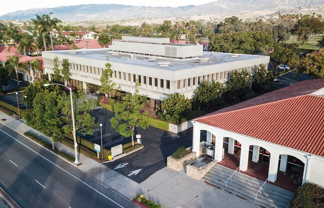
Property Record
3820 State St, Santa Barbara, CA 93105


NEARBY LISTINGS FOR SALE OR LEASE
Property Detail
3820 State St
Santa Maria-Santa Barbara, CA
Santa Barbara
057-240-052
SB CITY MAP 42
Officebuilding
Santa Barbara
X
California
06083C1378H
c
2024
1.79 AC
2025
N Santa Barbara/Goleta
000102
Santa Barbara/Sta Maria/Goleta
DEMOGRAPHICS near 3820 State St
1 mile
3 mile
5 mile
2024 Total Population
15,840
79,112
134,545
2029 Population
15,943
79,000
134,014
Pop Growth 2024-2029
+ 0.65%
(0.14%)
(0.39%)
Average Age
44
43
42
2024 Total Households
6,767
31,750
51,941
HH Growth 2024-2029
+ 0.65%
(0.22%)
(0.43%)
Median Household Inc
$99,731
$102,495
$101,474
Avg Household Size
2.30
2.30
2.40
2024 Avg HH Vehicles
2.00
2.00
2.00
Median Home Value
$1,021,698
$1,070,515
$1,066,760
Median Year Built
1972
1965
1966
Nearby Places
Map Layers
Map Styles
 Street
 Aerial
Transit
 Traffic
 Biking
Places
Listings with unknown addresses are not visible on the map
- Restaurants
- Banks
- Shops
- Fitness
- Groceries
PUBLIC TRANSPORTATION
COMMUTER RAIL
Drive
Walk
Distance
8 min
4.6 mi
Drive
Walk
Distance
10 min
6.3 mi
AIRPORT
Santa Barbara Municipal
Drive
Walk
Distance
Santa Barbara Municipal
24 min
8.5 mi
SALE & LEASE HISTORY
LISTING DATE
SALE/LEASE

May 25, 2018
For Lease
Jul 11, 2018
For Lease
Jan 16, 2019
For Lease
Nearby Properties
Address
Land Use
TOTAL SIZE
Lot Size
Zoning
Address
Land Use
TOTAL SIZE
Lot Size
Zoning
710 SF
9.92 AC
SP8
Address
Land Use
TOTAL SIZE
Lot Size
Zoning
16.87 AC
E3SD2
Address
Land Use
TOTAL SIZE
Lot Size
Zoning
0.39 AC
C2
Address
Land Use
TOTAL SIZE
Lot Size
Zoning
7.06 AC
R240R
Address
Land Use
TOTAL SIZE
Lot Size
Zoning
Address
Land Use
TOTAL SIZE
Lot Size
Zoning
1.43 AC
Address
Land Use
TOTAL SIZE
Lot Size
Zoning
10.48 AC
C2SD2
Address
Land Use
TOTAL SIZE
Lot Size
Zoning
22,376 SF
17.82 AC
35EX1
Address
Land Use
TOTAL SIZE
Lot Size
Zoning
0.37 AC
C2
Address
Land Use
TOTAL SIZE
Lot Size
Zoning
8.79 AC
C2SD2
Address
Land Use
TOTAL SIZE
Lot Size
Zoning
4.32 AC
CP
Address
Land Use
TOTAL SIZE
Lot Size
Zoning
0.99 AC
Address
Land Use
TOTAL SIZE
Lot Size
Zoning
9.21 AC
R2
Address
Land Use
TOTAL SIZE
Lot Size
Zoning
1.32 AC
Address
Land Use
TOTAL SIZE
Lot Size
Zoning
4.94 AC
CPSD2
Address
Land Use
TOTAL SIZE
Lot Size
Zoning
2.62 AC
C2
Address
Land Use
TOTAL SIZE
Lot Size
Zoning
11.37 AC
E1
Address
Land Use
TOTAL SIZE
Lot Size
Zoning
27,346 SF
8.72 AC
SP7
Address
Land Use
TOTAL SIZE
Lot Size
Zoning
20,559 SF
17.82 AC
35EX1
Address
Land Use
TOTAL SIZE
Lot Size
Zoning
1.35 AC
C2SD2
Address
Land Use
TOTAL SIZE
Lot Size
Zoning
1,525 SF
2.40 AC
SP8
Address
Land Use
TOTAL SIZE
Lot Size
Zoning
8,625 SF
22.82 AC
25EX1
Address
Land Use
TOTAL SIZE
Lot Size
Zoning
9,456 SF
3.71 AC
15EX1
Address
Land Use
TOTAL SIZE
Lot Size
Zoning
0.93 AC
Address
Land Use
TOTAL SIZE
Lot Size
Zoning
5.91 AC
DR20
Address
Land Use
TOTAL SIZE
Lot Size
Zoning
19,308 SF
4.96 AC
15EX1
Address
Land Use
TOTAL SIZE
Lot Size
Zoning
1 AC
C2
Address
Land Use
TOTAL SIZE
Lot Size
Zoning
5.44 AC
R3SD2
Address
Land Use
TOTAL SIZE
Lot Size
Zoning
14.08 AC
E3
Address
Land Use
TOTAL SIZE
Lot Size
Zoning
4.08 AC
C1SD2
The World's #1 Commercial Real Estate Marketplace
Connect with us
© 2026 CoStar Group
The information above has been obtained from sources believed reliable. While we do not doubt its accuracy we have not verified it and make no guarantee, warranty or representation about it. It is your responsibility to independently confirm its accuracy and completeness. Any projections, opinions, assumptions, or estimates used are for example only and do not represent the current or future performance of the property. The value of this transaction to you depends on tax and other factors which should be evaluated by your tax, financial, and legal advisors. You and your advisors should conduct a careful, independent investigation of the property to determine to your satisfaction the suitability of the property for your needs.