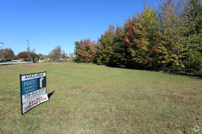
Property Record
3821 Sutton Way, High Point, NC 27265

Property Detail
3821 Sutton Way
Greensboro-High Point, NC
13 PH 3 PB123-121 WENDOVER LAND PL:123-121
0196486
GUILFORD
Commercialnec
North Carolina
GB
13
B and X Area of moderate flood hazard, usually the area between the limits of the 100-year and 500-year floods.
0.71 AC
2024
Airport/W Guilford County
2025
Greensboro/Winston-Salem
014409
NEARBY LISTINGS FOR SALE OR LEASE
DEMOGRAPHICS near 3821 Sutton Way
1 mile
3 mile
5 mile
2025 Total Population
8,639
46,233
126,341
2030 Population
8,854
47,625
130,504
Pop Growth 2025-2030
+ 2.49%
+ 3.01%
+ 3.30%
Average Age
41
42
40
2025 Total Households
3,715
18,985
51,101
HH Growth 2025-2030
+ 2.66%
+ 3.12%
+ 3.49%
Median Household Inc
$71,773
$82,878
$70,018
Avg Household Size
2.30
2.40
2.30
2025 Avg HH Vehicles
2.00
2.00
2.00
Median Home Value
$274,862
$284,047
$256,693
Median Year Built
2000
1995
1991
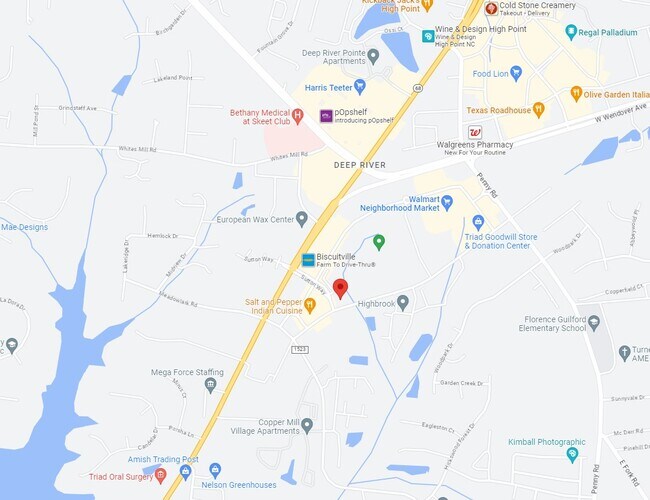
Nearby Places
Map Layers
Map Styles
 Street
 Aerial
Transit
 Traffic
 Biking
Places
Listings with unknown addresses are not visible on the map
- Restaurants
- Banks
- Shops
- Fitness
- Groceries
PUBLIC TRANSPORTATION
COMMUTER RAIL
High Point Station (Piedmont - North Carolina by Train (NC Train))
Drive
Walk
Distance
High Point Station (Piedmont - North Carolina by Train (NC Train))
11 min
5.7 mi
AIRPORT
Piedmont Triad International
Drive
Walk
Distance
Piedmont Triad International
17 min
6.9 mi
SALE & LEASE HISTORY
LISTING DATE
SALE/LEASE

Sep 24, 2016
For Sale
Nov 16, 2016
For Sale
Dec 15, 2017
For Sale
Nearby Properties
Address
Land Use
TOTAL SIZE
Lot Size
Zoning
Address
Land Use
TOTAL SIZE
Lot Size
Zoning
256,051 SF
37.69 AC
LI
Address
Land Use
TOTAL SIZE
Lot Size
Zoning
552,314 SF
38.47 AC
PDR
Address
Land Use
TOTAL SIZE
Lot Size
Zoning
400,000 SF
46.72 AC
LI
Address
Land Use
TOTAL SIZE
Lot Size
Zoning
354,454 SF
20.65 AC
RM-18
Address
Land Use
TOTAL SIZE
Lot Size
Zoning
291,895 SF
21.52 AC
RM-26
Address
Land Use
TOTAL SIZE
Lot Size
Zoning
363,308 SF
29.41 AC
RM-16
Address
Land Use
TOTAL SIZE
Lot Size
Zoning
309,749 SF
16.74 AC
CZ-PDM
Address
Land Use
TOTAL SIZE
Lot Size
Zoning
30,322 SF
964.25 AC
PNR
Address
Land Use
TOTAL SIZE
Lot Size
Zoning
274,999 SF
21.57 AC
LI
Address
Land Use
TOTAL SIZE
Lot Size
Zoning
214,941 SF
13.29 AC
PDR
Address
Land Use
TOTAL SIZE
Lot Size
Zoning
227,652 SF
21.64 AC
LI
Address
Land Use
TOTAL SIZE
Lot Size
Zoning
240,936 SF
12.02 AC
PDM
Address
Land Use
TOTAL SIZE
Lot Size
Zoning
269,956 SF
19.44 AC
OI
Address
Land Use
TOTAL SIZE
Lot Size
Zoning
209,184 SF
13.52 AC
OI
Address
Land Use
TOTAL SIZE
Lot Size
Zoning
75,588 SF
6.49 AC
LI
Address
Land Use
TOTAL SIZE
Lot Size
Zoning
760,545 SF
69.50 AC
LI
Address
Land Use
TOTAL SIZE
Lot Size
Zoning
176,000 SF
12.95 AC
CZ-I
Address
Land Use
TOTAL SIZE
Lot Size
Zoning
1.32 AC
PNR
Address
Land Use
TOTAL SIZE
Lot Size
Zoning
304,447 SF
27.69 AC
RM-16
Address
Land Use
TOTAL SIZE
Lot Size
Zoning
342,988 SF
29.36 AC
LI
Address
Land Use
TOTAL SIZE
Lot Size
Zoning
128,435 SF
10.40 AC
LI
Address
Land Use
TOTAL SIZE
Lot Size
Zoning
361,412 SF
35.81 AC
LI
Address
Land Use
TOTAL SIZE
Lot Size
Zoning
311,785 SF
107.44 AC
PI
Address
Land Use
TOTAL SIZE
Lot Size
Zoning
233,893 SF
51.31 AC
LI
Address
Land Use
TOTAL SIZE
Lot Size
Zoning
99,998 SF
12.44 AC
LI
Address
Land Use
TOTAL SIZE
Lot Size
Zoning
266,881 SF
29.68 AC
AG
Address
Land Use
TOTAL SIZE
Lot Size
Zoning
136,759 SF
16.35 AC
RC
Address
Land Use
TOTAL SIZE
Lot Size
Zoning
94,213 SF
10.35 AC
LI
Address
Land Use
TOTAL SIZE
Lot Size
Zoning
181,106 SF
16.23 AC
RM-16
Address
Land Use
TOTAL SIZE
Lot Size
Zoning
182,232 SF
20.17 AC
RM-16
The World's #1 Commercial Real Estate Marketplace
Connect with us
© 2026 CoStar Group
The information above has been obtained from sources believed reliable. While we do not doubt its accuracy we have not verified it and make no guarantee, warranty or representation about it. It is your responsibility to independently confirm its accuracy and completeness. Any projections, opinions, assumptions, or estimates used are for example only and do not represent the current or future performance of the property. The value of this transaction to you depends on tax and other factors which should be evaluated by your tax, financial, and legal advisors. You and your advisors should conduct a careful, independent investigation of the property to determine to your satisfaction the suitability of the property for your needs.