Property Record
3821 W Avera Dr, Sioux Falls, SD 57108
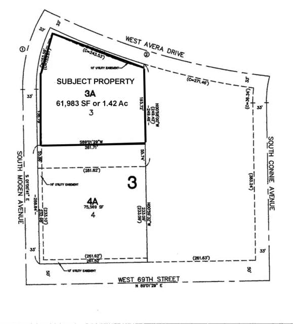


Property Detail
3821 W Avera Dr
Sioux Falls, SD-MN
LOT 2 BLOCK 2 SONLER ADD CITY OF SIOUX FALLS
280.57.02.002
Minnehaha
Commercialnec
South Dakota
MUNICIPALI
2
B and X Area of moderate flood hazard, usually the area between the limits of the 100-year and 500-year floods.
2.62 AC
2025
Sioux Falls
2025
Other Market Areas
010110
NEARBY LISTINGS FOR SALE OR LEASE
DEMOGRAPHICS near 3821 W Avera Dr
1 mile
3 mile
5 mile
2025 Total Population
9,376
65,263
157,261
2030 Population
10,305
70,264
169,055
Pop Growth 2025-2030
+ 9.91%
+ 7.66%
+ 7.50%
Average Age
39
39
38
2025 Total Households
4,436
27,126
65,067
HH Growth 2025-2030
+ 10.12%
+ 7.90%
+ 7.77%
Median Household Inc
$66,063
$77,871
$74,101
Avg Household Size
2.10
2.30
2.30
2025 Avg HH Vehicles
2.00
2.00
2.00
Median Home Value
$351,692
$320,694
$308,955
Median Year Built
2004
1999
1995
Nearby Places
Map Layers
Map Styles
 Street
 Aerial
Layers
 Traffic
 Biking
Places
Listings with unknown addresses are not visible on the map
- Restaurants
- Banks
- Shops
- Fitness
- Groceries
PUBLIC TRANSPORTATION
AIRPORT
Joe Foss Field
Drive
Walk
Distance
Joe Foss Field
17 min
11.5 mi
Nearby Properties
Address
Land Use
TOTAL SIZE
Lot Size
Zoning
Address
Land Use
TOTAL SIZE
Lot Size
Zoning
32.77 AC
Address
Land Use
TOTAL SIZE
Lot Size
Zoning
8.89 AC
MUNICIPALI
Address
Land Use
TOTAL SIZE
Lot Size
Zoning
408,018 SF
53.02 AC
FP;FP
Address
Land Use
TOTAL SIZE
Lot Size
Zoning
8.80 AC
MUNICIPALI
Address
Land Use
TOTAL SIZE
Lot Size
Zoning
8.25 AC
MUNICIPALI
Address
Land Use
TOTAL SIZE
Lot Size
Zoning
7,252 SF
12.07 AC
Address
Land Use
TOTAL SIZE
Lot Size
Zoning
11.26 AC
MUNICIPALI
Address
Land Use
TOTAL SIZE
Lot Size
Zoning
317,992 SF
27 AC
Address
Land Use
TOTAL SIZE
Lot Size
Zoning
201,028 SF
5.42 AC
FP;FP
Address
Land Use
TOTAL SIZE
Lot Size
Zoning
8.52 AC
MUNICIPALI
Address
Land Use
TOTAL SIZE
Lot Size
Zoning
4.60 AC
MUNICIPALI
Address
Land Use
TOTAL SIZE
Lot Size
Zoning
15.40 AC
MUNICIPALI
Address
Land Use
TOTAL SIZE
Lot Size
Zoning
10.75 AC
MUNICIPALI
Address
Land Use
TOTAL SIZE
Lot Size
Zoning
172,212 SF
15.89 AC
Address
Land Use
TOTAL SIZE
Lot Size
Zoning
9.45 AC
MUNICIPALI
Address
Land Use
TOTAL SIZE
Lot Size
Zoning
80,964 SF
23.34 AC
Address
Land Use
TOTAL SIZE
Lot Size
Zoning
7.91 AC
MUNICIPALI
Address
Land Use
TOTAL SIZE
Lot Size
Zoning
100,053 SF
8.50 AC
FP;FP
Address
Land Use
TOTAL SIZE
Lot Size
Zoning
9.56 AC
MUNICIPALI
Address
Land Use
TOTAL SIZE
Lot Size
Zoning
9.59 AC
MUNICIPALI
Address
Land Use
TOTAL SIZE
Lot Size
Zoning
8.57 AC
MUNICIPALI
Address
Land Use
TOTAL SIZE
Lot Size
Zoning
11.91 AC
MUNICIPALI
Address
Land Use
TOTAL SIZE
Lot Size
Zoning
16.45 AC
MUNICIPALI
Address
Land Use
TOTAL SIZE
Lot Size
Zoning
11.12 AC
MUNICIPALI
Address
Land Use
TOTAL SIZE
Lot Size
Zoning
1.66 AC
FP;FP
Address
Land Use
TOTAL SIZE
Lot Size
Zoning
7.07 AC
MUNICIPALI
Address
Land Use
TOTAL SIZE
Lot Size
Zoning
9.82 AC
MUNICIPALI
Address
Land Use
TOTAL SIZE
Lot Size
Zoning
3.43 AC
MUNICIPALI
Address
Land Use
TOTAL SIZE
Lot Size
Zoning
220,834 SF
11.46 AC
Address
Land Use
TOTAL SIZE
Lot Size
Zoning
211,577 SF
11.58 AC
The World's #1 Commercial Real Estate Marketplace
Connect with us
© 2026 CoStar Group
The information above has been obtained from sources believed reliable. While we do not doubt its accuracy we have not verified it and make no guarantee, warranty or representation about it. It is your responsibility to independently confirm its accuracy and completeness. Any projections, opinions, assumptions, or estimates used are for example only and do not represent the current or future performance of the property. The value of this transaction to you depends on tax and other factors which should be evaluated by your tax, financial, and legal advisors. You and your advisors should conduct a careful, independent investigation of the property to determine to your satisfaction the suitability of the property for your needs.