Property Record
3825 S Kinnickinnic Ave, Saint Francis, WI 53235


NEARBY LISTINGS FOR SALE OR LEASE
Property Detail
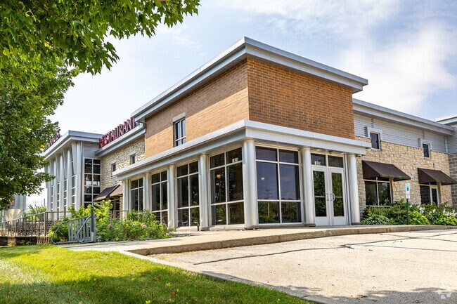
3825 S Kinnickinnic Ave
Milwaukee-Waukesha-West Allis, WI
SLIDE 8779 DPC 10523531 MAP 8755
545-8009-000
Milwaukee
Commercialnec
Wisconsin
X
2
55079C0157E
2.36 AC
2023
Milwaukee SE
2024
Milwaukee/Madison
185100
DEMOGRAPHICS near 3825 S Kinnickinnic Ave
1 Mile
3 Mile
5 Mile
2024 Total Population
12,458
73,595
212,659
2029 Population
12,190
71,753
207,299
Pop Growth 2024-2029
(2.15%)
(2.50%)
(2.52%)
Average Age
43
39
37
2024 Total Households
6,206
32,698
86,623
HH Growth 2024-2029
(2.21%)
(2.54%)
(2.50%)
Median Household Inc
$64,594
$64,572
$56,699
Avg Household Size
2.00
2.20
2.40
2024 Avg HH Vehicles
2.00
2.00
2.00
Median Home Value
$215,650
$187,803
$181,911
Median Year Built
1952
1949
1950
Nearby Places
Map Layers
Map Styles
 Street
 Aerial
- Restaurants
- Banks
- Shops
- Fitness
- Groceries
PUBLIC TRANSPORTATION
COMMUTER RAIL
DRIVE
WALK
Distance
12 min
4.5 mi
DRIVE
WALK
Distance
11 min
5.8 mi
AIRPORT
General Mitchell International
DRIVE
WALK
Distance
General Mitchell International
10 min
3.9 mi
Freight Ports
Port Milwaukee
DRIVE
WALK
Distance
Port Milwaukee
8 min
3.1 mi
SALE & LEASE HISTORY
LISTING DATE
SALE/LEASE

Sep 10, 2021
For Lease
Sep 09, 2022
For Lease
Jan 18, 2024
For Sale
Apr 17, 2020
For Sale
Nearby Properties
Address
Land Use
TOTAL SIZE
Lot Size
Zoning
Address
Land Use
TOTAL SIZE
Lot Size
Zoning
319,559 SF
6.29 AC
PD
Address
Land Use
TOTAL SIZE
Lot Size
Zoning
Address
Land Use
TOTAL SIZE
Lot Size
Zoning
11.09 AC
Address
Land Use
TOTAL SIZE
Lot Size
Zoning
204,809 SF
1.04 AC
IM
Address
Land Use
TOTAL SIZE
Lot Size
Zoning
48.34 AC
IO1
Address
Land Use
TOTAL SIZE
Lot Size
Zoning
2,610 SF
1.04 AC
IM
Address
Land Use
TOTAL SIZE
Lot Size
Zoning
222,100 SF
1.29 AC
PD
Address
Land Use
TOTAL SIZE
Lot Size
Zoning
197,354 SF
18 AC
CS
Address
Land Use
TOTAL SIZE
Lot Size
Zoning
0.43 AC
RT3
Address
Land Use
TOTAL SIZE
Lot Size
Zoning
183,291 SF
11.48 AC
IM
Address
Land Use
TOTAL SIZE
Lot Size
Zoning
Address
Land Use
TOTAL SIZE
Lot Size
Zoning
76.97 AC
IH
Address
Land Use
TOTAL SIZE
Lot Size
Zoning
360,000 SF
14.60 AC
IL1
Address
Land Use
TOTAL SIZE
Lot Size
Zoning
378,000 SF
19.24 AC
M-1PUD
Address
Land Use
TOTAL SIZE
Lot Size
Zoning
94.05 AC
PK
Address
Land Use
TOTAL SIZE
Lot Size
Zoning
153,300 SF
7.39 AC
M-1PUD
Address
Land Use
TOTAL SIZE
Lot Size
Zoning
Address
Land Use
TOTAL SIZE
Lot Size
Zoning
Address
Land Use
TOTAL SIZE
Lot Size
Zoning
66,300 SF
3.95 AC
LB1
Address
Land Use
TOTAL SIZE
Lot Size
Zoning
108,471 SF
0.54 AC
PD
Address
Land Use
TOTAL SIZE
Lot Size
Zoning
91,454 SF
0.46 AC
PD
Address
Land Use
TOTAL SIZE
Lot Size
Zoning
Address
Land Use
TOTAL SIZE
Lot Size
Zoning
Address
Land Use
TOTAL SIZE
Lot Size
Zoning
111,759 SF
9.31 AC
LB2
Address
Land Use
TOTAL SIZE
Lot Size
Zoning
153,000 SF
8.22 AC
M-1PUD
Address
Land Use
TOTAL SIZE
Lot Size
Zoning
149,489 SF
7.43 AC
M-1PUD
Address
Land Use
TOTAL SIZE
Lot Size
Zoning
142,210 SF
14.70 AC
M-1PUD
Address
Land Use
TOTAL SIZE
Lot Size
Zoning
70,516 SF
8.26 AC
IH
Address
Land Use
TOTAL SIZE
Lot Size
Zoning
405,764 SF
12.70 AC
M-2
Address
Land Use
TOTAL SIZE
Lot Size
Zoning
300,313 SF
10.22 AC
IL1
The World's #1 Commercial Real Estate Marketplace
Connect with us
© 2025 CoStar Group
The information above has been obtained from sources believed reliable. While we do not doubt its accuracy we have not verified it and make no guarantee, warranty or representation about it. It is your responsibility to independently confirm its accuracy and completeness. Any projections, opinions, assumptions, or estimates used are for example only and do not represent the current or future performance of the property. The value of this transaction to you depends on tax and other factors which should be evaluated by your tax, financial, and legal advisors. You and your advisors should conduct a careful, independent investigation of the property to determine to your satisfaction the suitability of the property for your needs.