Property Record
3825 S Power Rd, Mesa, AZ 85212


NEARBY LISTINGS FOR SALE OR LEASE
-
-
View all Mesa listings for sale on LoopNet.com
Property Detail
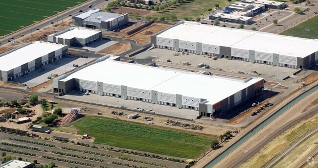
3825 S Power Rd
Phoenix-Mesa-Chandler, AZ
N 300F OF W 387.67F OF FOL DESC PCL S 893.80F OF N 1718.45F OF SEC 18 LY W OF THE W ROW LN OF THE RWCD CAN EX ANY POR LY W/I SLY 598.53F OF THE NLY 1372.96F OF NW4 OF SD SEC P/F 19-0963421 & EX ROW COM NW COR SEC 18 TH S 1373.38F TO POB TH E 95.02F T
304-17-008Z
Maricopa
Commercialacreage
Arizona
2025
2.21 AC
2025
Gateway Airport/Loop 202
422623
Phoenix
DEMOGRAPHICS near 3825 S Power Rd
1 Mile
3 Mile
5 Mile
2024 Total Population
5,846
91,053
270,148
2029 Population
6,301
99,044
294,924
Pop Growth 2024-2029
+ 7.78%
+ 8.78%
+ 9.17%
Average Age
31
36
39
2024 Total Households
1,760
30,252
96,905
HH Growth 2024-2029
+ 7.78%
+ 8.99%
+ 9.42%
Median Household Inc
$96,277
$96,022
$89,185
Avg Household Size
3.20
2.90
2.70
2024 Avg HH Vehicles
2.00
2.00
2.00
Median Home Value
$527,879
$413,737
$390,045
Median Year Built
2008
2002
1999
Nearby Places
Map Layers
Map Styles
 Street
 Aerial
- Restaurants
- Banks
- Shops
- Fitness
- Groceries
PUBLIC TRANSPORTATION
AIRPORT
Phoenix-Mesa Gateway
DRIVE
WALK
Distance
Phoenix-Mesa Gateway
8 min
4.0 mi
Phoenix Sky Harbor International
DRIVE
WALK
Distance
Phoenix Sky Harbor International
35 min
25.1 mi
Nearby Properties
Address
Land Use
TOTAL SIZE
Lot Size
Zoning
Address
Land Use
TOTAL SIZE
Lot Size
Zoning
184.86 AC
Address
Land Use
TOTAL SIZE
Lot Size
Zoning
93,214 SF
10.60 AC
PF
Address
Land Use
TOTAL SIZE
Lot Size
Zoning
93.03 AC
Address
Land Use
TOTAL SIZE
Lot Size
Zoning
484,906 SF
199.48 AC
Address
Land Use
TOTAL SIZE
Lot Size
Zoning
1,195,173 SF
71.41 AC
Address
Land Use
TOTAL SIZE
Lot Size
Zoning
1,358,386 SF
611.30 AC
LI
Address
Land Use
TOTAL SIZE
Lot Size
Zoning
12.66 AC
Address
Land Use
TOTAL SIZE
Lot Size
Zoning
604,432 SF
56.74 AC
PF
Address
Land Use
TOTAL SIZE
Lot Size
Zoning
403,171 SF
34.53 AC
PF
Address
Land Use
TOTAL SIZE
Lot Size
Zoning
580,492 SF
41.81 AC
R3
Address
Land Use
TOTAL SIZE
Lot Size
Zoning
615,202 SF
35.88 AC
AG
Address
Land Use
TOTAL SIZE
Lot Size
Zoning
524,905 SF
40.33 AC
Address
Land Use
TOTAL SIZE
Lot Size
Zoning
245,425 SF
205.62 AC
I-1
Address
Land Use
TOTAL SIZE
Lot Size
Zoning
412,581 SF
21.15 AC
MFM
Address
Land Use
TOTAL SIZE
Lot Size
Zoning
4.60 AC
C-C
Address
Land Use
TOTAL SIZE
Lot Size
Zoning
396,754 SF
46.84 AC
PF
Address
Land Use
TOTAL SIZE
Lot Size
Zoning
414,288 SF
28.67 AC
LI
Address
Land Use
TOTAL SIZE
Lot Size
Zoning
238,386 SF
40.25 AC
BP
Address
Land Use
TOTAL SIZE
Lot Size
Zoning
94,701 SF
7.89 AC
LC
Address
Land Use
TOTAL SIZE
Lot Size
Zoning
308,343 SF
13.90 AC
MFM
Address
Land Use
TOTAL SIZE
Lot Size
Zoning
266,467 SF
47.47 AC
PF
Address
Land Use
TOTAL SIZE
Lot Size
Zoning
274,993 SF
16.44 AC
Address
Land Use
TOTAL SIZE
Lot Size
Zoning
18.75 AC
PF
Address
Land Use
TOTAL SIZE
Lot Size
Zoning
143,232 SF
26.94 AC
PF
Address
Land Use
TOTAL SIZE
Lot Size
Zoning
3.03 AC
C-C
Address
Land Use
TOTAL SIZE
Lot Size
Zoning
330,496 SF
18.63 AC
LI
Address
Land Use
TOTAL SIZE
Lot Size
Zoning
142,871 SF
40.83 AC
PF
Address
Land Use
TOTAL SIZE
Lot Size
Zoning
312,726 SF
17.01 AC
MFL
Address
Land Use
TOTAL SIZE
Lot Size
Zoning
129,201 SF
24.65 AC
LI
Address
Land Use
TOTAL SIZE
Lot Size
Zoning
50,726 SF
633.66 AC
I-1
The World's #1 Commercial Real Estate Marketplace
Connect with us
© 2026 CoStar Group
The information above has been obtained from sources believed reliable. While we do not doubt its accuracy we have not verified it and make no guarantee, warranty or representation about it. It is your responsibility to independently confirm its accuracy and completeness. Any projections, opinions, assumptions, or estimates used are for example only and do not represent the current or future performance of the property. The value of this transaction to you depends on tax and other factors which should be evaluated by your tax, financial, and legal advisors. You and your advisors should conduct a careful, independent investigation of the property to determine to your satisfaction the suitability of the property for your needs.