Property Record
38251 Highway 160, Mancos, CO 81328
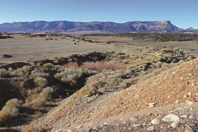

Property Detail
38251 Highway 160
R017420
QUARTER: SW SECTION: 36 TOWNSHIP: 36 RANGE: 14 QUARTER: NW SECTION: 1 TOWNSHIP: 35 RANGE: 14 TR IN NW/4 S: 1 T: 35 R: 14
Realpropertynec
MONTEZUMA
A/R 35+
Colorado
A Areas with a 1% annual chance of flooding and a 26% chance of flooding over the life of a 30-year mortgage.
39.49 AC
2025
Colorado Southwest Area
2025
Other Market Areas
969100
NEARBY LISTINGS FOR SALE OR LEASE
-
-
View all Mancos listings for sale on LoopNet.com
DEMOGRAPHICS near 38251 Highway 160
1 mile
3 mile
5 mile
2025 Total Population
68
835
2,829
2030 Population
70
864
2,934
Pop Growth 2025-2030
+ 2.94%
+ 3.47%
+ 3.71%
Average Age
44
45
46
2025 Total Households
30
366
1,236
HH Growth 2025-2030
+ 3.33%
+ 3.28%
+ 3.56%
Median Household Inc
$77,500
$74,558
$80,697
Avg Household Size
2.20
2.30
2.30
2025 Avg HH Vehicles
2.00
2.00
2.00
Median Home Value
$450,000
$459,999
$472,292
Median Year Built
1985
1990
1991
Nearby Places
Map Layers
Map Styles
 Street
 Aerial
Layers
 Traffic
 Biking
Places
Listings with unknown addresses are not visible on the map
- Restaurants
- Banks
- Shops
- Fitness
- Groceries
SALE & LEASE HISTORY
LISTING DATE
SALE/LEASE

Feb 15, 2018
For Sale
Nearby Properties
Address
Land Use
TOTAL SIZE
Lot Size
Zoning
Address
Land Use
TOTAL SIZE
Lot Size
Zoning
586.46 AC
A-80+
Address
Land Use
TOTAL SIZE
Lot Size
Zoning
5,104 SF
121 AC
A/R 10-34
Address
Land Use
TOTAL SIZE
Lot Size
Zoning
1.90 AC
INDHZ
Address
Land Use
TOTAL SIZE
Lot Size
Zoning
1,832 SF
15.68 AC
COMZ
Address
Land Use
TOTAL SIZE
Lot Size
Zoning
36 AC
A/R 35+
Address
Land Use
TOTAL SIZE
Lot Size
Zoning
3,000 SF
3 AC
INDLZ
Address
Land Use
TOTAL SIZE
Lot Size
Zoning
35.34 AC
A/R 35+
Address
Land Use
TOTAL SIZE
Lot Size
Zoning
19.77 AC
A/R 10-34
Address
Land Use
TOTAL SIZE
Lot Size
Zoning
2,573 SF
62.33 AC
A/R 35+
Address
Land Use
TOTAL SIZE
Lot Size
Zoning
1,500 SF
35.03 AC
A/R 35+
Address
Land Use
TOTAL SIZE
Lot Size
Zoning
10,000 SF
203.87 AC
A/R 35+
Address
Land Use
TOTAL SIZE
Lot Size
Zoning
30.08 AC
A/R 10-34
Address
Land Use
TOTAL SIZE
Lot Size
Zoning
4,800 SF
463.22 AC
A/R 10-34
Address
Land Use
TOTAL SIZE
Lot Size
Zoning
16.41 AC
A/R 10-34
Address
Land Use
TOTAL SIZE
Lot Size
Zoning
6.58 AC
A/R 3-9
Address
Land Use
TOTAL SIZE
Lot Size
Zoning
35.28 AC
A/R 10-34
Address
Land Use
TOTAL SIZE
Lot Size
Zoning
5,040 SF
90.50 AC
A/R 10-34
Address
Land Use
TOTAL SIZE
Lot Size
Zoning
6.90 AC
A/R 3-9
Address
Land Use
TOTAL SIZE
Lot Size
Zoning
3,000 SF
243.88 AC
A/R 35+
Address
Land Use
TOTAL SIZE
Lot Size
Zoning
3.02 AC
A/R 3-9
Address
Land Use
TOTAL SIZE
Lot Size
Zoning
1,296 SF
A/R 10-34
Address
Land Use
TOTAL SIZE
Lot Size
Zoning
3.10 AC
A/R 3-9
Address
Land Use
TOTAL SIZE
Lot Size
Zoning
4 AC
A/R 3-9
Address
Land Use
TOTAL SIZE
Lot Size
Zoning
1,050 SF
2 AC
AR ES
Address
Land Use
TOTAL SIZE
Lot Size
Zoning
2,990 SF
2 AC
HISTZ
Address
Land Use
TOTAL SIZE
Lot Size
Zoning
1,800 SF
35.58 AC
A/R 35+
Address
Land Use
TOTAL SIZE
Lot Size
Zoning
20.21 AC
A/R 10-34
Address
Land Use
TOTAL SIZE
Lot Size
Zoning
1,938 SF
38.82 AC
INDLZ
Address
Land Use
TOTAL SIZE
Lot Size
Zoning
2,050 SF
135.39 AC
A/R 35+
Address
Land Use
TOTAL SIZE
Lot Size
Zoning
1,700 SF
121.79 AC
A-80+
The World's #1 Commercial Real Estate Marketplace
Connect with us
© 2026 CoStar Group
The information above has been obtained from sources believed reliable. While we do not doubt its accuracy we have not verified it and make no guarantee, warranty or representation about it. It is your responsibility to independently confirm its accuracy and completeness. Any projections, opinions, assumptions, or estimates used are for example only and do not represent the current or future performance of the property. The value of this transaction to you depends on tax and other factors which should be evaluated by your tax, financial, and legal advisors. You and your advisors should conduct a careful, independent investigation of the property to determine to your satisfaction the suitability of the property for your needs.