Property Record
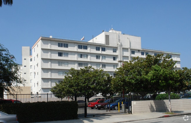
3828 Delmas Ter, Culver City, CA 90232


NEARBY LISTINGS FOR SALE OR LEASE
Property Detail
3828 Delmas Ter
Los Angeles-Long Beach-Glendale, CA
Dunns Boulevard Square
4207-002-027
TR=2444 POR OF VAC ALLEY ADJ ON NE AND LOTS 9, 10, 11, 12, 13 AND 14 BLK 13
Hospitalpublic
Los Angeles
X
California
06037C1595G
9-14
2024
1.02 AC
2025
Culver City
702400
Los Angeles
181,372 SF
DEMOGRAPHICS near 3828 Delmas Ter
1 Mile
3 Mile
5 Mile
2024 Total Population
43,820
306,137
876,762
2029 Population
42,956
299,446
857,746
Pop Growth 2024-2029
(1.97%)
(2.19%)
(2.17%)
Average Age
38
40
40
2024 Total Households
21,089
129,357
378,620
HH Growth 2024-2029
(2.17%)
(2.35%)
(2.34%)
Median Household Inc
$94,249
$92,972
$91,206
Avg Household Size
2.00
2.30
2.20
2024 Avg HH Vehicles
1.00
2.00
2.00
Median Home Value
$1,093,545
$1,080,710
$1,061,594
Median Year Built
1973
1963
1964
Nearby Places
Map Layers
Map Styles
 Street
 Aerial
- Restaurants
- Banks
- Shops
- Fitness
- Groceries
PUBLIC TRANSPORTATION
AIRPORT
Los Angeles International
DRIVE
WALK
Distance
Los Angeles International
15 min
7.1 mi
Bob Hope
DRIVE
WALK
Distance
Bob Hope
32 min
15.9 mi
Long Beach (Daugherty Field)
DRIVE
WALK
Distance
Long Beach (Daugherty Field)
33 min
24.6 mi
Nearby Properties
Address
Land Use
TOTAL SIZE
Lot Size
Zoning
Address
Land Use
TOTAL SIZE
Lot Size
Zoning
1,436,724 SF
21.11 AC
LAC2
Address
Land Use
TOTAL SIZE
Lot Size
Zoning
157,691 SF
45.86 AC
CCS1*
Address
Land Use
TOTAL SIZE
Lot Size
Zoning
597,158 SF
2.15 AC
LAC2
Address
Land Use
TOTAL SIZE
Lot Size
Zoning
1,353,044 SF
6.18 AC
LAC2
Address
Land Use
TOTAL SIZE
Lot Size
Zoning
5.57 AC
LAC2
Address
Land Use
TOTAL SIZE
Lot Size
Zoning
33,373 SF
52.98 AC
LACCS
Address
Land Use
TOTAL SIZE
Lot Size
Zoning
346,856 SF
3.67 AC
CCC3*
Address
Land Use
TOTAL SIZE
Lot Size
Zoning
840,124 SF
2.77 AC
LAC2
Address
Land Use
TOTAL SIZE
Lot Size
Zoning
636,436 SF
6.62 AC
LAC2
Address
Land Use
TOTAL SIZE
Lot Size
Zoning
597,713 SF
11.18 AC
CCS1YY
Address
Land Use
TOTAL SIZE
Lot Size
Zoning
803,989 SF
LAC2
Address
Land Use
TOTAL SIZE
Lot Size
Zoning
1,232,625 SF
2.40 AC
LAC2
Address
Land Use
TOTAL SIZE
Lot Size
Zoning
1,226,598 SF
2.30 AC
LAC2
Address
Land Use
TOTAL SIZE
Lot Size
Zoning
824,156 SF
2.15 AC
LAC2
Address
Land Use
TOTAL SIZE
Lot Size
Zoning
767,078 SF
9.30 AC
LAC2
Address
Land Use
TOTAL SIZE
Lot Size
Zoning
871,235 SF
14.56 AC
LAC2
Address
Land Use
TOTAL SIZE
Lot Size
Zoning
605,678 SF
LAC2
Address
Land Use
TOTAL SIZE
Lot Size
Zoning
808,626 SF
1.88 AC
LAC2
Address
Land Use
TOTAL SIZE
Lot Size
Zoning
368,411 SF
10.91 AC
C2-2D-CPIO
Address
Land Use
TOTAL SIZE
Lot Size
Zoning
1,572,709 SF
4.34 AC
LAC2
Address
Land Use
TOTAL SIZE
Lot Size
Zoning
1,057,271 SF
2.50 AC
LAC2
Address
Land Use
TOTAL SIZE
Lot Size
Zoning
487,810 SF
2.21 AC
LAC2
Address
Land Use
TOTAL SIZE
Lot Size
Zoning
500,824 SF
3.59 AC
LAC2
Address
Land Use
TOTAL SIZE
Lot Size
Zoning
634,370 SF
1.89 AC
BHC3*
Address
Land Use
TOTAL SIZE
Lot Size
Zoning
321,055 SF
5.98 AC
LAM(PV)
Address
Land Use
TOTAL SIZE
Lot Size
Zoning
78,793 SF
3.53 AC
LAMR1
Address
Land Use
TOTAL SIZE
Lot Size
Zoning
914,871 SF
4.37 AC
LAC2
Address
Land Use
TOTAL SIZE
Lot Size
Zoning
337,336 SF
2.71 AC
LAR4
Address
Land Use
TOTAL SIZE
Lot Size
Zoning
274,892 SF
3.53 AC
CCC3EY
Address
Land Use
TOTAL SIZE
Lot Size
Zoning
297,937 SF
1.59 AC
CCC3*
The World's #1 Commercial Real Estate Marketplace
Connect with us
© 2026 CoStar Group
The information above has been obtained from sources believed reliable. While we do not doubt its accuracy we have not verified it and make no guarantee, warranty or representation about it. It is your responsibility to independently confirm its accuracy and completeness. Any projections, opinions, assumptions, or estimates used are for example only and do not represent the current or future performance of the property. The value of this transaction to you depends on tax and other factors which should be evaluated by your tax, financial, and legal advisors. You and your advisors should conduct a careful, independent investigation of the property to determine to your satisfaction the suitability of the property for your needs.