Property Record
3828 W Stan Schlueter Loop, Killeen, TX 76549


Property Detail
3828 W Stan Schlueter Loop
Killeen-Temple, TX
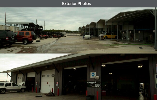
MAYO AUTOMOTIVE ADDITION, BLOCK 001, LOT 0001, ACRES 2.006
441061
Bell
Commercialnec
Texas
B and X Area of moderate flood hazard, usually the area between the limits of the 100-year and 500-year floods.
1
2025
4.01 AC
2025
Greater Killeen
023116
Killeen/Temple/Fort Hood
8,400 SF
NEARBY LISTINGS FOR SALE OR LEASE
DEMOGRAPHICS near 3828 W Stan Schlueter Loop
1 mile
3 mile
5 mile
2025 Total Population
18,722
73,506
136,981
2030 Population
19,887
77,671
144,398
Pop Growth 2025-2030
+ 6.22%
+ 5.67%
+ 5.41%
Average Age
30
31
31
2025 Total Households
6,113
24,985
46,166
HH Growth 2025-2030
+ 6.30%
+ 5.78%
+ 5.83%
Median Household Inc
$72,845
$64,563
$59,260
Avg Household Size
3.00
2.90
2.70
2025 Avg HH Vehicles
2.00
2.00
2.00
Median Home Value
$236,273
$230,953
$222,781
Median Year Built
2007
2002
1995
Nearby Places
Map Layers
Map Styles
 Street
 Aerial
Transit
 Traffic
 Biking
Places
Listings with unknown addresses are not visible on the map
- Restaurants
- Banks
- Shops
- Fitness
- Groceries
PUBLIC TRANSPORTATION
AIRPORT
Robert Gray AAF
Drive
Walk
Distance
Robert Gray AAF
13 min
5.7 mi
Killeen Municipal
Drive
Walk
Distance
Killeen Municipal
15 min
7.4 mi
Freight Ports
Port of Houston
Drive
Walk
Distance
Port of Houston
254 min
218.1 mi
SALE & LEASE HISTORY
LISTING DATE
SALE/LEASE

May 16, 2019
For Sale
Nearby Properties
Address
Land Use
TOTAL SIZE
Lot Size
Zoning
Address
Land Use
TOTAL SIZE
Lot Size
Zoning
1 SF
13.88 AC
Address
Land Use
TOTAL SIZE
Lot Size
Zoning
1 SF
27.58 AC
Address
Land Use
TOTAL SIZE
Lot Size
Zoning
211,272 SF
18.64 AC
Address
Land Use
TOTAL SIZE
Lot Size
Zoning
273,949 SF
21.92 AC
Address
Land Use
TOTAL SIZE
Lot Size
Zoning
1 SF
19.23 AC
Address
Land Use
TOTAL SIZE
Lot Size
Zoning
88,836 SF
3.32 AC
Address
Land Use
TOTAL SIZE
Lot Size
Zoning
173,508 SF
8.90 AC
R-3
Address
Land Use
TOTAL SIZE
Lot Size
Zoning
1 SF
40.54 AC
Address
Land Use
TOTAL SIZE
Lot Size
Zoning
313.70 AC
Address
Land Use
TOTAL SIZE
Lot Size
Zoning
1 SF
31.31 AC
Address
Land Use
TOTAL SIZE
Lot Size
Zoning
49,739 SF
Address
Land Use
TOTAL SIZE
Lot Size
Zoning
1 SF
27.42 AC
Address
Land Use
TOTAL SIZE
Lot Size
Zoning
174,898 SF
35.19 AC
Address
Land Use
TOTAL SIZE
Lot Size
Zoning
185,646 SF
10.65 AC
Address
Land Use
TOTAL SIZE
Lot Size
Zoning
1 SF
18.98 AC
Address
Land Use
TOTAL SIZE
Lot Size
Zoning
114,108 SF
11.31 AC
Address
Land Use
TOTAL SIZE
Lot Size
Zoning
1 SF
17.41 AC
Address
Land Use
TOTAL SIZE
Lot Size
Zoning
45,248 SF
5.97 AC
Address
Land Use
TOTAL SIZE
Lot Size
Zoning
134,770 SF
7.95 AC
Address
Land Use
TOTAL SIZE
Lot Size
Zoning
76,282 SF
7.15 AC
B-5/R-3
Address
Land Use
TOTAL SIZE
Lot Size
Zoning
102,456 SF
8.25 AC
Address
Land Use
TOTAL SIZE
Lot Size
Zoning
112,170 SF
11.34 AC
Address
Land Use
TOTAL SIZE
Lot Size
Zoning
104,530 SF
11.86 AC
Address
Land Use
TOTAL SIZE
Lot Size
Zoning
116,505 SF
11.29 AC
Address
Land Use
TOTAL SIZE
Lot Size
Zoning
51,126 SF
5.79 AC
Address
Land Use
TOTAL SIZE
Lot Size
Zoning
57,369 SF
11.86 AC
Address
Land Use
TOTAL SIZE
Lot Size
Zoning
114,228 SF
7.06 AC
Address
Land Use
TOTAL SIZE
Lot Size
Zoning
89,440 SF
12.18 AC
Address
Land Use
TOTAL SIZE
Lot Size
Zoning
46,260 SF
2.14 AC
Address
Land Use
TOTAL SIZE
Lot Size
Zoning
118,890 SF
1.97 AC
The World's #1 Commercial Real Estate Marketplace
Connect with us
© 2026 CoStar Group
The information above has been obtained from sources believed reliable. While we do not doubt its accuracy we have not verified it and make no guarantee, warranty or representation about it. It is your responsibility to independently confirm its accuracy and completeness. Any projections, opinions, assumptions, or estimates used are for example only and do not represent the current or future performance of the property. The value of this transaction to you depends on tax and other factors which should be evaluated by your tax, financial, and legal advisors. You and your advisors should conduct a careful, independent investigation of the property to determine to your satisfaction the suitability of the property for your needs.