No Photo
Property Record
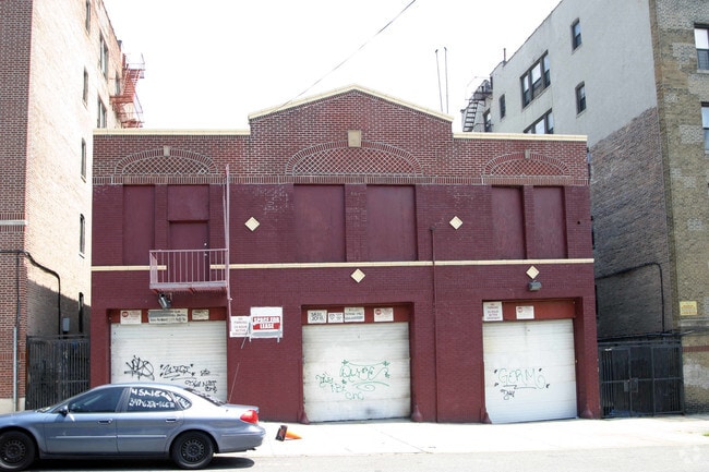
383 E 201St St, Bronx, NY 10458

Property Detail
383 E 201St St
03281-0075
BRONX
Apartment
New York
R8
75
B and X Area of moderate flood hazard, usually the area between the limits of the 100-year and 500-year floods.
0.15 AC
2024
Bronx
2025
Westchester/So Connecticut
039700
New York-Jersey City-White Plains, NY-NJ
40,098 SF
NEARBY LISTINGS FOR SALE OR LEASE
DEMOGRAPHICS near 383 E 201St St
1 mile
3 mile
5 mile
2024 Total Population
164,836
1,076,918
1,898,404
2029 Population
163,149
1,056,688
1,879,498
Pop Growth 2024-2029
(1.02%)
(1.88%)
(1.00%)
Average Age
37
39
39
2024 Total Households
56,999
381,523
689,613
HH Growth 2024-2029
(1.54%)
(2.13%)
(1.06%)
Median Household Inc
$44,040
$50,960
$52,324
Avg Household Size
2.70
2.60
2.60
2024 Avg HH Vehicles
.00
1.00
1.00
Median Home Value
$500,134
$502,950
$529,467
Median Year Built
1947
1950
1952
Nearby Places
Map Layers
Map Styles
 Street
 Aerial
Transit
 Traffic
 Biking
Places
Listings with unknown addresses are not visible on the map
- Restaurants
- Banks
- Shops
- Fitness
- Groceries
Nearby Properties
Address
Land Use
TOTAL SIZE
Lot Size
Zoning
Address
Land Use
TOTAL SIZE
Lot Size
Zoning
1,299,700 SF
29.82 AC
R6
Address
Land Use
TOTAL SIZE
Lot Size
Zoning
550,000 SF
8.75 AC
M1-1
Address
Land Use
TOTAL SIZE
Lot Size
Zoning
1,743,584 SF
77.87 AC
R6
Address
Land Use
TOTAL SIZE
Lot Size
Zoning
1,427,393 SF
39.94 AC
R4
Address
Land Use
TOTAL SIZE
Lot Size
Zoning
481,172 SF
205.58 AC
PARK
Address
Land Use
TOTAL SIZE
Lot Size
Zoning
1,132,500 SF
62.44 AC
R6
Address
Land Use
TOTAL SIZE
Lot Size
Zoning
895,256 SF
8.32 AC
R7-1
Address
Land Use
TOTAL SIZE
Lot Size
Zoning
1,237,424 SF
21.25 AC
R6
Address
Land Use
TOTAL SIZE
Lot Size
Zoning
485,484 SF
39.63 AC
R5
Address
Land Use
TOTAL SIZE
Lot Size
Zoning
204,200 SF
1.68 AC
R7-1
Address
Land Use
TOTAL SIZE
Lot Size
Zoning
667,405 SF
5.51 AC
R6
Address
Land Use
TOTAL SIZE
Lot Size
Zoning
390,750 SF
265 AC
PARK
Address
Land Use
TOTAL SIZE
Lot Size
Zoning
617,567 SF
3.19 AC
R7-1
Address
Land Use
TOTAL SIZE
Lot Size
Zoning
537,208 SF
4.73 AC
C4-3
Address
Land Use
TOTAL SIZE
Lot Size
Zoning
545,388 SF
29.07 AC
C4-3
Address
Land Use
TOTAL SIZE
Lot Size
Zoning
43.65 AC
PARK
Address
Land Use
TOTAL SIZE
Lot Size
Zoning
631,237 SF
30.93 AC
R5
Address
Land Use
TOTAL SIZE
Lot Size
Zoning
707,353 SF
29.34 AC
R6
Address
Land Use
TOTAL SIZE
Lot Size
Zoning
480,769 SF
1.21 AC
R8
Address
Land Use
TOTAL SIZE
Lot Size
Zoning
1,392,950 SF
19.67 AC
M2-1
Address
Land Use
TOTAL SIZE
Lot Size
Zoning
851,821 SF
7.95 AC
R4
Address
Land Use
TOTAL SIZE
Lot Size
Zoning
259.87 AC
PARK
Address
Land Use
TOTAL SIZE
Lot Size
Zoning
393,924 SF
4.50 AC
R7-2
Address
Land Use
TOTAL SIZE
Lot Size
Zoning
4,928 SF
64.19 AC
PARK
Address
Land Use
TOTAL SIZE
Lot Size
Zoning
224,037 SF
0.82 AC
C45X
Address
Land Use
TOTAL SIZE
Lot Size
Zoning
269,100 SF
1.63 AC
R4
Address
Land Use
TOTAL SIZE
Lot Size
Zoning
87,000 SF
455.70 AC
PARK
Address
Land Use
TOTAL SIZE
Lot Size
Zoning
361,354 SF
C4-2
Address
Land Use
TOTAL SIZE
Lot Size
Zoning
18,445 SF
510.83 AC
PARK
Address
Land Use
TOTAL SIZE
Lot Size
Zoning
251,884 SF
21.53 AC
R6
The World's #1 Commercial Real Estate Marketplace
Connect with us
© 2026 CoStar Group
The information above has been obtained from sources believed reliable. While we do not doubt its accuracy we have not verified it and make no guarantee, warranty or representation about it. It is your responsibility to independently confirm its accuracy and completeness. Any projections, opinions, assumptions, or estimates used are for example only and do not represent the current or future performance of the property. The value of this transaction to you depends on tax and other factors which should be evaluated by your tax, financial, and legal advisors. You and your advisors should conduct a careful, independent investigation of the property to determine to your satisfaction the suitability of the property for your needs.