Property Record
3830 10 Oaks Rd, Glenelg, MD 21737


NEARBY LISTINGS FOR SALE OR LEASE
Property Detail
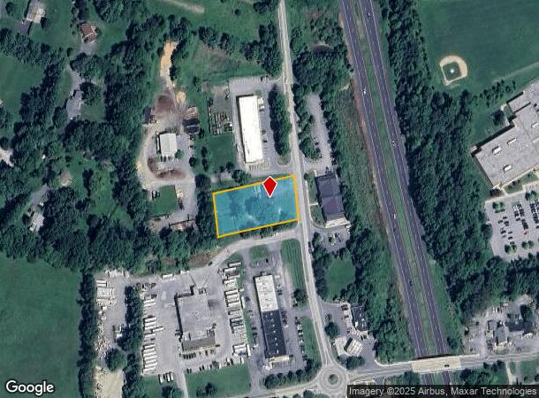
3830 10 Oaks Rd
03-284832
West Friendship
Animalhospitalvet
1 A 3830 TEN OAKS RD WEST FRIENDSHIP
X
Howard
24013C0425D
Maryland
2024
1 AC
2025
Outlying Howard County
603003
Baltimore
2,002 SF
Baltimore-Columbia-Towson, MD
DEMOGRAPHICS near 3830 10 Oaks Rd
1 Mile
3 Mile
5 Mile
2024 Total Population
1,830
12,313
28,526
2029 Population
1,871
12,584
29,187
Pop Growth 2024-2029
+ 2.24%
+ 2.20%
+ 2.32%
Average Age
42
42
42
2024 Total Households
559
3,764
8,944
HH Growth 2024-2029
+ 2.15%
+ 2.18%
+ 2.31%
Median Household Inc
$189,367
$205,682
$198,840
Avg Household Size
3.20
3.20
3.10
2024 Avg HH Vehicles
3.00
3.00
3.00
Median Home Value
$823,830
$843,917
$823,164
Median Year Built
1986
1987
1992
Nearby Places
Map Layers
Map Styles
 Street
 Aerial
- Restaurants
- Banks
- Shops
- Fitness
- Groceries
PUBLIC TRANSPORTATION
AIRPORT
Baltimore/Washington International Thurgood Marshall
DRIVE
WALK
Distance
Baltimore/Washington International Thurgood Marshall
38 min
26.6 mi
Ronald Reagan Washington Ntl
DRIVE
WALK
Distance
Ronald Reagan Washington Ntl
60 min
37.8 mi
Freight Ports
Port of Baltimore
DRIVE
WALK
Distance
Port of Baltimore
40 min
26.9 mi
Nearby Properties
Address
Land Use
TOTAL SIZE
Lot Size
Zoning
Address
Land Use
TOTAL SIZE
Lot Size
Zoning
44,492 SF
22.78 AC
RRDEO
Address
Land Use
TOTAL SIZE
Lot Size
Zoning
67,052 SF
76.72 AC
RRDEO
Address
Land Use
TOTAL SIZE
Lot Size
Zoning
124,170 SF
10.05 AC
RRDEO
Address
Land Use
TOTAL SIZE
Lot Size
Zoning
28,259 SF
80.75 AC
RRDEO
Address
Land Use
TOTAL SIZE
Lot Size
Zoning
49,968 SF
39.74 AC
RCDEO
Address
Land Use
TOTAL SIZE
Lot Size
Zoning
70,523 SF
30 AC
RCDEO
Address
Land Use
TOTAL SIZE
Lot Size
Zoning
54,858 SF
12 AC
RCDEO
Address
Land Use
TOTAL SIZE
Lot Size
Zoning
5,192 SF
920.76 AC
RCDEO
Address
Land Use
TOTAL SIZE
Lot Size
Zoning
2,755 SF
184.93 AC
RRDEO
Address
Land Use
TOTAL SIZE
Lot Size
Zoning
31 AC
RRDEO
Address
Land Use
TOTAL SIZE
Lot Size
Zoning
26.13 AC
RRDEO
Address
Land Use
TOTAL SIZE
Lot Size
Zoning
4,529 SF
86.92 AC
RCDEO
Address
Land Use
TOTAL SIZE
Lot Size
Zoning
17,605 SF
7.40 AC
B2
Address
Land Use
TOTAL SIZE
Lot Size
Zoning
6,804 SF
10.41 AC
RCDEO
Address
Land Use
TOTAL SIZE
Lot Size
Zoning
7,052 SF
5.23 AC
RRDEO
Address
Land Use
TOTAL SIZE
Lot Size
Zoning
2,000 SF
7.98 AC
B2
Address
Land Use
TOTAL SIZE
Lot Size
Zoning
66.38 AC
RRDEO
Address
Land Use
TOTAL SIZE
Lot Size
Zoning
16,656 SF
1.67 AC
B2
Address
Land Use
TOTAL SIZE
Lot Size
Zoning
1,400 SF
6.69 AC
B2
Address
Land Use
TOTAL SIZE
Lot Size
Zoning
8,401 SF
7.84 AC
RCDEO
Address
Land Use
TOTAL SIZE
Lot Size
Zoning
43,680 SF
3.16 AC
B2
Address
Land Use
TOTAL SIZE
Lot Size
Zoning
11,464 SF
3.01 AC
B2
Address
Land Use
TOTAL SIZE
Lot Size
Zoning
5,862 SF
4.09 AC
RRDEO
Address
Land Use
TOTAL SIZE
Lot Size
Zoning
5,000 SF
2.10 AC
B1
Address
Land Use
TOTAL SIZE
Lot Size
Zoning
7,408 SF
2.65 AC
B2
Address
Land Use
TOTAL SIZE
Lot Size
Zoning
4,868 SF
0.95 AC
B1
Address
Land Use
TOTAL SIZE
Lot Size
Zoning
3,069 SF
1.36 AC
B2
Address
Land Use
TOTAL SIZE
Lot Size
Zoning
3,572 SF
5.41 AC
RRDEO
Address
Land Use
TOTAL SIZE
Lot Size
Zoning
4,526 SF
6.79 AC
RRDEO
Address
Land Use
TOTAL SIZE
Lot Size
Zoning
4,590 SF
4.19 AC
B2
The World's #1 Commercial Real Estate Marketplace
Connect with us
© 2025 CoStar Group
The information above has been obtained from sources believed reliable. While we do not doubt its accuracy we have not verified it and make no guarantee, warranty or representation about it. It is your responsibility to independently confirm its accuracy and completeness. Any projections, opinions, assumptions, or estimates used are for example only and do not represent the current or future performance of the property. The value of this transaction to you depends on tax and other factors which should be evaluated by your tax, financial, and legal advisors. You and your advisors should conduct a careful, independent investigation of the property to determine to your satisfaction the suitability of the property for your needs.