Property Record
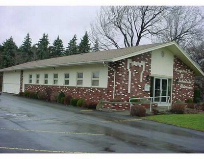
3830 Stone Rd, Middleport, NY 14105

Property Detail
3830 Stone Rd
292289-085-000-0001-036-000
7 15
Religious
NIAGARA
RES/AG
New York
B and X Area of moderate flood hazard, usually the area between the limits of the 100-year and 500-year floods.
36.000
2025
1.09 AC
2025
Outlying Niagara County
024101
Buffalo/Niagara Falls
3,200 SF
Buffalo-Cheektowaga, NY
NEARBY LISTINGS FOR SALE OR LEASE
DEMOGRAPHICS near 3830 Stone Rd
1 mile
3 mile
5 mile
2025 Total Population
1,295
3,726
11,746
2030 Population
1,276
3,654
11,501
Pop Growth 2025-2030
(1.47%)
(1.93%)
(2.09%)
Average Age
41
43
42
2025 Total Households
546
1,542
4,889
HH Growth 2025-2030
(1.47%)
(1.95%)
(2.13%)
Median Household Inc
$69,218
$79,583
$72,600
Avg Household Size
2.40
2.40
2.30
2025 Avg HH Vehicles
2.00
2.00
2.00
Median Home Value
$135,135
$152,759
$143,291
Median Year Built
1947
1949
1948
Nearby Places
Map Layers
Map Styles
 Street
 Aerial
Layers
 Traffic
 Biking
Places
Listings with unknown addresses are not visible on the map
- Restaurants
- Banks
- Shops
- Fitness
- Groceries
PUBLIC TRANSPORTATION
AIRPORT
Niagara Falls International
Drive
Walk
Distance
Niagara Falls International
41 min
28.8 mi
Buffalo Niagara International
Drive
Walk
Distance
Buffalo Niagara International
42 min
30.1 mi
Freight Ports
Albany, NY Port
Drive
Walk
Distance
Albany, NY Port
327 min
277.0 mi
Nearby Properties
Address
Land Use
TOTAL SIZE
Lot Size
Zoning
Address
Land Use
TOTAL SIZE
Lot Size
Zoning
Address
Land Use
TOTAL SIZE
Lot Size
Zoning
82,664 SF
24.40 AC
R1
Address
Land Use
TOTAL SIZE
Lot Size
Zoning
114,038 SF
65.10 AC
01 - NOT Z
Address
Land Use
TOTAL SIZE
Lot Size
Zoning
Address
Land Use
TOTAL SIZE
Lot Size
Zoning
Address
Land Use
TOTAL SIZE
Lot Size
Zoning
Address
Land Use
TOTAL SIZE
Lot Size
Zoning
Address
Land Use
TOTAL SIZE
Lot Size
Zoning
Address
Land Use
TOTAL SIZE
Lot Size
Zoning
65,059 SF
10.44 AC
RA
Address
Land Use
TOTAL SIZE
Lot Size
Zoning
Address
Land Use
TOTAL SIZE
Lot Size
Zoning
39,516 SF
44.90 AC
I
Address
Land Use
TOTAL SIZE
Lot Size
Zoning
113,002 SF
13.92 AC
I1
Address
Land Use
TOTAL SIZE
Lot Size
Zoning
Address
Land Use
TOTAL SIZE
Lot Size
Zoning
Address
Land Use
TOTAL SIZE
Lot Size
Zoning
Address
Land Use
TOTAL SIZE
Lot Size
Zoning
Address
Land Use
TOTAL SIZE
Lot Size
Zoning
0.28 AC
Address
Land Use
TOTAL SIZE
Lot Size
Zoning
Address
Land Use
TOTAL SIZE
Lot Size
Zoning
420.90 AC
RES/AG
Address
Land Use
TOTAL SIZE
Lot Size
Zoning
Address
Land Use
TOTAL SIZE
Lot Size
Zoning
Address
Land Use
TOTAL SIZE
Lot Size
Zoning
Address
Land Use
TOTAL SIZE
Lot Size
Zoning
Address
Land Use
TOTAL SIZE
Lot Size
Zoning
5,640 SF
5.15 AC
I1
Address
Land Use
TOTAL SIZE
Lot Size
Zoning
4,064 SF
86.79 AC
RA
Address
Land Use
TOTAL SIZE
Lot Size
Zoning
Address
Land Use
TOTAL SIZE
Lot Size
Zoning
11,898 SF
0.50 AC
B1
Address
Land Use
TOTAL SIZE
Lot Size
Zoning
4,096 SF
1 AC
R1
Address
Land Use
TOTAL SIZE
Lot Size
Zoning
62,448 SF
3.40 AC
I
Address
Land Use
TOTAL SIZE
Lot Size
Zoning
20,148 SF
1.30 AC
R1
The World's #1 Commercial Real Estate Marketplace
Connect with us
© 2026 CoStar Group
The information above has been obtained from sources believed reliable. While we do not doubt its accuracy we have not verified it and make no guarantee, warranty or representation about it. It is your responsibility to independently confirm its accuracy and completeness. Any projections, opinions, assumptions, or estimates used are for example only and do not represent the current or future performance of the property. The value of this transaction to you depends on tax and other factors which should be evaluated by your tax, financial, and legal advisors. You and your advisors should conduct a careful, independent investigation of the property to determine to your satisfaction the suitability of the property for your needs.