Property Record
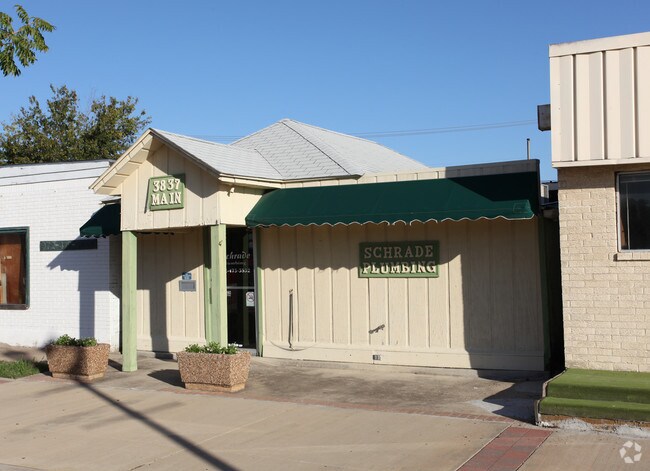
3837 Main St, Rowlett, TX 75088


Property Detail
3837 Main St
44000500000090000
ORIG TOWN ROWLETT LT 9 VOL2005106/09174 DD06012005 CO-DC 0005000000900 3CW00050000
Storebuilding
DALLAS
Z205
Texas
B and X Area of moderate flood hazard, usually the area between the limits of the 100-year and 500-year floods.
9
2025
0.05 AC
2025
Sachse/Rowlett
018133
Dallas/Ft Worth
704 SF
Dallas-Fort Worth-Arlington, TX
NEARBY LISTINGS FOR SALE OR LEASE
DEMOGRAPHICS near 3837 Main St
1 mile
3 mile
5 mile
2025 Total Population
7,928
69,809
213,340
2030 Population
8,223
72,378
221,481
Pop Growth 2025-2030
+ 3.72%
+ 3.68%
+ 3.82%
Average Age
40
40
38
2025 Total Households
2,877
23,238
70,808
HH Growth 2025-2030
+ 3.82%
+ 3.76%
+ 3.94%
Median Household Inc
$103,940
$101,971
$87,137
Avg Household Size
2.70
3.00
3.00
2025 Avg HH Vehicles
2.00
2.00
2.00
Median Home Value
$352,793
$353,219
$315,565
Median Year Built
1986
1992
1986
Nearby Places
Map Layers
Map Styles
 Street
 Aerial
Layers
 Traffic
 Biking
Places
Listings with unknown addresses are not visible on the map
- Restaurants
- Banks
- Shops
- Fitness
- Groceries
PUBLIC TRANSPORTATION
TRANSIT/SUBWAY
Downtown Rowlett (Blue Line - Dallas Area Rapid Transit (DART))
Drive
Walk
Distance
Downtown Rowlett (Blue Line - Dallas Area Rapid Transit (DART))
2 min
4 min
0.2 mi
AIRPORT
Dallas Love Field
Drive
Walk
Distance
Dallas Love Field
40 min
25.1 mi
Dallas-Fort Worth International
Drive
Walk
Distance
Dallas-Fort Worth International
48 min
34.1 mi
Nearby Properties
Address
Land Use
TOTAL SIZE
Lot Size
Zoning
Address
Land Use
TOTAL SIZE
Lot Size
Zoning
261,164 SF
32.58 AC
Address
Land Use
TOTAL SIZE
Lot Size
Zoning
260,782 SF
16.30 AC
Z77
Address
Land Use
TOTAL SIZE
Lot Size
Zoning
427,231 SF
9.96 AC
Z38
Address
Land Use
TOTAL SIZE
Lot Size
Zoning
313,217 SF
3.61 AC
Z205
Address
Land Use
TOTAL SIZE
Lot Size
Zoning
228,458 SF
5.56 AC
Z236
Address
Land Use
TOTAL SIZE
Lot Size
Zoning
178,125 SF
10.50 AC
Z77
Address
Land Use
TOTAL SIZE
Lot Size
Zoning
77,102 SF
27.47 AC
Z144
Address
Land Use
TOTAL SIZE
Lot Size
Zoning
0.12 AC
Z63
Address
Land Use
TOTAL SIZE
Lot Size
Zoning
43,600 SF
62.86 AC
Z306
Address
Land Use
TOTAL SIZE
Lot Size
Zoning
420,500 SF
33.25 AC
Address
Land Use
TOTAL SIZE
Lot Size
Zoning
261,000 SF
1 AC
Z318
Address
Land Use
TOTAL SIZE
Lot Size
Zoning
271,051 SF
10.28 AC
Z01
Address
Land Use
TOTAL SIZE
Lot Size
Zoning
145,203 SF
12.86 AC
Z239
Address
Land Use
TOTAL SIZE
Lot Size
Zoning
76,812 SF
9.22 AC
Z144
Address
Land Use
TOTAL SIZE
Lot Size
Zoning
226,800 SF
4.98 AC
Z340
Address
Land Use
TOTAL SIZE
Lot Size
Zoning
151,893 SF
5.40 AC
Z308
Address
Land Use
TOTAL SIZE
Lot Size
Zoning
82,847 SF
4.87 AC
Z236
Address
Land Use
TOTAL SIZE
Lot Size
Zoning
78,017 SF
1.75 AC
Z236
Address
Land Use
TOTAL SIZE
Lot Size
Zoning
83,154 SF
14.39 AC
Z386
Address
Land Use
TOTAL SIZE
Lot Size
Zoning
140,000 SF
12.76 AC
Address
Land Use
TOTAL SIZE
Lot Size
Zoning
141,200 SF
10.81 AC
Address
Land Use
TOTAL SIZE
Lot Size
Zoning
150,926 SF
9.33 AC
Address
Land Use
TOTAL SIZE
Lot Size
Zoning
52,797 SF
5.41 AC
Z92
Address
Land Use
TOTAL SIZE
Lot Size
Zoning
147.23 AC
Z114
Address
Land Use
TOTAL SIZE
Lot Size
Zoning
0.02 AC
Z236
Address
Land Use
TOTAL SIZE
Lot Size
Zoning
203,983 SF
31.19 AC
Z92
Address
Land Use
TOTAL SIZE
Lot Size
Zoning
65,518 SF
1.34 AC
Z01
Address
Land Use
TOTAL SIZE
Lot Size
Zoning
178,197 SF
4.42 AC
Z239
Address
Land Use
TOTAL SIZE
Lot Size
Zoning
25,700 SF
20.56 AC
SF7
Address
Land Use
TOTAL SIZE
Lot Size
Zoning
45,800 SF
5.06 AC
Z92
The World's #1 Commercial Real Estate Marketplace
Connect with us
© 2026 CoStar Group
The information above has been obtained from sources believed reliable. While we do not doubt its accuracy we have not verified it and make no guarantee, warranty or representation about it. It is your responsibility to independently confirm its accuracy and completeness. Any projections, opinions, assumptions, or estimates used are for example only and do not represent the current or future performance of the property. The value of this transaction to you depends on tax and other factors which should be evaluated by your tax, financial, and legal advisors. You and your advisors should conduct a careful, independent investigation of the property to determine to your satisfaction the suitability of the property for your needs.