Property Record
384 Curk Roberts Rd, Braselton, GA 30517

NEARBY LISTINGS FOR SALE OR LEASE
Property Detail
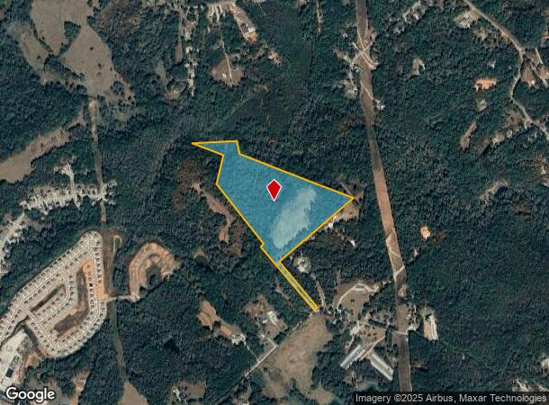
384 Curk Roberts Rd
117-026
TRACTS 2 & 4 PLAT BOOK 74 PAGE 142
Agriculturalland
Jackson
A
Georgia
13013C0025D
38.58 AC
2025
Jackson County
2024
Atlanta
010109
Jefferson, GA
DEMOGRAPHICS near 384 Curk Roberts Rd
1 Mile
3 Mile
5 Mile
2024 Total Population
1,396
16,056
39,675
2029 Population
1,784
19,590
46,961
Pop Growth 2024-2029
+ 27.79%
+ 22.01%
+ 18.36%
Average Age
38
38
40
2024 Total Households
462
5,336
13,712
HH Growth 2024-2029
+ 26.19%
+ 21.01%
+ 17.44%
Median Household Inc
$95,731
$93,391
$89,495
Avg Household Size
3.00
3.00
2.90
2024 Avg HH Vehicles
2.00
2.00
2.00
Median Home Value
$299,031
$315,189
$327,912
Median Year Built
2006
2005
2004
Nearby Places
Map Layers
Map Styles
 Street
 Aerial
- Restaurants
- Banks
- Shops
- Fitness
- Groceries
SALE & LEASE HISTORY
LISTING DATE
SALE/LEASE

Nov 06, 2018
For Sale
Nearby Properties
Address
Land Use
TOTAL SIZE
Lot Size
Zoning
Address
Land Use
TOTAL SIZE
Lot Size
Zoning
341,330 SF
71.15 AC
001
Address
Land Use
TOTAL SIZE
Lot Size
Zoning
750 SF
001
Address
Land Use
TOTAL SIZE
Lot Size
Zoning
613,440 SF
50 AC
003
Address
Land Use
TOTAL SIZE
Lot Size
Zoning
510,720 SF
48.46 AC
M1
Address
Land Use
TOTAL SIZE
Lot Size
Zoning
348,990 SF
86.93 AC
M
Address
Land Use
TOTAL SIZE
Lot Size
Zoning
502,088 SF
36.80 AC
MD
Address
Land Use
TOTAL SIZE
Lot Size
Zoning
462,000 SF
30.12 AC
M1
Address
Land Use
TOTAL SIZE
Lot Size
Zoning
446,439 SF
30.47 AC
003
Address
Land Use
TOTAL SIZE
Lot Size
Zoning
500,500 SF
53.92 AC
MI
Address
Land Use
TOTAL SIZE
Lot Size
Zoning
438,375 SF
32.69 AC
Address
Land Use
TOTAL SIZE
Lot Size
Zoning
209,040 SF
39.07 AC
MD
Address
Land Use
TOTAL SIZE
Lot Size
Zoning
805,954 SF
52.41 AC
003
Address
Land Use
TOTAL SIZE
Lot Size
Zoning
547,250 SF
47.51 AC
M1
Address
Land Use
TOTAL SIZE
Lot Size
Zoning
360,290 SF
35.90 AC
C
Address
Land Use
TOTAL SIZE
Lot Size
Zoning
9,800 SF
681.58 AC
PCD
Address
Land Use
TOTAL SIZE
Lot Size
Zoning
554,285 SF
70.18 AC
Address
Land Use
TOTAL SIZE
Lot Size
Zoning
18,510 SF
490.78 AC
PRD/PCD
Address
Land Use
TOTAL SIZE
Lot Size
Zoning
222,000 SF
20.59 AC
003
Address
Land Use
TOTAL SIZE
Lot Size
Zoning
131,875 SF
18.93 AC
C
Address
Land Use
TOTAL SIZE
Lot Size
Zoning
76,792 SF
19.31 AC
003
Address
Land Use
TOTAL SIZE
Lot Size
Zoning
28,282 SF
6.36 AC
C2
Address
Land Use
TOTAL SIZE
Lot Size
Zoning
146,571 SF
21.60 AC
E2
Address
Land Use
TOTAL SIZE
Lot Size
Zoning
60,128 SF
2.48 AC
001
Address
Land Use
TOTAL SIZE
Lot Size
Zoning
128,874 SF
11.57 AC
001
Address
Land Use
TOTAL SIZE
Lot Size
Zoning
59,160 SF
19.72 AC
I-2
Address
Land Use
TOTAL SIZE
Lot Size
Zoning
7,500 SF
5 AC
I-2
Address
Land Use
TOTAL SIZE
Lot Size
Zoning
21,268 SF
7 AC
MI
Address
Land Use
TOTAL SIZE
Lot Size
Zoning
279.02 AC
AR-1
Address
Land Use
TOTAL SIZE
Lot Size
Zoning
29,600 SF
10.06 AC
I-2
Address
Land Use
TOTAL SIZE
Lot Size
Zoning
24,000 SF
3.46 AC
I-2
The World's #1 Commercial Real Estate Marketplace
Connect with us
© 2025 CoStar Group
The information above has been obtained from sources believed reliable. While we do not doubt its accuracy we have not verified it and make no guarantee, warranty or representation about it. It is your responsibility to independently confirm its accuracy and completeness. Any projections, opinions, assumptions, or estimates used are for example only and do not represent the current or future performance of the property. The value of this transaction to you depends on tax and other factors which should be evaluated by your tax, financial, and legal advisors. You and your advisors should conduct a careful, independent investigation of the property to determine to your satisfaction the suitability of the property for your needs.