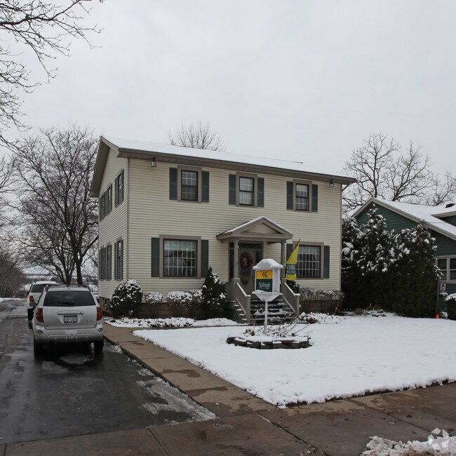
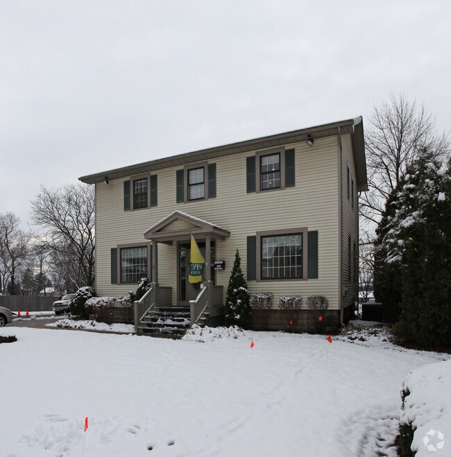
Property Record
384 N Main St, Canandaigua, NY 14424
NEARBY LISTINGS FOR SALE OR LEASE
Property Detail
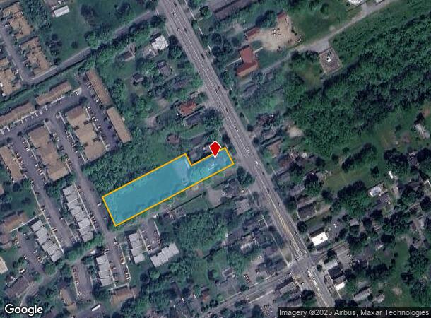
384 N Main St
Rochester, NY
Ontario
320200-070-020-0001-008-000
New York
Officebuilding
8.000
2025
0.96 AC
2024
Outlying Ontario County
050800
Rochester
3,084 SF
DEMOGRAPHICS near 384 N Main St
1 Mile
3 Mile
5 Mile
2024 Total Population
6,395
17,028
29,044
2029 Population
6,349
17,124
29,171
Pop Growth 2024-2029
(0.72%)
+ 0.56%
+ 0.44%
Average Age
44
45
44
2024 Total Households
2,957
7,820
12,431
HH Growth 2024-2029
(0.88%)
+ 0.72%
+ 0.51%
Median Household Inc
$59,290
$68,537
$77,564
Avg Household Size
2.10
2.10
2.20
2024 Avg HH Vehicles
2.00
2.00
2.00
Median Home Value
$202,707
$217,938
$218,846
Median Year Built
1966
1976
1980
Nearby Places
- Restaurants
- Banks
- Shops
- Fitness
- Groceries
PUBLIC TRANSPORTATION
AIRPORT
Frederick Douglass/Greater Rochester International
DRIVE
WALK
Distance
Frederick Douglass/Greater Rochester International
40 min
29.1 mi
Freight Ports
Albany, NY Port
DRIVE
WALK
Distance
Albany, NY Port
247 min
208.9 mi
Nearby Properties
Address
Land Use
TOTAL SIZE
Lot Size
Zoning
Address
Land Use
TOTAL SIZE
Lot Size
Zoning
56,880 SF
328.70 AC
AR1
Address
Land Use
TOTAL SIZE
Lot Size
Zoning
250,612 SF
24.10 AC
HR
Address
Land Use
TOTAL SIZE
Lot Size
Zoning
202,319 SF
2.69 AC
PUD
Address
Land Use
TOTAL SIZE
Lot Size
Zoning
246,702 SF
30 AC
R1A
Address
Land Use
TOTAL SIZE
Lot Size
Zoning
100,758 SF
5.80 AC
PUD
Address
Land Use
TOTAL SIZE
Lot Size
Zoning
266,624 SF
59.10 AC
R1B
Address
Land Use
TOTAL SIZE
Lot Size
Zoning
46,212 SF
8.40 AC
CL
Address
Land Use
TOTAL SIZE
Lot Size
Zoning
39,480 SF
10.90 AC
PUD
Address
Land Use
TOTAL SIZE
Lot Size
Zoning
75,357 SF
13.10 AC
MH
Address
Land Use
TOTAL SIZE
Lot Size
Zoning
800,000 SF
102 AC
IND M
Address
Land Use
TOTAL SIZE
Lot Size
Zoning
74,343 SF
88.50 AC
IND M
Address
Land Use
TOTAL SIZE
Lot Size
Zoning
146,058 SF
21.40 AC
R1B
Address
Land Use
TOTAL SIZE
Lot Size
Zoning
10,306 SF
29.60 AC
PUD
Address
Land Use
TOTAL SIZE
Lot Size
Zoning
3,716 SF
6.60 AC
PR
Address
Land Use
TOTAL SIZE
Lot Size
Zoning
82,885 SF
5 AC
HR
Address
Land Use
TOTAL SIZE
Lot Size
Zoning
4,519 SF
40 AC
M1
Address
Land Use
TOTAL SIZE
Lot Size
Zoning
114,533 SF
16.90 AC
C3
Address
Land Use
TOTAL SIZE
Lot Size
Zoning
196,012 SF
17.80 AC
CC
Address
Land Use
TOTAL SIZE
Lot Size
Zoning
Address
Land Use
TOTAL SIZE
Lot Size
Zoning
132,040 SF
12.10 AC
PUD
Address
Land Use
TOTAL SIZE
Lot Size
Zoning
Address
Land Use
TOTAL SIZE
Lot Size
Zoning
3,053 SF
16.20 AC
M1
Address
Land Use
TOTAL SIZE
Lot Size
Zoning
9,344 SF
11.62 AC
R3
Address
Land Use
TOTAL SIZE
Lot Size
Zoning
44,867 SF
0.85 AC
HR
Address
Land Use
TOTAL SIZE
Lot Size
Zoning
17,713 SF
6 AC
HR
Address
Land Use
TOTAL SIZE
Lot Size
Zoning
14,220 SF
35.50 AC
M1
Address
Land Use
TOTAL SIZE
Lot Size
Zoning
101,854 SF
3.60 AC
R3
Address
Land Use
TOTAL SIZE
Lot Size
Zoning
48,000 SF
33.60 AC
IND
Address
Land Use
TOTAL SIZE
Lot Size
Zoning
38,181 SF
8.40 AC
MR
Address
Land Use
TOTAL SIZE
Lot Size
Zoning
38,181 SF
13.40 AC
MR
The World's #1 Commercial Real Estate Marketplace
Connect with us
© 2025 CoStar Group
The information above has been obtained from sources believed reliable. While we do not doubt its accuracy we have not verified it and make no guarantee, warranty or representation about it. It is your responsibility to independently confirm its accuracy and completeness. Any projections, opinions, assumptions, or estimates used are for example only and do not represent the current or future performance of the property. The value of this transaction to you depends on tax and other factors which should be evaluated by your tax, financial, and legal advisors. You and your advisors should conduct a careful, independent investigation of the property to determine to your satisfaction the suitability of the property for your needs.