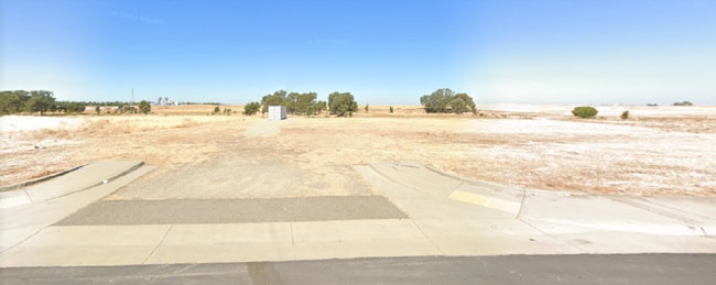
Property Record
3840 Prosperity Dr, Rocklin, CA 95765


NEARBY LISTINGS FOR SALE OR LEASE
Property Detail
3840 Prosperity Dr
Sacramento--Roseville--Arden-Arcade, CA
Nichols Drive Industrial Park
495-020-013
1.0 AC LOT 24 NICHOLS DRIVE INDUSTRIAL PARK- CC-7
Industrialacreage
Placer
X
California
06061C0929H
24
2024
1 AC
2025
Roseville/Rocklin
021328
Sacramento
DEMOGRAPHICS near 3840 Prosperity Dr
1 Mile
3 Mile
5 Mile
2024 Total Population
2,058
75,179
201,462
2029 Population
2,205
81,549
217,680
Pop Growth 2024-2029
+ 7.14%
+ 8.47%
+ 8.05%
Average Age
37
38
41
2024 Total Households
635
25,399
73,046
HH Growth 2024-2029
+ 7.24%
+ 8.46%
+ 8.02%
Median Household Inc
$139,825
$126,876
$112,979
Avg Household Size
3.20
2.90
2.70
2024 Avg HH Vehicles
2.00
2.00
2.00
Median Home Value
$668,354
$701,063
$663,890
Median Year Built
2004
2004
2001
Nearby Places
Map Layers
Map Styles
 Street
 Aerial
- Restaurants
- Banks
- Shops
- Fitness
- Groceries
PUBLIC TRANSPORTATION
COMMUTER RAIL
Rocklin Amtrak Station (Capitol Corridor - Amtrak)
DRIVE
WALK
Distance
Rocklin Amtrak Station (Capitol Corridor - Amtrak)
14 min
6.3 mi
Roseville (California Zephyr - Amtrak, Capitol Corridor - Amtrak)
DRIVE
WALK
Distance
Roseville (California Zephyr - Amtrak, Capitol Corridor - Amtrak)
14 min
6.6 mi
AIRPORT
Sacramento International
DRIVE
WALK
Distance
Sacramento International
45 min
32.6 mi
Freight Ports
Port of Stockton
DRIVE
WALK
Distance
Port of Stockton
88 min
72.8 mi
SALE & LEASE HISTORY
LISTING DATE
SALE/LEASE

Sep 24, 2016
For Sale
Mar 18, 2021
For Sale
Apr 18, 2024
For Sale
Nearby Properties
Address
Land Use
TOTAL SIZE
Lot Size
Zoning
Address
Land Use
TOTAL SIZE
Lot Size
Zoning
341,145 SF
12 AC
Address
Land Use
TOTAL SIZE
Lot Size
Zoning
471,741 SF
15.14 AC
Address
Land Use
TOTAL SIZE
Lot Size
Zoning
280,129 SF
14.90 AC
Address
Land Use
TOTAL SIZE
Lot Size
Zoning
401,656 SF
28 AC
Address
Land Use
TOTAL SIZE
Lot Size
Zoning
130,228 SF
11.10 AC
Address
Land Use
TOTAL SIZE
Lot Size
Zoning
1,032,692 SF
81.30 AC
INPDC
Address
Land Use
TOTAL SIZE
Lot Size
Zoning
243,765 SF
14.24 AC
Address
Land Use
TOTAL SIZE
Lot Size
Zoning
144,760 SF
26.70 AC
Address
Land Use
TOTAL SIZE
Lot Size
Zoning
769,698 SF
50.39 AC
Address
Land Use
TOTAL SIZE
Lot Size
Zoning
411,344 SF
41.50 AC
Address
Land Use
TOTAL SIZE
Lot Size
Zoning
244,077 SF
8.70 AC
Address
Land Use
TOTAL SIZE
Lot Size
Zoning
401,175 SF
19.80 AC
Address
Land Use
TOTAL SIZE
Lot Size
Zoning
193,126 SF
75.84 AC
Address
Land Use
TOTAL SIZE
Lot Size
Zoning
217,756 SF
8.90 AC
Address
Land Use
TOTAL SIZE
Lot Size
Zoning
191,820 SF
12.40 AC
Address
Land Use
TOTAL SIZE
Lot Size
Zoning
718,131 SF
42 AC
Address
Land Use
TOTAL SIZE
Lot Size
Zoning
159,069 SF
6.09 AC
Address
Land Use
TOTAL SIZE
Lot Size
Zoning
12,176 SF
22.70 AC
Address
Land Use
TOTAL SIZE
Lot Size
Zoning
198,530 SF
11.50 AC
Address
Land Use
TOTAL SIZE
Lot Size
Zoning
314,360 SF
18.90 AC
Address
Land Use
TOTAL SIZE
Lot Size
Zoning
222,453 SF
27.60 AC
Address
Land Use
TOTAL SIZE
Lot Size
Zoning
198,824 SF
29.66 AC
Address
Land Use
TOTAL SIZE
Lot Size
Zoning
474,641 SF
30.80 AC
Address
Land Use
TOTAL SIZE
Lot Size
Zoning
200,928 SF
3.65 AC
Address
Land Use
TOTAL SIZE
Lot Size
Zoning
118,199 SF
5.50 AC
Address
Land Use
TOTAL SIZE
Lot Size
Zoning
111,110 SF
11.73 AC
Address
Land Use
TOTAL SIZE
Lot Size
Zoning
93,992 SF
6.90 AC
The World's #1 Commercial Real Estate Marketplace
Connect with us
© 2025 CoStar Group
The information above has been obtained from sources believed reliable. While we do not doubt its accuracy we have not verified it and make no guarantee, warranty or representation about it. It is your responsibility to independently confirm its accuracy and completeness. Any projections, opinions, assumptions, or estimates used are for example only and do not represent the current or future performance of the property. The value of this transaction to you depends on tax and other factors which should be evaluated by your tax, financial, and legal advisors. You and your advisors should conduct a careful, independent investigation of the property to determine to your satisfaction the suitability of the property for your needs.