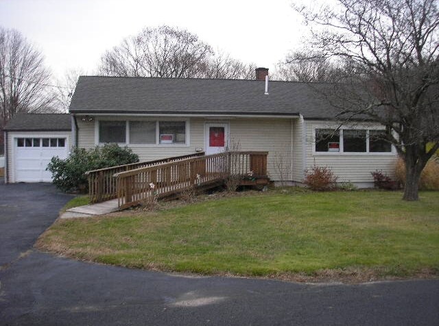
Property Record
3845 Whitney Ave, Hamden, CT 06518


NEARBY LISTINGS FOR SALE OR LEASE
Property Detail
3845 Whitney Ave
HAMD-003329-000019
New Haven
Commercialbuilding
Connecticut
X
0000
09009C0291J
0.66 AC
2024
Hamden
2025
Westchester/So Connecticut
166002
New Haven, CT
1,076 SF
DEMOGRAPHICS near 3845 Whitney Ave
1 Mile
3 Mile
5 Mile
2024 Total Population
2,629
27,727
90,254
2029 Population
2,646
27,829
90,365
Pop Growth 2024-2029
+ 0.65%
+ 0.37%
+ 0.12%
Average Age
38
41
43
2024 Total Households
710
9,265
35,394
HH Growth 2024-2029
+ 0.56%
+ 0.29%
+ 0.09%
Median Household Inc
$122,840
$113,829
$97,193
Avg Household Size
2.50
2.40
2.30
2024 Avg HH Vehicles
2.00
2.00
2.00
Median Home Value
$333,460
$328,699
$304,080
Median Year Built
1968
1979
1971
Nearby Places
Map Layers
Map Styles
 Street
 Aerial
- Restaurants
- Banks
- Shops
- Fitness
- Groceries
PUBLIC TRANSPORTATION
COMMUTER RAIL
Wallingford Amtrak (Amtrak Hartford Line - Amtrak, Hartford Line - Amtrak, Northeast Regional - Amtrak, Valley Flyer - Amtrak)
DRIVE
WALK
Distance
Wallingford Amtrak (Amtrak Hartford Line - Amtrak, Hartford Line - Amtrak, Northeast Regional - Amtrak, Valley Flyer - Amtrak)
11 min
6.6 mi
Wallingford (Hartford Line - CONN DOT)
DRIVE
WALK
Distance
Wallingford (Hartford Line - CONN DOT)
13 min
7.0 mi
AIRPORT
Tweed/New Haven
DRIVE
WALK
Distance
Tweed/New Haven
23 min
14.3 mi
Freight Ports
Port of New Haven
DRIVE
WALK
Distance
Port of New Haven
19 min
12.0 mi
Nearby Properties
Address
Land Use
TOTAL SIZE
Lot Size
Zoning
Address
Land Use
TOTAL SIZE
Lot Size
Zoning
33,122 SF
23.06 AC
T4
Address
Land Use
TOTAL SIZE
Lot Size
Zoning
23,338 SF
37.36 AC
R-40
Address
Land Use
TOTAL SIZE
Lot Size
Zoning
28,824 SF
44.93 AC
T4
Address
Land Use
TOTAL SIZE
Lot Size
Zoning
123,288 SF
1.81 AC
BA
Address
Land Use
TOTAL SIZE
Lot Size
Zoning
77,042 SF
39.29 AC
R2
Address
Land Use
TOTAL SIZE
Lot Size
Zoning
65,713 SF
15.66 AC
R40
Address
Land Use
TOTAL SIZE
Lot Size
Zoning
46,950 SF
6.71 AC
C-3
Address
Land Use
TOTAL SIZE
Lot Size
Zoning
64,522 SF
2.86 AC
R4T3
Address
Land Use
TOTAL SIZE
Lot Size
Zoning
24.66 AC
R40
Address
Land Use
TOTAL SIZE
Lot Size
Zoning
1,386 AC
R1
Address
Land Use
TOTAL SIZE
Lot Size
Zoning
8.33 AC
R4
Address
Land Use
TOTAL SIZE
Lot Size
Zoning
100.78 AC
R2
Address
Land Use
TOTAL SIZE
Lot Size
Zoning
43,825 SF
13.59 AC
R3
Address
Land Use
TOTAL SIZE
Lot Size
Zoning
4.43 AC
R4T3
Address
Land Use
TOTAL SIZE
Lot Size
Zoning
4.02 AC
T4
Address
Land Use
TOTAL SIZE
Lot Size
Zoning
4.31 AC
T4
Address
Land Use
TOTAL SIZE
Lot Size
Zoning
4.63 AC
M
Address
Land Use
TOTAL SIZE
Lot Size
Zoning
59,515 SF
5.53 AC
T4
Address
Land Use
TOTAL SIZE
Lot Size
Zoning
30.54 AC
PDD
Address
Land Use
TOTAL SIZE
Lot Size
Zoning
158 AC
R1
Address
Land Use
TOTAL SIZE
Lot Size
Zoning
14,418 SF
1.17 AC
T4
Address
Land Use
TOTAL SIZE
Lot Size
Zoning
3 AC
M
Address
Land Use
TOTAL SIZE
Lot Size
Zoning
8,964 SF
35.19 AC
R2
Address
Land Use
TOTAL SIZE
Lot Size
Zoning
91,666 SF
4.82 AC
M
Address
Land Use
TOTAL SIZE
Lot Size
Zoning
20,160 SF
3.33 AC
M
Address
Land Use
TOTAL SIZE
Lot Size
Zoning
2.44 AC
T35T
Address
Land Use
TOTAL SIZE
Lot Size
Zoning
2,400 SF
33.04 AC
R2
Address
Land Use
TOTAL SIZE
Lot Size
Zoning
521.89 AC
R1
Address
Land Use
TOTAL SIZE
Lot Size
Zoning
53,507 SF
3.16 AC
M
Address
Land Use
TOTAL SIZE
Lot Size
Zoning
56,017 SF
4.77 AC
M
The World's #1 Commercial Real Estate Marketplace
Connect with us
© 2026 CoStar Group
The information above has been obtained from sources believed reliable. While we do not doubt its accuracy we have not verified it and make no guarantee, warranty or representation about it. It is your responsibility to independently confirm its accuracy and completeness. Any projections, opinions, assumptions, or estimates used are for example only and do not represent the current or future performance of the property. The value of this transaction to you depends on tax and other factors which should be evaluated by your tax, financial, and legal advisors. You and your advisors should conduct a careful, independent investigation of the property to determine to your satisfaction the suitability of the property for your needs.