Property Record
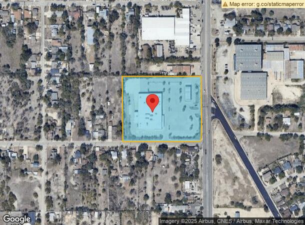
3847 Pleasanton Rd, San Antonio, TX 78221

NEARBY LISTINGS FOR SALE OR LEASE
Property Detail
3847 Pleasanton Rd
San Antonio-New Braunfels, TX
Harlandale Acres 8 Bl 11099
11099-006-0761
NCB 11099 BLK 6 LOT 76 (DUPLICATE LOT # TO PID 473302) (CYPRESS COMMERCIAL PLEASANTON) 2016-NEW PER PLAT 9690/15-21 FILED 9-25-2015. JF/GIS/11-9-15
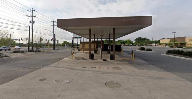
Supermarket
Bexar
X
Texas
48029C0560F
55
2024
5.30 AC
2025
South
151700
San Antonio
71,807 SF
DEMOGRAPHICS near 3847 Pleasanton Rd
1 Mile
3 Mile
5 Mile
2024 Total Population
13,182
82,692
206,714
2029 Population
13,886
87,482
220,538
Pop Growth 2024-2029
+ 5.34%
+ 5.79%
+ 6.69%
Average Age
38
37
37
2024 Total Households
4,286
26,751
70,256
HH Growth 2024-2029
+ 5.51%
+ 5.94%
+ 6.87%
Median Household Inc
$51,079
$44,923
$43,897
Avg Household Size
3.00
3.00
2.80
2024 Avg HH Vehicles
2.00
2.00
2.00
Median Home Value
$125,220
$124,608
$127,455
Median Year Built
1966
1967
1964
Nearby Places
Map Layers
Map Styles
 Street
 Aerial
- Restaurants
- Banks
- Shops
- Fitness
- Groceries
PUBLIC TRANSPORTATION
COMMUTER RAIL
San Antonio Amtrak Station (Sunset Limited - Amtrak, Texas Eagle - Amtrak)
DRIVE
WALK
Distance
San Antonio Amtrak Station (Sunset Limited - Amtrak, Texas Eagle - Amtrak)
15 min
7.5 mi
AIRPORT
San Antonio International
DRIVE
WALK
Distance
San Antonio International
23 min
15.0 mi
Freight Ports
Port of Corpus Christi
DRIVE
WALK
Distance
Port of Corpus Christi
146 min
141.3 mi
SALE & LEASE HISTORY
LISTING DATE
SALE/LEASE

Sep 24, 2016
For Sale
Sep 23, 2016
For Sale
Oct 17, 2018
For Lease
Feb 01, 2023
For Sale
Nearby Properties
Address
Land Use
TOTAL SIZE
Lot Size
Zoning
Address
Land Use
TOTAL SIZE
Lot Size
Zoning
548,048 SF
27.53 AC
Address
Land Use
TOTAL SIZE
Lot Size
Zoning
12,504,292 SF
32.18 AC
Address
Land Use
TOTAL SIZE
Lot Size
Zoning
504,337 SF
45.55 AC
Address
Land Use
TOTAL SIZE
Lot Size
Zoning
447,169 SF
46.74 AC
Address
Land Use
TOTAL SIZE
Lot Size
Zoning
163.70 AC
Address
Land Use
TOTAL SIZE
Lot Size
Zoning
71,607 SF
10.46 AC
Address
Land Use
TOTAL SIZE
Lot Size
Zoning
218,003 SF
12.33 AC
Address
Land Use
TOTAL SIZE
Lot Size
Zoning
11,553 SF
67.15 AC
Address
Land Use
TOTAL SIZE
Lot Size
Zoning
80,936 SF
13.48 AC
Address
Land Use
TOTAL SIZE
Lot Size
Zoning
20.58 AC
Address
Land Use
TOTAL SIZE
Lot Size
Zoning
45,363 SF
4.29 AC
Address
Land Use
TOTAL SIZE
Lot Size
Zoning
143,067 SF
11.69 AC
Address
Land Use
TOTAL SIZE
Lot Size
Zoning
56,875 SF
10.04 AC
Address
Land Use
TOTAL SIZE
Lot Size
Zoning
526.61 AC
Address
Land Use
TOTAL SIZE
Lot Size
Zoning
166,270 SF
13.95 AC
Address
Land Use
TOTAL SIZE
Lot Size
Zoning
38,671 SF
5.20 AC
Address
Land Use
TOTAL SIZE
Lot Size
Zoning
141,606 SF
13.74 AC
Address
Land Use
TOTAL SIZE
Lot Size
Zoning
67,184 SF
60.16 AC
Address
Land Use
TOTAL SIZE
Lot Size
Zoning
203,232 SF
24.20 AC
Address
Land Use
TOTAL SIZE
Lot Size
Zoning
244,072 SF
13.97 AC
Address
Land Use
TOTAL SIZE
Lot Size
Zoning
109,591 SF
5.65 AC
Address
Land Use
TOTAL SIZE
Lot Size
Zoning
89,949 SF
7.14 AC
Address
Land Use
TOTAL SIZE
Lot Size
Zoning
47.74 AC
Address
Land Use
TOTAL SIZE
Lot Size
Zoning
154,556 SF
7.52 AC
Address
Land Use
TOTAL SIZE
Lot Size
Zoning
73,178 SF
23.11 AC
Address
Land Use
TOTAL SIZE
Lot Size
Zoning
144,137 SF
10.44 AC
Address
Land Use
TOTAL SIZE
Lot Size
Zoning
34,344 SF
9.79 AC
Address
Land Use
TOTAL SIZE
Lot Size
Zoning
72,868 SF
14.79 AC
Address
Land Use
TOTAL SIZE
Lot Size
Zoning
51,960 SF
8 AC
Address
Land Use
TOTAL SIZE
Lot Size
Zoning
86,352 SF
5.05 AC
The World's #1 Commercial Real Estate Marketplace
Connect with us
© 2026 CoStar Group
The information above has been obtained from sources believed reliable. While we do not doubt its accuracy we have not verified it and make no guarantee, warranty or representation about it. It is your responsibility to independently confirm its accuracy and completeness. Any projections, opinions, assumptions, or estimates used are for example only and do not represent the current or future performance of the property. The value of this transaction to you depends on tax and other factors which should be evaluated by your tax, financial, and legal advisors. You and your advisors should conduct a careful, independent investigation of the property to determine to your satisfaction the suitability of the property for your needs.