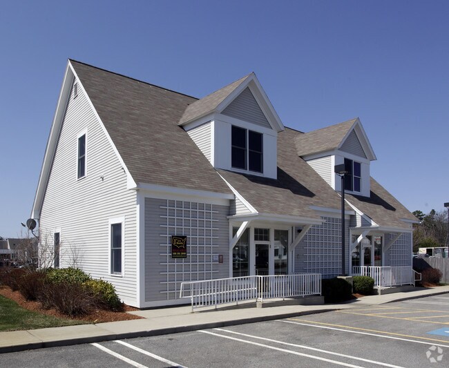
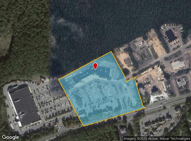
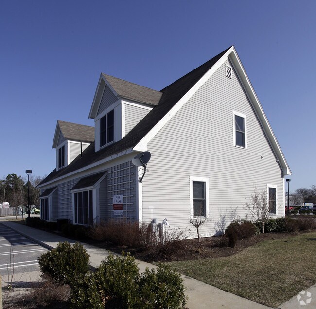
Property Record
3840 Falmouth Rd, Marstons Mills, MA 02648
NEARBY LISTINGS FOR SALE OR LEASE
Property Detail
3840 Falmouth Rd
MMIL-000058-000000-000039-000002
Barnstable
Commercialnec
Massachusetts
X
39002
25001C0543J
7.55 AC
2020
Cape Cod
2025
Other Market Areas
013200
Barnstable Town, MA
DEMOGRAPHICS near 3840 Falmouth Rd
1 Mile
3 Mile
5 Mile
2024 Total Population
1,890
20,725
43,603
2029 Population
1,901
21,001
44,150
Pop Growth 2024-2029
+ 0.58%
+ 1.33%
+ 1.25%
Average Age
49
47
48
2024 Total Households
775
8,567
18,252
HH Growth 2024-2029
+ 0.39%
+ 1.27%
+ 1.21%
Median Household Inc
$119,886
$101,734
$99,201
Avg Household Size
2.40
2.40
2.30
2024 Avg HH Vehicles
2.00
2.00
2.00
Median Home Value
$618,812
$489,391
$478,040
Median Year Built
1983
1983
1983
Nearby Places
- Restaurants
- Banks
- Shops
- Fitness
- Groceries
PUBLIC TRANSPORTATION
COMMUTER RAIL
Hyannis (CapeFLYER - Cape Cod Regional Transit Authority)
DRIVE
WALK
Distance
Hyannis (CapeFLYER - Cape Cod Regional Transit Authority)
15 min
8.0 mi
AIRPORT
Martha's Vineyard
DRIVE
WALK
Distance
Martha's Vineyard
92 min
31.0 mi
Freight Ports
Port of New Bedford Harbor
DRIVE
WALK
Distance
Port of New Bedford Harbor
65 min
45.2 mi
Nearby Properties
Address
Land Use
TOTAL SIZE
Lot Size
Zoning
Address
Land Use
TOTAL SIZE
Lot Size
Zoning
10.94 AC
R3
Address
Land Use
TOTAL SIZE
Lot Size
Zoning
Address
Land Use
TOTAL SIZE
Lot Size
Zoning
3.28 AC
RF
Address
Land Use
TOTAL SIZE
Lot Size
Zoning
79,282 SF
43.70 AC
RC;BA
Address
Land Use
TOTAL SIZE
Lot Size
Zoning
6.44 AC
RF
Address
Land Use
TOTAL SIZE
Lot Size
Zoning
6,460 SF
9 AC
RF
Address
Land Use
TOTAL SIZE
Lot Size
Zoning
4.66 AC
R
Address
Land Use
TOTAL SIZE
Lot Size
Zoning
13.30 AC
I1
Address
Land Use
TOTAL SIZE
Lot Size
Zoning
6,095 SF
2.26 AC
1
Address
Land Use
TOTAL SIZE
Lot Size
Zoning
Address
Land Use
TOTAL SIZE
Lot Size
Zoning
9,162 SF
3.11 AC
RF
Address
Land Use
TOTAL SIZE
Lot Size
Zoning
1.34 AC
RF
Address
Land Use
TOTAL SIZE
Lot Size
Zoning
3.92 AC
R
Address
Land Use
TOTAL SIZE
Lot Size
Zoning
7,528 SF
2.20 AC
RF
Address
Land Use
TOTAL SIZE
Lot Size
Zoning
2.32 AC
RF
Address
Land Use
TOTAL SIZE
Lot Size
Zoning
1.52 AC
RF;RF-
Address
Land Use
TOTAL SIZE
Lot Size
Zoning
0.28 AC
RF
Address
Land Use
TOTAL SIZE
Lot Size
Zoning
69,251 SF
7.06 AC
S&D;RF
Address
Land Use
TOTAL SIZE
Lot Size
Zoning
6,226 SF
2.85 AC
Address
Land Use
TOTAL SIZE
Lot Size
Zoning
158.42 AC
R
Address
Land Use
TOTAL SIZE
Lot Size
Zoning
2.45 AC
RC;RF-
Address
Land Use
TOTAL SIZE
Lot Size
Zoning
1.97 AC
RF
Address
Land Use
TOTAL SIZE
Lot Size
Zoning
2.82 AC
RF
Address
Land Use
TOTAL SIZE
Lot Size
Zoning
5.20 AC
RF
Address
Land Use
TOTAL SIZE
Lot Size
Zoning
2.91 AC
RF
Address
Land Use
TOTAL SIZE
Lot Size
Zoning
7.43 AC
RF
Address
Land Use
TOTAL SIZE
Lot Size
Zoning
229.61 AC
R3
Address
Land Use
TOTAL SIZE
Lot Size
Zoning
22.50 AC
R
Address
Land Use
TOTAL SIZE
Lot Size
Zoning
3,719 SF
1.62 AC
RF
The World's #1 Commercial Real Estate Marketplace
Connect with us
© 2025 CoStar Group
The information above has been obtained from sources believed reliable. While we do not doubt its accuracy we have not verified it and make no guarantee, warranty or representation about it. It is your responsibility to independently confirm its accuracy and completeness. Any projections, opinions, assumptions, or estimates used are for example only and do not represent the current or future performance of the property. The value of this transaction to you depends on tax and other factors which should be evaluated by your tax, financial, and legal advisors. You and your advisors should conduct a careful, independent investigation of the property to determine to your satisfaction the suitability of the property for your needs.