Property Record
3848 A1a S, Saint Augustine, FL 32080
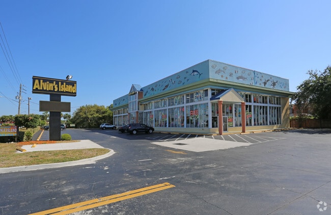


Property Detail
3848 A1a S
174510-5000
7-1 PT OF GL 4 LYING E OF A1A & N OF VERSAGGI DR - 306.11FT ON A1A OR1266/1798 & 4001/450(TR/D) &4077/1641(C/D)
Storemultistory
ST. JOHNS
BU-1A
Florida
B and X Area of moderate flood hazard, usually the area between the limits of the 100-year and 500-year floods.
7-1
2025
1.10 AC
2026
St Johns County
021410
Jacksonville (Florida)
10,010 SF
Jacksonville, FL
NEARBY LISTINGS FOR SALE OR LEASE
DEMOGRAPHICS near 3848 A1a S
1 mile
3 mile
5 mile
2025 Total Population
7,380
32,926
64,231
2030 Population
8,890
38,752
75,151
Pop Growth 2025-2030
+ 20.46%
+ 17.69%
+ 17.00%
Average Age
56
52
50
2025 Total Households
3,729
15,946
29,609
HH Growth 2025-2030
+ 21.02%
+ 18.19%
+ 17.56%
Median Household Inc
$78,355
$82,960
$80,167
Avg Household Size
2.00
2.00
2.10
2025 Avg HH Vehicles
2.00
2.00
2.00
Median Home Value
$695,068
$539,182
$489,731
Median Year Built
1988
1992
1994
Nearby Places
Map Layers
Map Styles
 Street
 Aerial
Layers
 Traffic
 Biking
Places
Listings with unknown addresses are not visible on the map
- Restaurants
- Banks
- Shops
- Fitness
- Groceries
Nearby Properties
Address
Land Use
TOTAL SIZE
Lot Size
Zoning
Address
Land Use
TOTAL SIZE
Lot Size
Zoning
279,494 SF
6.06 AC
Address
Land Use
TOTAL SIZE
Lot Size
Zoning
106,797 SF
10.80 AC
Address
Land Use
TOTAL SIZE
Lot Size
Zoning
127,090 SF
4.06 AC
R2
Address
Land Use
TOTAL SIZE
Lot Size
Zoning
7,133 SF
18.57 AC
RS3
Address
Land Use
TOTAL SIZE
Lot Size
Zoning
8,556 SF
20.32 AC
CHT
Address
Land Use
TOTAL SIZE
Lot Size
Zoning
7,021 SF
6.29 AC
OR
Address
Land Use
TOTAL SIZE
Lot Size
Zoning
85,384 SF
5.42 AC
R2
Address
Land Use
TOTAL SIZE
Lot Size
Zoning
46,787 SF
3.04 AC
BU1A
Address
Land Use
TOTAL SIZE
Lot Size
Zoning
62,867 SF
48.30 AC
OR
Address
Land Use
TOTAL SIZE
Lot Size
Zoning
54,119 SF
2.03 AC
BU-1
Address
Land Use
TOTAL SIZE
Lot Size
Zoning
76,239 SF
1.07 AC
CM1
Address
Land Use
TOTAL SIZE
Lot Size
Zoning
27,185 SF
206.55 AC
PUD
Address
Land Use
TOTAL SIZE
Lot Size
Zoning
52,011 SF
11.51 AC
CG-B
Address
Land Use
TOTAL SIZE
Lot Size
Zoning
8,997 SF
7.13 AC
PUD
Address
Land Use
TOTAL SIZE
Lot Size
Zoning
46,796 SF
1.36 AC
R2
Address
Land Use
TOTAL SIZE
Lot Size
Zoning
52,176 SF
7.86 AC
Address
Land Use
TOTAL SIZE
Lot Size
Zoning
26,624 SF
2.24 AC
PUD
Address
Land Use
TOTAL SIZE
Lot Size
Zoning
25,453 SF
322.02 AC
OR
Address
Land Use
TOTAL SIZE
Lot Size
Zoning
20,618 SF
1.24 AC
BU-1A
Address
Land Use
TOTAL SIZE
Lot Size
Zoning
96,200 SF
7.76 AC
RG-O
Address
Land Use
TOTAL SIZE
Lot Size
Zoning
2,700 SF
4.20 AC
CM1
Address
Land Use
TOTAL SIZE
Lot Size
Zoning
38.17 AC
OR
Address
Land Use
TOTAL SIZE
Lot Size
Zoning
16,270 SF
1 AC
Address
Land Use
TOTAL SIZE
Lot Size
Zoning
1.85 AC
RG2
Address
Land Use
TOTAL SIZE
Lot Size
Zoning
2,950 SF
7.34 AC
OR
Address
Land Use
TOTAL SIZE
Lot Size
Zoning
7,318 SF
18 AC
OR
Address
Land Use
TOTAL SIZE
Lot Size
Zoning
21,239 SF
1.05 AC
BU-1
Address
Land Use
TOTAL SIZE
Lot Size
Zoning
6,182 SF
0.99 AC
Address
Land Use
TOTAL SIZE
Lot Size
Zoning
46,944 SF
6.20 AC
RS2
Address
Land Use
TOTAL SIZE
Lot Size
Zoning
The World's #1 Commercial Real Estate Marketplace
Connect with us
© 2026 CoStar Group
The information above has been obtained from sources believed reliable. While we do not doubt its accuracy we have not verified it and make no guarantee, warranty or representation about it. It is your responsibility to independently confirm its accuracy and completeness. Any projections, opinions, assumptions, or estimates used are for example only and do not represent the current or future performance of the property. The value of this transaction to you depends on tax and other factors which should be evaluated by your tax, financial, and legal advisors. You and your advisors should conduct a careful, independent investigation of the property to determine to your satisfaction the suitability of the property for your needs.