Property Record
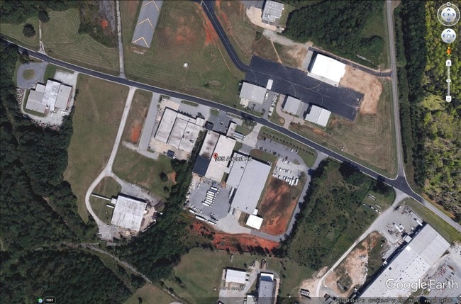
385 Airport Rd, Salisbury, NC 28147
Property Detail
385 Airport Rd
471-041
3.08AC
Warehouse
Rowan
B and X Area of moderate flood hazard, usually the area between the limits of the 100-year and 500-year floods.
North Carolina
2025
3.08 AC
2025
Rowan County
051204
Charlotte
37,216 SF
Charlotte-Concord-Gastonia, NC-SC
NEARBY LISTINGS FOR SALE OR LEASE
DEMOGRAPHICS near 385 Airport Rd
1 mile
3 mile
5 mile
2025 Total Population
1,647
18,999
57,227
2030 Population
1,738
19,781
59,603
Pop Growth 2025-2030
+ 5.53%
+ 4.12%
+ 4.15%
Average Age
35
40
40
2025 Total Households
566
7,147
22,124
HH Growth 2025-2030
+ 5.65%
+ 4.35%
+ 4.41%
Median Household Inc
$37,153
$61,393
$57,685
Avg Household Size
2.90
2.50
2.40
2025 Avg HH Vehicles
2.00
2.00
2.00
Median Home Value
$207,843
$257,107
$255,556
Median Year Built
1986
1985
1981
Nearby Places
Map Layers
Map Styles
 Street
 Aerial
Transit
 Traffic
 Biking
Places
Listings with unknown addresses are not visible on the map
- Restaurants
- Banks
- Shops
- Fitness
- Groceries
PUBLIC TRANSPORTATION
COMMUTER RAIL
Salisbury Station (Piedmont - North Carolina by Train (NC Train))
Drive
Walk
Distance
Salisbury Station (Piedmont - North Carolina by Train (NC Train))
9 min
4.1 mi
AIRPORT
Concord-Padgett Regional
Drive
Walk
Distance
Concord-Padgett Regional
35 min
25.2 mi
Charlotte/Douglas International
Drive
Walk
Distance
Charlotte/Douglas International
61 min
45.6 mi
SALE & LEASE HISTORY
LISTING DATE
SALE/LEASE

Dec 20, 2019
For Sale
Nearby Properties
Address
Land Use
TOTAL SIZE
Lot Size
Zoning
Address
Land Use
TOTAL SIZE
Lot Size
Zoning
739,291 SF
61.21 AC
Address
Land Use
TOTAL SIZE
Lot Size
Zoning
116,333 SF
30.31 AC
Address
Land Use
TOTAL SIZE
Lot Size
Zoning
673,920 SF
44.85 AC
Address
Land Use
TOTAL SIZE
Lot Size
Zoning
41,142 SF
16.18 AC
Address
Land Use
TOTAL SIZE
Lot Size
Zoning
360,312 SF
106.52 AC
Address
Land Use
TOTAL SIZE
Lot Size
Zoning
468,000 SF
43.12 AC
Address
Land Use
TOTAL SIZE
Lot Size
Zoning
27,321 SF
11.66 AC
Address
Land Use
TOTAL SIZE
Lot Size
Zoning
75,000 SF
82.04 AC
Address
Land Use
TOTAL SIZE
Lot Size
Zoning
99,416 SF
31.69 AC
Address
Land Use
TOTAL SIZE
Lot Size
Zoning
338,336 SF
32.55 AC
Address
Land Use
TOTAL SIZE
Lot Size
Zoning
144,720 SF
14.53 AC
Address
Land Use
TOTAL SIZE
Lot Size
Zoning
316,672 SF
64.08 AC
Address
Land Use
TOTAL SIZE
Lot Size
Zoning
37,281 SF
10 AC
Address
Land Use
TOTAL SIZE
Lot Size
Zoning
12,960 SF
22.04 AC
Address
Land Use
TOTAL SIZE
Lot Size
Zoning
82,856 SF
40.24 AC
Address
Land Use
TOTAL SIZE
Lot Size
Zoning
88,852 SF
36.93 AC
Address
Land Use
TOTAL SIZE
Lot Size
Zoning
56,676 SF
2.73 AC
HB:HIGHWAY
Address
Land Use
TOTAL SIZE
Lot Size
Zoning
86,517 SF
14 AC
Address
Land Use
TOTAL SIZE
Lot Size
Zoning
25,068 SF
7.18 AC
HB:HIGHWAY
Address
Land Use
TOTAL SIZE
Lot Size
Zoning
88,638 SF
55.39 AC
Address
Land Use
TOTAL SIZE
Lot Size
Zoning
69,072 SF
11.32 AC
HB:HIGHWAY
Address
Land Use
TOTAL SIZE
Lot Size
Zoning
56,212 SF
297.34 AC
Address
Land Use
TOTAL SIZE
Lot Size
Zoning
19,626 SF
2.29 AC
HB:HIGHWAY
Address
Land Use
TOTAL SIZE
Lot Size
Zoning
63,227 SF
9.23 AC
HB:HIGHWAY
Address
Land Use
TOTAL SIZE
Lot Size
Zoning
81,700 SF
9.67 AC
HB:HIGHWAY
Address
Land Use
TOTAL SIZE
Lot Size
Zoning
23,526 SF
9.36 AC
Address
Land Use
TOTAL SIZE
Lot Size
Zoning
84,336 SF
34.98 AC
RR
Address
Land Use
TOTAL SIZE
Lot Size
Zoning
95,916 SF
24.60 AC
M1:LIGHT I
Address
Land Use
TOTAL SIZE
Lot Size
Zoning
54,879 SF
1.74 AC
Address
Land Use
TOTAL SIZE
Lot Size
Zoning
20,608 SF
153.99 AC
The World's #1 Commercial Real Estate Marketplace
Connect with us
© 2026 CoStar Group
The information above has been obtained from sources believed reliable. While we do not doubt its accuracy we have not verified it and make no guarantee, warranty or representation about it. It is your responsibility to independently confirm its accuracy and completeness. Any projections, opinions, assumptions, or estimates used are for example only and do not represent the current or future performance of the property. The value of this transaction to you depends on tax and other factors which should be evaluated by your tax, financial, and legal advisors. You and your advisors should conduct a careful, independent investigation of the property to determine to your satisfaction the suitability of the property for your needs.