Property Record
385 Douglas Pike, Smithfield, RI 02917
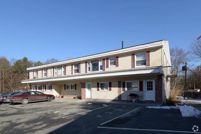


Property Detail
385 Douglas Pike
SMIT-000042-000000-000007
Providence
Commercialofficeresidentialmixeduse
Rhode Island
PD
8
B and X Area of moderate flood hazard, usually the area between the limits of the 100-year and 500-year floods.
2.60 AC
2025
Northeastern Providence County
2025
Providence
012602
Providence-Warwick, RI-MA
NEARBY LISTINGS FOR SALE OR LEASE
-
-
View all Smithfield listings for sale on LoopNet.com
DEMOGRAPHICS near 385 Douglas Pike
1 mile
3 mile
5 mile
2025 Total Population
3,702
43,418
188,376
2030 Population
3,872
45,209
194,775
Pop Growth 2025-2030
+ 4.59%
+ 4.13%
+ 3.40%
Average Age
46
44
40
2025 Total Households
1,607
18,553
73,119
HH Growth 2025-2030
+ 4.54%
+ 4.23%
+ 3.50%
Median Household Inc
$88,706
$93,932
$79,465
Avg Household Size
2.20
2.20
2.40
2025 Avg HH Vehicles
2.00
2.00
2.00
Median Home Value
$493,690
$406,489
$376,181
Median Year Built
1969
1974
1961
Nearby Places
Map Layers
Map Styles
 Street
 Aerial
Layers
 Traffic
 Biking
Places
Listings with unknown addresses are not visible on the map
- Restaurants
- Banks
- Shops
- Fitness
- Groceries
PUBLIC TRANSPORTATION
COMMUTER RAIL
Pawtucket/Central Falls (Foxboro Event Service - MBTA, Providence/Stoughton Line - MBTA)
Drive
Walk
Distance
Pawtucket/Central Falls (Foxboro Event Service - MBTA, Providence/Stoughton Line - MBTA)
10 min
6.3 mi
Providence (Providence/Stoughton Line - Massachusetts Bay Transportation Authority Commuter Rail (Purple Line))
Drive
Walk
Distance
Providence (Providence/Stoughton Line - Massachusetts Bay Transportation Authority Commuter Rail (Purple Line))
11 min
7.0 mi
AIRPORT
Rhode Island Tf Green International
Drive
Walk
Distance
Rhode Island Tf Green International
27 min
15.2 mi
Freight Ports
Port of Davisville, RI
Drive
Walk
Distance
Port of Davisville, RI
41 min
26.8 mi
SALE & LEASE HISTORY
LISTING DATE
SALE/LEASE

Sep 29, 2023
For Sale
Nearby Properties
Address
Land Use
TOTAL SIZE
Lot Size
Zoning
Address
Land Use
TOTAL SIZE
Lot Size
Zoning
254,488 SF
17.50 AC
IS
Address
Land Use
TOTAL SIZE
Lot Size
Zoning
89.07 AC
PD
Address
Land Use
TOTAL SIZE
Lot Size
Zoning
53.18 AC
C
Address
Land Use
TOTAL SIZE
Lot Size
Zoning
123.25 AC
R40
Address
Land Use
TOTAL SIZE
Lot Size
Zoning
200.05 AC
RA40
Address
Land Use
TOTAL SIZE
Lot Size
Zoning
140,678 SF
37.04 AC
RA40
Address
Land Use
TOTAL SIZE
Lot Size
Zoning
38.50 AC
RA40
Address
Land Use
TOTAL SIZE
Lot Size
Zoning
159,028 SF
12.09 AC
RG
Address
Land Use
TOTAL SIZE
Lot Size
Zoning
288,736 SF
11.99 AC
RG
Address
Land Use
TOTAL SIZE
Lot Size
Zoning
315.90 AC
I
Address
Land Use
TOTAL SIZE
Lot Size
Zoning
166,368 SF
10.74 AC
R20
Address
Land Use
TOTAL SIZE
Lot Size
Zoning
237,440 SF
19.31 AC
IS
Address
Land Use
TOTAL SIZE
Lot Size
Zoning
175,231 SF
9.37 AC
Address
Land Use
TOTAL SIZE
Lot Size
Zoning
115,802 SF
10.30 AC
PC
Address
Land Use
TOTAL SIZE
Lot Size
Zoning
Address
Land Use
TOTAL SIZE
Lot Size
Zoning
Address
Land Use
TOTAL SIZE
Lot Size
Zoning
185,010 SF
7.75 AC
MG
Address
Land Use
TOTAL SIZE
Lot Size
Zoning
137,704 SF
11.57 AC
Address
Land Use
TOTAL SIZE
Lot Size
Zoning
56,451 SF
5 AC
C
Address
Land Use
TOTAL SIZE
Lot Size
Zoning
22,868 SF
12.22 AC
R20
Address
Land Use
TOTAL SIZE
Lot Size
Zoning
124,397 SF
13.66 AC
C
Address
Land Use
TOTAL SIZE
Lot Size
Zoning
89,788 SF
11.25 AC
R20
Address
Land Use
TOTAL SIZE
Lot Size
Zoning
114,795 SF
1.93 AC
BL
Address
Land Use
TOTAL SIZE
Lot Size
Zoning
72,531 SF
11.70 AC
R20
Address
Land Use
TOTAL SIZE
Lot Size
Zoning
60,254 SF
2.46 AC
RL10
Address
Land Use
TOTAL SIZE
Lot Size
Zoning
72,802 SF
4.05 AC
IS
Address
Land Use
TOTAL SIZE
Lot Size
Zoning
968 SF
8.25 AC
IS
Address
Land Use
TOTAL SIZE
Lot Size
Zoning
9.73 AC
RG7
Address
Land Use
TOTAL SIZE
Lot Size
Zoning
125,419 SF
10.94 AC
CG
Address
Land Use
TOTAL SIZE
Lot Size
Zoning
20 AC
R20M
The World's #1 Commercial Real Estate Marketplace
Connect with us
© 2026 CoStar Group
The information above has been obtained from sources believed reliable. While we do not doubt its accuracy we have not verified it and make no guarantee, warranty or representation about it. It is your responsibility to independently confirm its accuracy and completeness. Any projections, opinions, assumptions, or estimates used are for example only and do not represent the current or future performance of the property. The value of this transaction to you depends on tax and other factors which should be evaluated by your tax, financial, and legal advisors. You and your advisors should conduct a careful, independent investigation of the property to determine to your satisfaction the suitability of the property for your needs.