Property Record
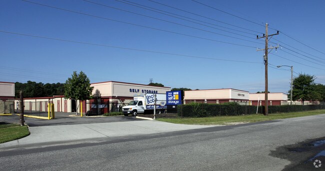
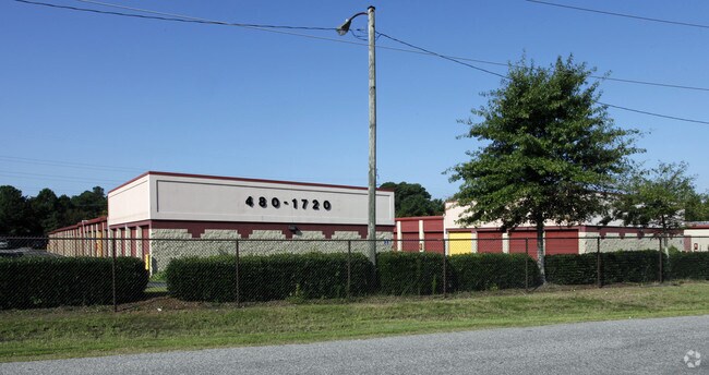
385 Naval Base Rd, Norfolk, VA 23505

Property Detail
385 Naval Base Rd
00200816
PARCELS B & C-1
Publicstorage
Norfolk City
I3
Virginia
B and X Area of moderate flood hazard, usually the area between the limits of the 100-year and 500-year floods.
5.92 AC
2025
Central Norfolk
2025
Hampton Roads
005701
Virginia Beach-Chesapeake-Norfolk, VA-NC
73,180 SF
NEARBY LISTINGS FOR SALE OR LEASE
-
-
View all Norfolk listings for sale on LoopNet.com
DEMOGRAPHICS near 385 Naval Base Rd
1 mile
3 mile
5 mile
2025 Total Population
12,467
122,622
218,319
2030 Population
12,159
120,025
215,078
Pop Growth 2025-2030
(2.47%)
(2.12%)
(1.48%)
Average Age
40
37
37
2025 Total Households
5,738
49,161
85,452
HH Growth 2025-2030
(2.61%)
(2.28%)
(1.64%)
Median Household Inc
$44,793
$65,608
$64,253
Avg Household Size
2.10
2.30
2.20
2025 Avg HH Vehicles
1.00
2.00
2.00
Median Home Value
$296,428
$299,673
$310,414
Median Year Built
1958
1960
1965
Nearby Places
Map Layers
Map Styles
 Street
 Aerial
Layers
 Traffic
 Biking
Places
Listings with unknown addresses are not visible on the map
- Restaurants
- Banks
- Shops
- Fitness
- Groceries
PUBLIC TRANSPORTATION
COMMUTER RAIL
Drive
Walk
Distance
13 min
6.5 mi
AIRPORT
Norfolk International
Drive
Walk
Distance
Norfolk International
12 min
5.3 mi
Newport News/Williamsburg International
Drive
Walk
Distance
Newport News/Williamsburg International
37 min
24.1 mi
Freight Ports
Virginia Port Authority - Norfolk
Drive
Walk
Distance
Virginia Port Authority - Norfolk
14 min
4.5 mi
Nearby Properties
Address
Land Use
TOTAL SIZE
Lot Size
Zoning
Address
Land Use
TOTAL SIZE
Lot Size
Zoning
1,190.45 AC
Address
Land Use
TOTAL SIZE
Lot Size
Zoning
777.89 AC
Address
Land Use
TOTAL SIZE
Lot Size
Zoning
92.17 AC
OSP
Address
Land Use
TOTAL SIZE
Lot Size
Zoning
8,423 SF
53.95 AC
Address
Land Use
TOTAL SIZE
Lot Size
Zoning
40.37 AC
R6
Address
Land Use
TOTAL SIZE
Lot Size
Zoning
213 AC
I5
Address
Land Use
TOTAL SIZE
Lot Size
Zoning
321,691 SF
30.58 AC
Address
Land Use
TOTAL SIZE
Lot Size
Zoning
126,088 SF
4.91 AC
C2
Address
Land Use
TOTAL SIZE
Lot Size
Zoning
91,982 SF
22.78 AC
IN1
Address
Land Use
TOTAL SIZE
Lot Size
Zoning
167,279 SF
9.97 AC
IN1
Address
Land Use
TOTAL SIZE
Lot Size
Zoning
10.40 AC
IN1
Address
Land Use
TOTAL SIZE
Lot Size
Zoning
235,750 SF
4.16 AC
UV
Address
Land Use
TOTAL SIZE
Lot Size
Zoning
11.09 AC
R14
Address
Land Use
TOTAL SIZE
Lot Size
Zoning
1,020 SF
13.45 AC
R11
Address
Land Use
TOTAL SIZE
Lot Size
Zoning
47,832 SF
7.51 AC
C2
Address
Land Use
TOTAL SIZE
Lot Size
Zoning
6,170 SF
18.46 AC
R13
Address
Land Use
TOTAL SIZE
Lot Size
Zoning
19.47 AC
86
Address
Land Use
TOTAL SIZE
Lot Size
Zoning
52,612 SF
4.94 AC
Address
Land Use
TOTAL SIZE
Lot Size
Zoning
27,840 SF
5.80 AC
R11
Address
Land Use
TOTAL SIZE
Lot Size
Zoning
14.02 AC
Address
Land Use
TOTAL SIZE
Lot Size
Zoning
41,754 SF
6.01 AC
Address
Land Use
TOTAL SIZE
Lot Size
Zoning
40,086 SF
4.81 AC
UV
Address
Land Use
TOTAL SIZE
Lot Size
Zoning
40,086 SF
4.95 AC
UV
Address
Land Use
TOTAL SIZE
Lot Size
Zoning
170,152 SF
6.07 AC
PDMU1
Address
Land Use
TOTAL SIZE
Lot Size
Zoning
6.96 AC
R11
Address
Land Use
TOTAL SIZE
Lot Size
Zoning
123,868 SF
0.12 AC
IN2
Address
Land Use
TOTAL SIZE
Lot Size
Zoning
25,880 SF
31.21 AC
91
Address
Land Use
TOTAL SIZE
Lot Size
Zoning
1.81 AC
R13
Address
Land Use
TOTAL SIZE
Lot Size
Zoning
36,530 SF
16.46 AC
IN1
Address
Land Use
TOTAL SIZE
Lot Size
Zoning
207,440 SF
3.74 AC
R12
The World's #1 Commercial Real Estate Marketplace
Connect with us
© 2026 CoStar Group
The information above has been obtained from sources believed reliable. While we do not doubt its accuracy we have not verified it and make no guarantee, warranty or representation about it. It is your responsibility to independently confirm its accuracy and completeness. Any projections, opinions, assumptions, or estimates used are for example only and do not represent the current or future performance of the property. The value of this transaction to you depends on tax and other factors which should be evaluated by your tax, financial, and legal advisors. You and your advisors should conduct a careful, independent investigation of the property to determine to your satisfaction the suitability of the property for your needs.