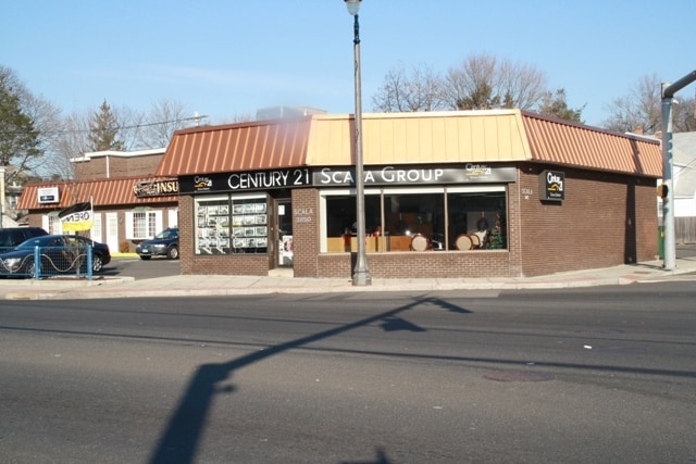
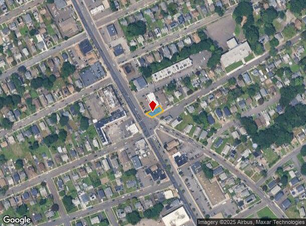
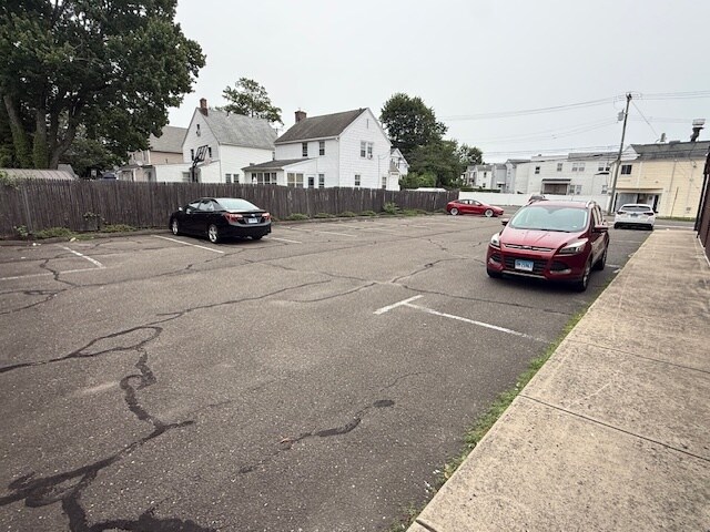
Property Record
3848 Main St, Bridgeport, CT 06606
Current Lease Availabilities
NEARBY LISTINGS FOR SALE OR LEASE
Property Detail
3848 Main St
BRID-002619-000033A
Fairfield
Commercialacreage
Connecticut
X
33-a
09001C0429G
0.08 AC
2024
Bridgeport
2025
Westchester/So Connecticut
072700
Bridgeport-Stamford-Norwalk, CT
DEMOGRAPHICS near 3848 Main St
1 Mile
3 Mile
5 Mile
2024 Total Population
28,438
157,901
273,205
2029 Population
28,550
157,946
273,262
Pop Growth 2024-2029
+ 0.39%
+ 0.03%
+ 0.02%
Average Age
39
38
39
2024 Total Households
10,128
55,735
97,068
HH Growth 2024-2029
+ 0.40%
(0.05%)
(0.04%)
Median Household Inc
$64,699
$59,804
$70,680
Avg Household Size
2.70
2.70
2.60
2024 Avg HH Vehicles
2.00
2.00
2.00
Median Home Value
$213,957
$285,166
$323,919
Median Year Built
1960
1954
1955
Nearby Places
Map Layers
Map Styles
 Street
 Aerial
- Restaurants
- Banks
- Shops
- Fitness
- Groceries
PUBLIC TRANSPORTATION
COMMUTER RAIL
Bridgeport Station (New Haven Line - Metro-North Commuter Railroad Company (Metro-North))
DRIVE
WALK
Distance
Bridgeport Station (New Haven Line - Metro-North Commuter Railroad Company (Metro-North))
5 min
2.9 mi
DRIVE
WALK
Distance
9 min
5.0 mi
AIRPORT
Tweed/New Haven
DRIVE
WALK
Distance
Tweed/New Haven
38 min
24.4 mi
Westchester County
DRIVE
WALK
Distance
Westchester County
51 min
35.7 mi
Long Island MacArthur
DRIVE
WALK
Distance
Long Island MacArthur
113 min
37.3 mi
Freight Ports
Port of New Haven
DRIVE
WALK
Distance
Port of New Haven
33 min
21.6 mi
Nearby Properties
Address
Land Use
TOTAL SIZE
Lot Size
Zoning
Address
Land Use
TOTAL SIZE
Lot Size
Zoning
77.74 AC
BC
Address
Land Use
TOTAL SIZE
Lot Size
Zoning
Address
Land Use
TOTAL SIZE
Lot Size
Zoning
10.42 AC
MDD
Address
Land Use
TOTAL SIZE
Lot Size
Zoning
111,525 SF
Address
Land Use
TOTAL SIZE
Lot Size
Zoning
23.95 AC
RB
Address
Land Use
TOTAL SIZE
Lot Size
Zoning
145,000 SF
15.70 AC
ILI
Address
Land Use
TOTAL SIZE
Lot Size
Zoning
38.62 AC
Address
Land Use
TOTAL SIZE
Lot Size
Zoning
356,837 SF
8.87 AC
RA
Address
Land Use
TOTAL SIZE
Lot Size
Zoning
120,955 SF
9.37 AC
RA
Address
Land Use
TOTAL SIZE
Lot Size
Zoning
22,848 SF
16.84 AC
IL-2
Address
Land Use
TOTAL SIZE
Lot Size
Zoning
335,633 SF
39.70 AC
R3
Address
Land Use
TOTAL SIZE
Lot Size
Zoning
4.14 AC
MUEM
Address
Land Use
TOTAL SIZE
Lot Size
Zoning
178,265 SF
6.92 AC
Address
Land Use
TOTAL SIZE
Lot Size
Zoning
83,122 SF
4.39 AC
Address
Land Use
TOTAL SIZE
Lot Size
Zoning
97,554 SF
6.25 AC
DR
Address
Land Use
TOTAL SIZE
Lot Size
Zoning
497,430 SF
4.16 AC
DCB
Address
Land Use
TOTAL SIZE
Lot Size
Zoning
23 AC
RC
Address
Land Use
TOTAL SIZE
Lot Size
Zoning
10.66 AC
ORR
Address
Land Use
TOTAL SIZE
Lot Size
Zoning
585,480 SF
3.66 AC
Address
Land Use
TOTAL SIZE
Lot Size
Zoning
493,114 SF
2.20 AC
DCB
Address
Land Use
TOTAL SIZE
Lot Size
Zoning
23.70 AC
RB
Address
Land Use
TOTAL SIZE
Lot Size
Zoning
22.43 AC
R3
Address
Land Use
TOTAL SIZE
Lot Size
Zoning
182,000 SF
12.10 AC
IL-2
Address
Land Use
TOTAL SIZE
Lot Size
Zoning
216,972 SF
2.53 AC
DCB
Address
Land Use
TOTAL SIZE
Lot Size
Zoning
13.15 AC
ORR
Address
Land Use
TOTAL SIZE
Lot Size
Zoning
3.77 AC
RA
Address
Land Use
TOTAL SIZE
Lot Size
Zoning
5.31 AC
RC
Address
Land Use
TOTAL SIZE
Lot Size
Zoning
16.73 AC
DCD
Address
Land Use
TOTAL SIZE
Lot Size
Zoning
79,739 SF
1.53 AC
PDD
Address
Land Use
TOTAL SIZE
Lot Size
Zoning
145,860 SF
2.41 AC
R3
The World's #1 Commercial Real Estate Marketplace
Connect with us
© 2026 CoStar Group
The information above has been obtained from sources believed reliable. While we do not doubt its accuracy we have not verified it and make no guarantee, warranty or representation about it. It is your responsibility to independently confirm its accuracy and completeness. Any projections, opinions, assumptions, or estimates used are for example only and do not represent the current or future performance of the property. The value of this transaction to you depends on tax and other factors which should be evaluated by your tax, financial, and legal advisors. You and your advisors should conduct a careful, independent investigation of the property to determine to your satisfaction the suitability of the property for your needs.