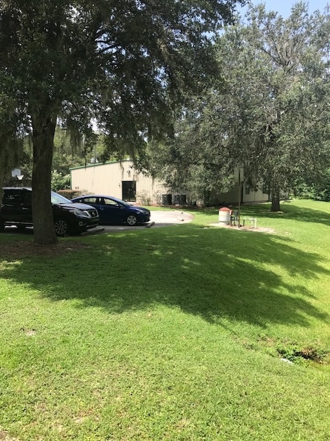
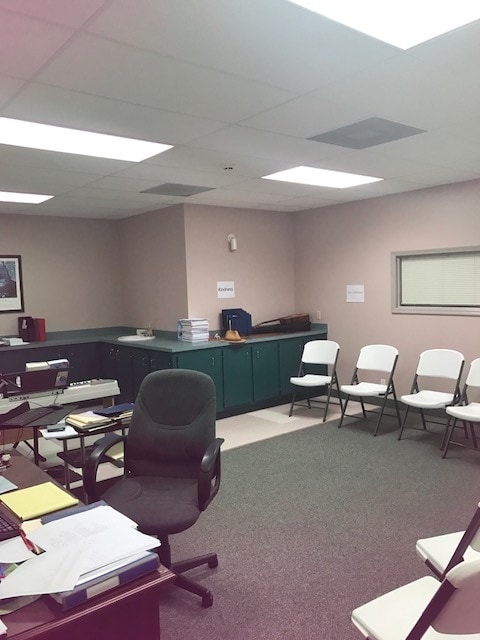
Property Record
3850 W Anthony Rd, Ocala, FL 34475

NEARBY LISTINGS FOR SALE OR LEASE
Property Detail
3850 W Anthony Rd
15377-001-00
Living Waters Worship Center
Privateschool
SEC 31 TWP 14 RGE 22 COM AT NW COR OF SE 1/4 OF SEC 31 TH S 00-15-10 W 1051.88 FT TO POB TH S 89-49-31 E 801.78 FT TH S 17-11-31 W 301.13 FT TH N 89-49-31 W 714.04 FT TH N 00-15-10 E 287.95 FT TO POB.
X
Marion
12083C0507D
Florida
0
5.01 AC
2025
Outlying Marion County
001301
Ocala
18,192 SF
Ocala, FL
DEMOGRAPHICS near 3850 W Anthony Rd
1 Mile
3 Mile
5 Mile
2024 Total Population
3,280
29,536
79,220
2029 Population
3,731
33,369
89,328
Pop Growth 2024-2029
+ 13.75%
+ 12.98%
+ 12.76%
Average Age
38
39
41
2024 Total Households
1,263
11,681
32,698
HH Growth 2024-2029
+ 13.70%
+ 12.94%
+ 12.82%
Median Household Inc
$42,846
$38,997
$48,222
Avg Household Size
2.50
2.50
2.30
2024 Avg HH Vehicles
2.00
2.00
2.00
Median Home Value
$216,949
$154,319
$175,638
Median Year Built
1985
1978
1982
Nearby Places
Map Layers
Map Styles
 Street
 Aerial
- Restaurants
- Banks
- Shops
- Fitness
- Groceries
SALE & LEASE HISTORY
LISTING DATE
SALE/LEASE

Nov 23, 2020
For Lease
Nov 23, 2020
For Sale
Dec 20, 2022
For Sale
Aug 22, 2017
For Lease
Nearby Properties
Address
Land Use
TOTAL SIZE
Lot Size
Zoning
Address
Land Use
TOTAL SIZE
Lot Size
Zoning
704,765 SF
71.04 AC
GU
Address
Land Use
TOTAL SIZE
Lot Size
Zoning
1,085,670 SF
87.92 AC
M1
Address
Land Use
TOTAL SIZE
Lot Size
Zoning
195,992 SF
5.72 AC
FBC
Address
Land Use
TOTAL SIZE
Lot Size
Zoning
612,196 SF
50.06 AC
M1
Address
Land Use
TOTAL SIZE
Lot Size
Zoning
617,520 SF
46.08 AC
M2
Address
Land Use
TOTAL SIZE
Lot Size
Zoning
441,040 SF
150.01 AC
M1
Address
Land Use
TOTAL SIZE
Lot Size
Zoning
458,983 SF
35.14 AC
M1
Address
Land Use
TOTAL SIZE
Lot Size
Zoning
135,945 SF
22.30 AC
PD
Address
Land Use
TOTAL SIZE
Lot Size
Zoning
444,381 SF
60 AC
M1
Address
Land Use
TOTAL SIZE
Lot Size
Zoning
62,164 SF
27.64 AC
PD
Address
Land Use
TOTAL SIZE
Lot Size
Zoning
350,895 SF
27.85 AC
M1
Address
Land Use
TOTAL SIZE
Lot Size
Zoning
112,663 SF
32.72 AC
INST
Address
Land Use
TOTAL SIZE
Lot Size
Zoning
19,117 SF
0.98 AC
FBC
Address
Land Use
TOTAL SIZE
Lot Size
Zoning
384,930 SF
17.76 AC
M1
Address
Land Use
TOTAL SIZE
Lot Size
Zoning
94,360 SF
17.51 AC
B5
Address
Land Use
TOTAL SIZE
Lot Size
Zoning
73,129 SF
17.98 AC
B4
Address
Land Use
TOTAL SIZE
Lot Size
Zoning
40,049 SF
1.06 AC
FBC
Address
Land Use
TOTAL SIZE
Lot Size
Zoning
86,327 SF
13.72 AC
INST
Address
Land Use
TOTAL SIZE
Lot Size
Zoning
81,689 SF
11.05 AC
B2
Address
Land Use
TOTAL SIZE
Lot Size
Zoning
116,876 SF
23.78 AC
M2
Address
Land Use
TOTAL SIZE
Lot Size
Zoning
81,174 SF
18.50 AC
B2
Address
Land Use
TOTAL SIZE
Lot Size
Zoning
11,351 SF
3.51 AC
B2
Address
Land Use
TOTAL SIZE
Lot Size
Zoning
47,984 SF
486.37 AC
PUD
Address
Land Use
TOTAL SIZE
Lot Size
Zoning
47,567 SF
12 AC
INST
Address
Land Use
TOTAL SIZE
Lot Size
Zoning
73,361 SF
23.20 AC
GU
Address
Land Use
TOTAL SIZE
Lot Size
Zoning
15,800 SF
1.15 AC
FBC
Address
Land Use
TOTAL SIZE
Lot Size
Zoning
66,531 SF
26.96 AC
B2
Address
Land Use
TOTAL SIZE
Lot Size
Zoning
55,809 SF
6.30 AC
M2
Address
Land Use
TOTAL SIZE
Lot Size
Zoning
35,518 SF
9.98 AC
B2
Address
Land Use
TOTAL SIZE
Lot Size
Zoning
30,082 SF
7.92 AC
PUD
The World's #1 Commercial Real Estate Marketplace
Connect with us
© 2026 CoStar Group
The information above has been obtained from sources believed reliable. While we do not doubt its accuracy we have not verified it and make no guarantee, warranty or representation about it. It is your responsibility to independently confirm its accuracy and completeness. Any projections, opinions, assumptions, or estimates used are for example only and do not represent the current or future performance of the property. The value of this transaction to you depends on tax and other factors which should be evaluated by your tax, financial, and legal advisors. You and your advisors should conduct a careful, independent investigation of the property to determine to your satisfaction the suitability of the property for your needs.