Property Record
3851 E Haystack St, Boise, ID 83716
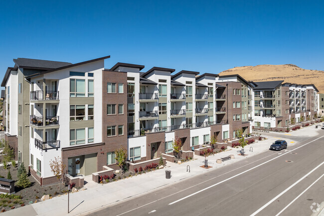

Property Detail
3851 E Haystack St
Boise City, ID
LOT 01 BLK 01 HAYSTACK SUB NO 01
R3523710100
ADA
Commercialbuilding
Idaho
SP-01
01
2024
5.25 AC
2025
Harris Ranch
000703
Boise City/Nampa
215,141 SF
NEARBY LISTINGS FOR SALE OR LEASE
DEMOGRAPHICS near 3851 E Haystack St
1 mile
3 mile
5 mile
2025 Total Population
8,238
41,395
88,687
2030 Population
8,713
43,346
93,314
Pop Growth 2025-2030
+ 5.77%
+ 4.71%
+ 5.22%
Average Age
43
41
39
2025 Total Households
3,164
17,310
38,561
HH Growth 2025-2030
+ 6.23%
+ 5.12%
+ 5.79%
Median Household Inc
$172,541
$121,543
$88,169
Avg Household Size
2.50
2.30
2.20
2025 Avg HH Vehicles
2.00
2.00
2.00
Median Home Value
$754,568
$650,901
$615,096
Median Year Built
2010
1994
1990
Nearby Places
Map Layers
Map Styles
 Street
 Aerial
Transit
 Traffic
 Biking
Places
Listings with unknown addresses are not visible on the map
- Restaurants
- Banks
- Shops
- Fitness
- Groceries
PUBLIC TRANSPORTATION
AIRPORT
Boise Air Trml/Gowen Field
Drive
Walk
Distance
Boise Air Trml/Gowen Field
24 min
8.5 mi
Freight Ports
Port of Portland
Drive
Walk
Distance
Port of Portland
486 min
438.4 mi
Nearby Properties
Address
Land Use
TOTAL SIZE
Lot Size
Zoning
Address
Land Use
TOTAL SIZE
Lot Size
Zoning
251,614 SF
12.62 AC
L-OD
Address
Land Use
TOTAL SIZE
Lot Size
Zoning
122,110 SF
12.66 AC
T-2D/DA
Address
Land Use
TOTAL SIZE
Lot Size
Zoning
347,991 SF
12.51 AC
SP-02
Address
Land Use
TOTAL SIZE
Lot Size
Zoning
356,969 SF
49.72 AC
M-1D
Address
Land Use
TOTAL SIZE
Lot Size
Zoning
197,268 SF
10.95 AC
R-3D
Address
Land Use
TOTAL SIZE
Lot Size
Zoning
245,240 SF
5.40 AC
R-2D
Address
Land Use
TOTAL SIZE
Lot Size
Zoning
214,318 SF
13.77 AC
R-2D
Address
Land Use
TOTAL SIZE
Lot Size
Zoning
259,565 SF
4.07 AC
SP-02
Address
Land Use
TOTAL SIZE
Lot Size
Zoning
10.03 AC
R-3D
Address
Land Use
TOTAL SIZE
Lot Size
Zoning
157,347 SF
7.97 AC
R-3
Address
Land Use
TOTAL SIZE
Lot Size
Zoning
366,032 SF
10.79 AC
C-4D
Address
Land Use
TOTAL SIZE
Lot Size
Zoning
220,160 SF
12.70 AC
M-1D
Address
Land Use
TOTAL SIZE
Lot Size
Zoning
190,180 SF
14.43 AC
R-2D
Address
Land Use
TOTAL SIZE
Lot Size
Zoning
237,299 SF
20.32 AC
M-1D
Address
Land Use
TOTAL SIZE
Lot Size
Zoning
127,351 SF
4.42 AC
L-OD
Address
Land Use
TOTAL SIZE
Lot Size
Zoning
50,674 SF
49.82 AC
T-2D
Address
Land Use
TOTAL SIZE
Lot Size
Zoning
150,147 SF
3.94 AC
SP-01
Address
Land Use
TOTAL SIZE
Lot Size
Zoning
140,088 SF
8.46 AC
R-2D
Address
Land Use
TOTAL SIZE
Lot Size
Zoning
161,421 SF
10.05 AC
R-1C
Address
Land Use
TOTAL SIZE
Lot Size
Zoning
246,070 SF
15.08 AC
L-OD
Address
Land Use
TOTAL SIZE
Lot Size
Zoning
3.41 AC
SP-02
Address
Land Use
TOTAL SIZE
Lot Size
Zoning
187,820 SF
11.39 AC
M-1D
Address
Land Use
TOTAL SIZE
Lot Size
Zoning
95,092 SF
4.24 AC
R-3D
Address
Land Use
TOTAL SIZE
Lot Size
Zoning
165,000 SF
10.60 AC
M-1D
Address
Land Use
TOTAL SIZE
Lot Size
Zoning
158,767 SF
3 AC
M-1D
Address
Land Use
TOTAL SIZE
Lot Size
Zoning
171,774 SF
10.14 AC
M-1D
Address
Land Use
TOTAL SIZE
Lot Size
Zoning
4.87 AC
L-OD
Address
Land Use
TOTAL SIZE
Lot Size
Zoning
174,290 SF
14.12 AC
C-3D
Address
Land Use
TOTAL SIZE
Lot Size
Zoning
0.82 AC
SP-02
The World's #1 Commercial Real Estate Marketplace
Connect with us
© 2026 CoStar Group
The information above has been obtained from sources believed reliable. While we do not doubt its accuracy we have not verified it and make no guarantee, warranty or representation about it. It is your responsibility to independently confirm its accuracy and completeness. Any projections, opinions, assumptions, or estimates used are for example only and do not represent the current or future performance of the property. The value of this transaction to you depends on tax and other factors which should be evaluated by your tax, financial, and legal advisors. You and your advisors should conduct a careful, independent investigation of the property to determine to your satisfaction the suitability of the property for your needs.